Indians.—At the time Columbus discovered America, the continent north of Mexico was inhabited by four great groups of aborigines, to whom was given the general name of "Indians," the discoverers believing they had circumnavigated the earth and arrived at the eastern border of India. In the extreme north were the Eskimo tribes, who have never played a conspicuous part in the country's history. The Algonquin group, probably the most important of the four, inhabited a triangle which may be roughly described by a line drawn from the mouth of the St. Lawrence river to the Rocky mountains, thence by a line from that point to the Atlantic coast near the Neuse river, and up the coast to the place of beginning. Also within this triangle lived the Iroquoian group, whose habitat was along the shores of Lakes Erie and Ontario, extending to the lower Susquehanna and westward into Illinois. South and east of the triangle were the tribes of the Muskhogean stock, the Creeks, Choctaws, etc. West of all these lay the Siouan group.
When the first white men visited the region now comprising the State of Kansas, they found it inhabited by four tribes of Indians: the Kansa or Kaw, which occupied the northeastern and central part of the State (Morehouse, Kansas Historical Collections, vol. X, p. 327, says they owned the larger part of Kansas) the Osage, located south of the Kansa; the Pawnee, whose country lay west and north of the Kansa; and the Padouca or Comanche, whose hunting grounds were in the western part of the state.
A hand-book issued by the bureau of American Ethnology in 1907 defines the Kansa as "A southwestern Siouan tribe; one of five, according to Dorsey's arrangement, of the Dhegiha group. Their linguistic relations are closest with the Osage, and are close with the Quapaw. In the traditional migration of the group, after the Quapaw had first separated therefrom, the main body divided at the mouth of the Osage river, the Osage moving up that stream and the Omaha and Ponca crossing the Missouri river and proceeding northward, while the Kansa ascended the Missouri on the south side to the month of the Kansas river."
The 15th annual report of the bureau (p. 191) says: "According to tribal traditions collected by Dorsey, the ancestors of the Omaha, Ponka, Kwapa, Osage and Kansa were originally one people dwelling on the Ohio and Wabash rivers, but gradually working westward. The first separation took place at the mouth of the Ohio. Those going down the Mississippi became the Kwapa or 'dawn stream people,' those who went up became the Omaha or 'up stream people.'
After the Kansa separated from the Omaha and Ponka and established themselves at the mouth of the Kansas river, they gradually extended their domain to the present northern boundary of Kansas, where they were met and driven back by the Iowa and Sauk tribes, who had already come in contact with the white traders from whom they had received fire arms. The Kansa, being without these superior weapons, were forced back to the Kansas river. Here they were visited by the "Big Knives," as they called the white men, who persuaded them to go farther west. The tribe then successively occupied some twenty villages along the Kansas valley before they were settled at Council Grove, whence they were finally removed to the Indian Territory in 1873.
Probably the first white man to acquire a knowledge of the Kansa Indians was Juan de Oñate, who met them on his expedition in 1601, and who refers to them as the "Escansaques." In this connection it is well to note that the name of the tribe is spelled in various ways. Morehouse, in the article already alluded to, says: "In the 9th volume of the Kansas Historical Collections Prof. Hay's article on the name Kansas, prepared in 1882, gives 24 ways of spelling the word. The editors of volume 9, in a footnote, add some 20 additional forms, and for several years past I have been gathering similar data coupled with authority for the same. At present (1907) I have all of the 44 forms mentioned and twice as many besides, or, in all, over 125 ways used in the past to spell the name designating this tribe of Indians, the verbal forerunners of the word Kansas."
Although Marquette's map of 1673 showed the location of the Kansa Indians, the French did not actually come in contact with the tribe until 1750, when, according to Stoddard, the French explorers and traders ascended the Missouri "to the mouth of the Kansas river, where they met with a welcome reception from the Indians. Their success in this quarter obliterated from their minds the reverses they had experienced on the upper Mississippi as likewise the very existence of the copper mines."
These early Frenchmen gave the tribe the name of Kah or Kaw, which, according to the story of an old Osage warrior, was a term of derision, meaning coward, and was given to the Kansa by the Osage because they refused to join in a war against the Cherokees. Another Frenchman, Bourgmont (q. v.), who visited the tribe in 1724, called them the "Canzes," and reported that they had two villages on the Missouri, one about 40 miles above the mouth of the Kansas and the other farther up the river, both on the right bank.These villages were also mentioned by Lewis and Clark nearly a century later. As the Lewis and Clark expedition ascended the Missouri a daily journal was kept, in which were recorded the events of each day as they proceeded. On June 28, 1804, referring to the Kansas river, the journal states that:
"This river receives its name from a Nation which dwells at this time on its banks & (has) 2 villages one about 20 leagues and the other 40 leagues up, those Indians are not verry noumerous at this time, reduced by war with their neighbors, &c. they formerly lived on the south banks of the Missourie 24 leagues above this river in an open and butifull plain, and were verry noumerous at the time the french first Settled the Illinois."
The journal for July 2 says: "We camped after dark on the S. Side above the Island and opposit the 1st old village of the Kanzes, which was Situated in the valley, between two points of high Land, and immediately on the river hank, back of the village and on a riseing ground at about one mile." Two days later (July 4) the journal contains this entry: "The right fork of Creek Independence meandering thro the Middle of the Plain a point of high Land near the river givs an ellivated Situation. at this place the Kanzas formerly lived, this Town appears to have cov'd a large space, the Nation must have been noumerous at the time they lived here, the Cause of their moveing to the Kansas River, I have never heard, nor can I learn," etc.
On Sept. 14, 1806, as the expedition was returning, the journal tells of a custom of the tribe to rob boats passing up the river. "We have every reason," says the narrator, "to expect to meet with them, and agreeably to their common custom of examining every thing in the perogues and takeing what they want out of them, it is probable they may wish to take those liberties with us, which we are deturmined not to allow of and for the Smallest insult we shall fire on them."
George J. Remsburg, who is regarded as an authority on matters relating to the Kansa Indians, says the grand village of the tribe, the one visited by Bourgmont in 1724, was located where the town of Doniphan now stands, and was known as "the village of the Twenty-four." After the Big Knives induced them to remove farther west the principal village of the tribe was near the southwest corner of Pottawatomie county. In the spring of 1880 Franklin G. Adams, secretary of the Kansas Historical Society, had the site of this village surveyed. In his report he states that the old village was "about two miles east of Manhattan, on a neck of land between the Kansas and Big Blue rivers. The rivers here by their course embrace a peninsular tract of about two miles in length, extending east and west. At the point where the village was situated the neck between the two rivers is about one-half mile wide, and the village stretched from the banks of the Kansas northward for the greater part of the distance across toward the Blue."
The 15th annual report of the Bureau of American Ethnology says there was a Kansa village at the mouth of the Saline river, and that the first treaty between them and the United States was concluded there. After the treaty of 1825 the tribes moved east again and in 1830 had two villages near the mouth of Mission creek a short distance west of Topeka. The village of American Chief, containing some 20 lodges and 100 followers, was on the west side of the creek about two miles from the Kansas river. Hard Chief's village, nearer the river, had some 500 or 600 inhabitants, and a third village, that of Fool Chief, was located on the north side of the Kansas, not far from the present station of Menoken on the Union Pacific railroad.
In 1847 the several remnants of the tribe were ordered to what was known as the "diminished reserve" at Council Grove. Concerning this movement on the part of the government of the United States, Morehouse says: "It was not only a blunder, but it was criminal after cheating them out of their Kansas valley homes, to remove them to Council Grove. Here they were placed near a trading center on the Santa Fe trail, where their contact with piejene (fire-water), the whisky of the whites, and other vices, proved far more injurious than any knowledge of civilization received could overcome. Here they were totally neglected in a religious way, and only experiments of a brief nature undertaken for their education."
Among the Kansa the gentile system prevailed. Dorsey reports seven phratries or tribal subdivisions, and these were still further divided into sixteen clans or gentes, viz.: Manyinka (earth lodge), Ta (deer), Panka (Ponca), Kanze (Kanza), Wasabe (black bear), Wanaghe (ghost), Kekin (carries a turtle on his back), Minkin (carries the sun on his back), Upan (elk), Khuga (white eagle), Han (night), Ibache (holds the firebrand to the sacred pipe), Hangatanga (large Hanga), Chedunga (buffalo bull), Chizhuwashtage (peacemaker), Lunikashinga (thundering people).
Ethnologically the Osage were closely allied to the Kansa. Geographically they were divided into three bands—Pahatsi (great), Utsehta (little), and the Santsukhdi band which lived in Arkansas. Dorsey thinks these divisions were comparatively modern in their origin. Marquette's map of 1675 showed the tribe located on a stream believed to be the Osage river, and other explorers and writers locate them in the same place. In 1686 Donay made mention of 17 villages of the Osage, but Father Jaques Gravier eight years later wrote from the Illinois mission that the tribe had but one village, the other 16 being mere hunting camps occupied only at intervals. Iberville, in 1701, gave an account of a tribe of some 1,500 families living in the region of the Arkansas river, near the Kansas and Missouri, and like them speaking a language that he took to be Quapaw. La Harpe says the Osage were a warlike tribe which kept the Caddoan tribes in a state of terror, also the Illinois Indians, though once when the latter were driven across the Mississippi by the Iroquois they found shelter with the Osage nation. Friendly relations must have been established between the Osage and Illinois in the 18th century, as Charlevoix met some Osages at Kaskaskia in 1721, and Bossu reports some at Cahokia in 1756.
Early in the 18th century French traders visited the Osage and succeeded in making peace treaties with the tribe that lasted for years. in 1714 some of the Osage warriors assisted the French against the Fox Indians at Detroit, and in 1806 a Little Osage chief named Chtoka (Wet Stone) told Lieut. Pike that he was at the defeat of Gen. Braddock in 1755, with all the warriors of his tribe that could be spared from the village. It is said that some of the Kansa Indians also marched to the assistance of the French on that occasion, but did not arrive in time to take part in the action. When Dutisne (q. v.) visited the tribe in 1719 he found on the Osage river a village consisting of about 100 cabins and 200 warriors, while southwest, on the Little Osage was another village. Dutisne's account was the first mention of the Osage tribe in the white man's history of America.
Mention has been made of Dorsey's belief that the Osage nation was originally one people, and that the division into three bands happened in at a comparatively recent period. According to Lewis and Clark about one-half of the Great Osage, under a chief named Big Track, migrated to the Arkansas river about 1802 and laid the foundation of the Santsukhdi band. Two years after this separation Lewis and Clark found the Great Osage, numbering 500 warriors, in a village on the south side of the Osage river, and the Little Osage, numbering 250 or 300 warriors, about 6 miles distant on the Arkansas river and one of its tributaries called the Vermilion river. The present Osage reservation was established in 1870.
The Indian name of the tribe was Wazhaze, which was corrupted by the French into Osage. A tribal tradition relates that originally the nation consisted of two tribes—the Tsishu or peace people, and the Wazhaze or true Osage. The former lived on a vegetarian diet and kept to the left, while the latter, being a war people, ate meat and kept to the right. After a time the two tribes began to trade with each other. The Tsishu came into possession of four kinds of corn and four kinds of pumpkins, which were dropped from the left hind legs of as many different buffalo, and this increased their importance as a tribe. Subsequently they met a warlike people called the "Hangda-utadhantse," with whom they made peace, and all three were then united under the general name of Wazhaze. After the consolidation the tribe was divided into 14 gentes—7 of the former Tsishu, 5 of the Hangda, and 2 of the Wazhaze, so that the number of gentes of the peace people and the war people were equal. In forming their camps it was the custom to locate the entrance on the east side, to the left of which were the gentes of the peace people, while the gentes of the war people were on the right, in harmony with the old tradition.
The Pawnee nation was a confederacy of tribes belonging to the Caddoan family, and called themselves Chahiksichahiks, "men of men." As the Caddoan tribes moved northeast the Pawnees separated from the main body somewhere near the Platte river in Nebraska, where their traditions say they acquired a territory by conquest, and where they were subsequently found by the Siouan tribes.
There is some question with regard to the origin of the name "Pawnee." The word Pani, which has become synonymous with Pawnee. means slave. As it was from this tribe that the Algonquian tribes about the great lakes obtained their slaves, some writers maintain that the word Pawnee is equivalent to the word slave, and that the tribal name resulted from the fact that so many members of it were subjected to a state of bondage. Hamilton says: "As most of the Indian slaves belonged to the nation of Panis (English Pawnees), the name Pani was given in the 18th century to every Indian reduced to servitude." Others, among whom is Prof. John B. Duubar, think the name Pawnee was probably derived from "pariki" (a horn), a term used to describe their manner of dressing the scalp lock, which they stiffened with paint and grease and bent it into a shape resembling a horn.
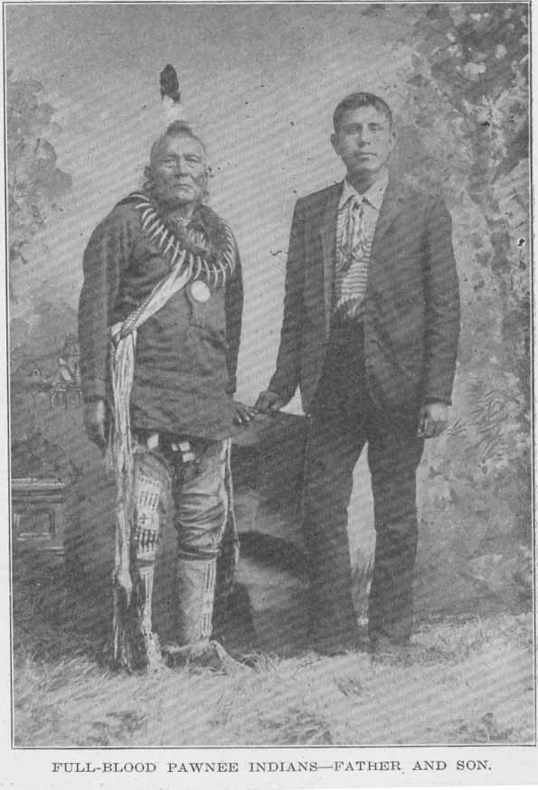
FULL-BLOOD PAWNEE INDIANS—FATHER AND SON.
The tribal organization of the Pawnees was based on the village communities, which represented subdivisions of the tribe. Each village had its name, its hereditary chiefs, a shrine, priests, etc. The dominating power in their religion was Tirawa (father), whose messengers were the winds, thunder, lightning and rain. Pawnee lodges were of two types—the common form of skins stretched over a framework of poles, and the earth lodge. The latter was circular in form, from 30 to 60 feet in diameter, partly under ground, and its construction was usually accompanied with elaborate religious ceremonies. Among the men, the only essential articles of wearing apparel were the breechcloth and moccasins, though these were supplemented by a robe and leggings in cold weather or on state occasions. After marriage a man went to live with his wife's family, though polygamy was not uncommon.
Juan de Oñate, in his account of his expedition in 1601, says the Escansaques and Quivirans were hereditary enemies, and Prof. Dunbar has demonstrated almost to an absolute certainty that the Quivirans mentioned by Oñate were the Pawnees, who were also the inhabitants of the ancient Indian province of Harahey. The first Pawnee to come in contact with the white man was the one whom the Spaniards of Coronado's expedition (q. v.) called "the Turk." Soon after the expedition of Oñate the Spanish settlers of New Mexico became acquainted with Pawnees through their raids into the white settlements for horses, and for two centuries the Spaniards tried to establish peaceful relations with the tribe, but with only partial success. Consequently the Pawnee villages in the 17th and 18th centuries were so remote from the white settlements that they escaped the influences generally so fatal to the aborigines.
In 1702 Iberville estimated the Pawnee population at 2,000 families. When Louisiana was purchased from France by the United States a century later the Pawnee country was south of the Niobrara river in Nebraska, extending southward into Kansas. On the west were the Cheyenne and Arapaho tribes, on the east were the Omahas, and south were the Otoes and Kansa. Soon after the Louisiana purchase, the Pawnees came in contact with white traders from St. Louis. In Sept., 1806, at the Pawnee village in what is now Republic county, Kan., Lieut. Pike lowered the Spanish flag and raised the flag of the United States. (See Pike's Expedition.) In 1838 the number of Pawnees was estimated at 10,000, but in 1849 the tribe was reduced to about 4,500 by a cholera epidemic. Five years before this, however, they ceded to the United States their lands south of the Platte and were removed from Kansas. Between the years 1873 and 1875 what remained of the tribe were settled upon a reservation in the Indian Territory. At that time there were about 1,000, representing four tribes of what was once the great Pawnee confederacy.
The Comanches or Padoucas, who inhabited western Kansas in the early part of the 18th century, were an offshoot of the Shoshoni of Wyoming, as shown by their language and traditions. The Siouan name was Padouca, by which they were called in the accounts of the early French explorers, notably Bourgmont, who visited the tribe in 1724. As late as 1805 the North Platte river was known as the Padouca fork. At that time the Comanche roamed over the country about the headwaters of the Arkansas, Red, Trinity and Brazos rivers in Colorado, Kansas, Oklahoma and Texas. According to a Kiowa tradition, when that tribe moved southward from the country about the Black-hills, the Arkansas river formed the northern boundary of the Comanche country. The hand-book of the Bureau of American Ethnology says: "It must be remembered that from 500 to 800 miles was an ordinary range for a prairie tribe, and that the Comanche were equally at home on the Platte and in the Bolson de Mapimi of Chihuahua."
For nearly two centuries the Comanches were at war with the Spaniards of the southwest and made frequent raids as far south as Durango. They were generally friendly with the Americans, but did not like the Texans. The Comanche was probably never a large tribe, as they did not settle down in villages, but lived as nomadic buffalo hunters, following the herds as they grazed from place to place. They were fine horsemen, the best riders on the plains, full of courage, had a high sense of honor, and considered themselves superior to the tribes with which they associated. In 1867 they were given a reservation in southwestern Oklahoma, but they did not go to it until after the outbreak of the plains tribes in 1874-75. (See Indian Wars.)
The Cheyennes (people of strange language) belonged to the Algonquian group. They are first mentioned in history by the name of "Chaa," some of them visiting La Salle's fort on the Illinois river to invite the French to their country where beaver and other fur-bearing animals were plentiful. At that time they inhabited the region bounded by the Mississippi, Minnesota and upper Red rivers. According to a Sioux tradition, the Cheyenne occupied the upper Mississippi country before the Sioux. When the latter appeared in that locality there was some friction between the two tribes, which resulted in the Cheyenne crossing the Missouri river and locating about the Black-hills, where they were found by Lewis and Clark in 1804. From there they drifted westward and southward, first occupying the region about the headwaters of the Platte and next along the Arkansas river in the vicinity of Bent's fort. A portion of the tribe remained on the Platte and the Yellowstone and became known as the northern Cheyennes.
The Cheyenne have a tradition that when they lived in Minnesota, before the coming of the Sioux, they lived in fixed villages, practiced agriculture, made pottery, etc., but everything was changed when the tribe was driven out and they became roving hunters. About the only institution of the old life that remained with them was the great tribal ceremony of the Sundance.
In 1838 the Cheyenne and Arapaho attacked the Kiowas on Wolf creek, Okla., but two years later peace was established between the tribes, after which the Cheyenne, Arapaho, Kiowa, Comanche and Apache were frequently allied in wars against the whites. The northern Cheyennes joined the Sioux in the Sitting Bull war of 1876. In the winter of 1878-79 a band of the northern Cheyenne was taken as prisoners to Fort Reno to be colonized with the southern Cheyenne in Oklahoma. The chiefs Dull Knife, Wild Hog and Little Wolf, with about 200 followers, escaped and were pursued to the Dakota border, where most of the warriors were killed.
In Feb., 1861, the Cheyennes and Arapahoes relinquished their title to lands in Nebraska, Wyoming, Colorado and northwest Kansas, and in 1867 the southern Cheyenne were given a reservation in western Oklahoma. They refused to occupy it, however, until after the surrender of 1875, when some of their leaders were sent to Florida as a final means of quelling the insurrection. In 1902 the southern Cheyenne were alloted lands in severalty. Two years later the Bureau of Ethnology reported 3,300 members of the tribe—1,900 southern and 1,400 northern.
The Arapaho (our people), a plains tribe of the Algonquian group, was closely allied with the Cheyenne for almost or quite a century. They were called by the Sioux and Cheyenne "Blue sky men" or "Cloud men." An Arapaho tradition tells how the tribe was once an agricultural people in northwestern Minnesota, but were forced across the Missouri river, where they met the Cheyenne, with whom they moved southward. Like the Cheyenne, they became divided, the northern Arapaho remaining about the mountains near the head of the Platte and the southern branch drifting to the Arkansas. In 1867 the southern portion of the tribe was given a reservation with the southern Cheyenne in Oklahoma. By 1892 they had made sufficient progress to justify the government in allotting them lands in severalty, the rest of the reservation being thrown open to white settlement. The northern branch was established in 1876 on a reservation in Wyoming.
Between the years 1825 and 1830, the Kansa and Osage tribes withdrew from a large part of their lands, which were turned over to the United States. This gave the national government the opportunity of establishing the long talked of Indian territory west of the Mississippi. Congress therefore passed a bill providing that the country west of the Mississippi, and not included in any state or organized territory of the United States, should be set apart as a home for the Indians. This Indian territory joined Missouri and Arkansas on the west and was annexed to those states for judicial purposes. During the decade following the passage of the bill, a number of eastern tribes found what they thought were permanent homes within the present State of Kansas. Among them were the Shawnees, Delawares, Ottawas, Miamis, Chippewas, Kickapoos, Sauks and Foxes, Wyandots, and a few others of less importance.
The Shawnees (southerners) were the first to seek a home in the new territory. The early history of the Shawnee tribe is somewhat obscure, though it was known to be an important tribe in Pennsylvania, Ohio, Tennessee, South Carolina, and along the Savannah river in Georgia, which stream Adair says was named for the tribe. Some writers claim that the Shawnees were identical with the Eries of the early Jesuits, and attempts have been made to show that they were allied to the Andaste or Conestoga of the Iroquois family. Their language was that of the central Algonqnian dialects—similar to that of the Sauks and Foxes—and the Delawares had a tradition that made the Shawnee and Nanticoke one people.
The recorded history of the Shawnee or Shawano begins about 1670, when there were two bodies, some distance apart, with the friendly Cherokee nation between. In 1672 the western Shawnee were allied with the Andaste in a war against the Iroquois. Twelve years later the Iroquois made war on the Miamis because they were trying to form an alliance with the Shawnees for the purpose of invading the Iroquois country. About the middle of the 18th century the eastern and western Shawnees were united in Ohio, and from that time to the treaty of Greeneville in 1795 were almost constantly at war with the English. They were driven from the head of the Scioto river to the head of the Miami, and after the Revolutionary war some of them went south and formed an alliance with the Creeks, with which tribe Bartram says they were closely connected, their language being almost identical. Others joined with a portion of the Delaware tribe and accepted a Spanish invitation to occupy a tract of land near Cape Girardeau, Mo.
In the early part of the 19th century the Shawnees in Indiana and Ohio, with some of the Delawares, joined the movement of the Shawnee chief Tecumseh and his brother, Tenskawata (the Prophet), to unite the tribes of the Ohio and Mississippi valleys in a general uprising against the whites. The conspiracy was effectually crushed by Gen. Harrison at the battle of Tippecanoe, Nov. 4, 1811. In the war of 1812 some of the Shawnees fought with the British until Tecumseh was killed at the battle of the Thames. The fall of their great war chief broke the warlike spirit of the tribe and the Shawnees sued for peace. In 1825 the Missouri Shawnees sold their lands and received a reservation in Kansas south of the Kansas river and bordering on the Missouri. The Ohio Shawnees sold their lands near Wapakoneta in 1831 and joined their brethren in Kansas, the mixed band of Shawnee and Seneca coming in about the same time. Some of the tribe in 1845 withdrew from the Kansas reservation and went to the Canadian river in Oklahoma. They became known as the "absentee Shawnee." In 1867 those with the Senecas removed to the Indian Territory, and in 1869 the main body was incorporated with the Cherokee nation.
The Shawnee tribe consisted of five divisions, which were further divided into 13 clans, the English names of which were the wolf, loon, bear, buzzard, panther, owl, turkey, deer, raccoon, turtle, snake, horse and rabbit. Of these the clan of the turtle was the most important, especially in their mythological traditions. About all that is left of this once great tribe are the names of rivers and towns that have been adopted by the white race, such as Chillicothe, Tippecanoe, Shawneetown, Wapakoneta, etc.
The Delawares, formerly the most important confederacy of the Algonquian stock, occupied the entire valley of the Delaware river. They called themselve the Lenape or Leni-lenape (real men). The English gave them the name of Delawares, and the French called them Loups (wolves). Morgan divides the Lenape into three phratries—the Munsee, Unami and the Unalachtigo—though it is probable that some of the bands in New Jersey may have formed a fourth phratry. The Tammany society in New York, the best known political society in the country, takes its name from Tamenend, the great chief of the Delawares.
About 1720 the Iroquois assumed authority over the Delawares and forbade them to sell their lands. This condition lasted until after the French and Indian war. Then they were gradually crowded westward by the white men and began to form settlements in Ohio, along the Muskingum river with the Hurons. Here they were supported by the French and became independent of the Iroquois. They opposed the English with determination until the treaty of Greeneville in 1795. Six years before that treaty was consummated the Spanish government of Louisiana gave the Delawares permission to settle in that province, near Cape Girardeau, Mo., with some of the Shawnee tribe. In 1820 there were two bands—numbering about 700—in Texas, but by 1835 most of the Delawares were settled upon their Kansas reservation between the Kansas and Missouri rivers. Their title to this reservation was finally extinguished in 1866, and on April 11, 1867, President Johnson approved an agreement by which the Delawares merged their tribal existence with the Cherokee nation.
In 1820 there was found an ancient hieroglyphic bark record giving the traditions of the Delaware tribe. This old record was translated and published by Brinton in 1885. It gives an account of the creation of the world by great Manito; and of the flood, in which Nanabush, the Strong White one, grandfather of men, created the turtle, on which some were saved. This book is known as the "Walam Olum."
The Munsees (where stones are gathered together), one of the three principal divisions of the Delawares, originally occupied the country about the headwaters of the Delaware river. By what was known as the "walking purchase," about 1740, they were defrauded out of the greater portion of their lands and forced to remove. They obtained lands from the Iroquois on the Susquehanna, where they lived until the Indian country was established by the act of 1830, when they removed to what is now Franklin county, Kan., with some of the Chippewa. The report of the Bureau of Ethnology for 1885 says the only Munsees then recognized officially by the United States were 72, living in Franklin county, Kan., all the others having been incorporated with the Cherokee nation.
The Ottawas (traders), according to one of their traditions, were once part of a tribe to which belonged also the Chippewa and Pottawatomi, all of the great Algonquian family. They moved as one tribe from their original habitat north of the great lakes, and separated about the straits of Mackinaw. Another account says that when the Iroquois destroyed the Hurons in 1648-49, the remnant of the Hurons found refuge with the Ottawa, which caused the Iroquois to turn on that tribe. The Ottawas and the Hurons then fled to Green bay, where they were welcomed by the Pottawatomi, who had preceded them to that locality.
The tribe is mentioned in the Jesuit Relations as early as 1670, when Father Dablon, superior of the mission at Mackinaw, said: "We call these people Upper Algonkin to distinguish them from the Lower Alkonkin, who are lower down in the vicinity of Tadousac and Quebec. People commonly give them the name of Ottawa, because, of more than 30 different tribes which are found in these countries, the first that descended to the French settlements were the Ottawa, whose name afterward attached to all the others."
After a time the Ottawas and Hurons went to the Mississippi and established themselves on an island in Lake Pepin. They were soon driven out by the Sioux and went to the Black river in Wisconsin, where the Hurons built a fort, but the Ottawas continued east to Chaquamegon bay. In 1700 the Hurons were located near Detroit and the Ottawas were between that post and the Saginaw bay. The Ohio Ottawas were removed west of the Mississippi in 1832. The following year, by the treaty of Chicago, those living along the west shore of Lake Michigan ceded their lands there and were given a reservation in Franklin county, Kan., the county seat of which bears the name of the tribe. In 1906 there were about 1,500 Ottawas living in Manitoulin and Cockburn islands, Canada; 197 under the Seneca school in Oklahoma; and nearly 4,000 in the State of Michigan.
The Chippewa or Ojibway (to roast till puckered up) formerly ranged along the shores of Lake Superior and Lake Huron, extending across Minnesota to the Turtle mountains in North Dakota. Warren says that at the time America was discovered the Chippewa lived at La Pointe, Ashland county, Wis., on the south shore of Lake Superior, where they had a village called Shangawaumikong. Early in the 18th century the Chippewa drove the Foxes from northern Wisconsin, and also drove the Sioux west of the Mississippi. Other Chippewa overran the peninsula lying between Lake Huron and Lake Erie and forced the Iroquois to withdraw from that section. Warren says there were ten principal divisions of the tribe scattered through Michigan, Wisconsin, Minnesota and North Dakota, and Morgan gives a list of 23 gentes. Prior to 1815 the Chippewa were frequently engaged in war with the whites, but after the treaty of that year they remained peaceful. In 1836 what were known as the Swan Creek and Black River Chippewa sold their lands in southern Michigan and removed to the Munsee reservation in Franklin county, Kan. In 1905 the Bureau of Ethnology estimated the number of Chippewa in the United States and Canada at 30,000, about one-half of which were in the United States.
The Miamis (peninsular people), one of the most important of the Algonquan tribes, was called by some of the early chroniclers the "Twightwees." The region over which they roamed was once outlined in a speech by their famous chief, Little Turtle, who said: "My fathers kindled the first fire at Detroit; thence they extended their lines to the headwaters of the Scioto; thence to its mouth; thence down the Ohio to the month of the Wabash, and thence to Chicago over Lake Michigan."
The men of the Miami tribe have been described as "of medium height, well built, heads rather round than oblong, countenances agreeable rather than sedate or morose, swift on foot and excessively fond of racing." The women spun thread of buffalo hair, of which they made bags in which to carry provisions when on a march. Their deities were the sun and the thunder, and they had but few minor gods. Six bands of the Miami were known to the French, the principal ones being the Piankeshaw, Wea and Pepicokia. The Piankeshaw was first mentioned by La Salle in 1682 as one of the tribes that gathered about his fort in the Illinois country. Chauvignerie classed the Piankeshaw, Wea and Pepicokia as one tribe, but inhabiting different villages. The Miami were divided into ten gentes—wolf, loon, eagle, buzzard, panther, turkey, raccoon, snow, sun and water—and the elk and crane were their principal totems. Early in the 19th century the Piankeshaw and Wea were located in Missouri, and in 1832 they agreed to remove to Kansas as one tribe. About 1854 they were consolidated with the Peorias and Kaskaskias, and in 1868 the consolidated tribe was removed to a reservation on the Neosho river in northeastern Oklahoma. Numerous treaties were made between the main body of the Miamis and the United States, and in Nov., 1840, the last of the tribe was removed west of the Mississippi. Six years later some of them were in Linn county, Kan., and others had been confederated with the Peorias and other tribes. In 1873 they were removed to the Indian Territory.
The Sauks and Foxes, usually spoken of as one tribe, were originally two separate and distinct tribes, but both of Algonquian stock. The Sauks, when first met by white men, inhabited the lower peninsula of Michigan and were known as 'yellow earth people." At that time the Foxes lived along the southern shore of Lake Superior and were called the "red earth people." There is a tribal tradition that before the Sauks became an independent people they belonged to an Algonquian group composed of the Pottawatomies, Foxes and Mascoutens. After the separation the Sauks and Foxes moved northwest, and in 1720 were located near Green bay, but as two separate tribes. Trouble with the Foxes led to a division of the Sauks, one faction going to the Foxes and the other to the Pottawatomies. In 1733 some Foxes pursued by the French took refuge at the Sank village near the present city of Green Bay, Wis. Sieur de Villiers made a demand for the surrender of the refugees, but it was refused, and in trying to take them by force several of the French were killed. Gov. Beauharnois, of Canada, then gave orders to make war on the Sauks and Foxes. This led to a close confederation of the two tribes, and since then they have been known as the Sauks and Foxes.
In the early days of the confederacy there were numerous gentes, but in time these were reduced to 14, viz: trout, sturgeon, bass, great lynx or fire dragon, sea, fox, wolf, bear, potato, elk, swan, grouse, eagle and thunder. Black Hawk, the Sauk chief, was a member of the thunder clan. After several treaties with the United States, the Sauks and Foxes in 1837 ceded their lands in Iowa and were given a reservation in Franklin and Osage counties, Kan. In 1859 the Foxes returned from a buffalo hunt to find that in their absence the Sauks had made a treaty ceding the Kansas reservation to the United States. The Fox chief refused to ratify the cession and with some of his trusty followers set out for Iowa, whither a few of the Foxes had previously returned. They purchased a small tract of land near Tama City, adding to it by subsequent purchases, until the tribe owned some 3,000 acres. From that time this faction of the Foxes had no further political connection with the Sauks. In 1867 the Kansas reservation passed into the hands of the United States government, the Indians accepting a reservation in the Indian Territory, and in 1889 they were allotted lands in severalty.
The Iowas (sleepy ones), according to Dorsey, were a southwestern Siouan tribe belonging to the Chiwere group, composed of the Iowas, Otoes and Missouris, all of which sprang from Winnebago stock, to which they were closely allied by language and tradition. Old Iowa chiefs told Dorsey that the tribe separated from the Winnebago on the shores of Lake Michigan, and at the time of the separation received the name of "gray snow." After the separation they lived successively on the Des Moines river, near the pipestone quarry in Minnesota, at the mouth of the Platte, and on the headwaters of the Little Platte in Missouri. In 1824 they ceded their lands in Missouri, and in 1836 removed to a reservation in the northeast corner of Kansas. When this reservation was ceded to the United States the tribe removed to central Oklahoma, where in 1890 they were alloted lands in severalty.
The Kickapoos, a tribe of the central Algonquian group, is first mentioned in history about 1670, when Father Allouez found them living near the portage between the Fox and Wisconsin rivers. Ethnologically the Kickapoos were closely related to the Sauks and Foxes, with whom they entered into a scheme for the destruction of Detroit in 1712. When the Illinois confederacy was broken up in 1765, the Kickapoos had their headquarters for a time at Peoria. They were allied with Tecumseh in his conspiracy early in the 19th century, and in 1832 took part in the Black Hawk war. Five years later they aided the government in the war with the Seminoles. After ceding their lands in central Illinois, they removed to Missouri and still later to Kansas, settling on a reservation near Fort Leavenworth. About 1852 a number of Kickapoos joined a party of Pottawatomies and went to Texas. Later they went to Mexico and became known as "Mexican Kickapoo." In 1905 the Bureau of Ethnology reported 434 Kickapoo—247 in Oklahoma and 167 in Kansas.
Among the Kickapoos the gentile system prevailed and marriage was outside of the gens. The principal gentes were water, tree, berry, thunder, man, bear, elk, turkey, bald eagle, wolf and fox. In summer they lived in houses of bark, and in winter in oval lodges constructed of reeds. They practiced agriculture in a primitive way. Their mythology was characterized by many fables of animals, the dog being especially venerated and regarded as an object of offering always acceptable to the great Manitou.
The Pottawatomies belonged to the Algonquian group and were first encountered by white men in the vicinity of Green Bay, Wis. They were originally associated with the Ottawa and Chippewa as one tribe, the separation taking place about the head of Lake Huron. Subsequently the three tribes at time formed a confederacy for offense or defense, and when removed west of the Mississippi asked to be united again. They sided with the French until about 1760, took part in the Pontiac conspiracy, and fought against the United States in the Revolution. The treaty of Greeneville put an end to hostilities, but in the war of 1812 they again allied themselves with the British. Between the years 1836 and 1841 they were removed west of the Mississippi, those in Indiana having to be removed by force. Some escaped to Canada and this band or their descendants still live on Walpole island in the St. Clair river. In 1846 all those in the United States were united on a reservation in Miami county, Kan. In Nov., 1861, this tract was ceded to the United States and the tribe accepted a reservation of 30 miles square near Holton, Jackson county, Kan., where some of the tribe still live. From government reports in 1908, it is ascertained that there were then about 2,500 Pottawatomies in the United States, 676 of whom were in Kansas.
The 15 gentes of the tribe were the wolf, bear, beaver, elk, loon, eagle, sturgeon, carp, bald eagle, thunder, rabbit, crow, fox, turkey and black hawk. Their most popular totems were the frog, tortoise, crab and crane. In early days they were sun-worshipers. Dog flesh was highly prized, especially in the "feast of dreams," when their special manitou was selected.
The Kiowas (principal people) once inhabited the region on the upper Missouri and the Yellowstone rivers. Next they formed an alliance with the Crows, but were driven southward by the Cheyenne and Arapaho to the country about the upper Arkansas and Canadian rivers in Colorado and Oklahoma. They are first mentioned in history by Spanish explorers about 1732, and in 1805 Lewis and Clark found them living on the North Platte. About 1840 they formed an alliance with the Comanches, with whom they were afterward frequently associated in raids on the frontier settlements of Texas and Mexico. In 1865 they joined with the Comanche in a treaty which ceded to the United States a large tract of land in Colorado, Texas and southwest Kansas, and three years later they were put on a reservation in northwest Texas and the western part of the Indian Territory.
The Quapaws, or Kwapa, a southwestern tribe of the Siouan group, is frequently mentioned by early writers, such as Joutel, Tonti, Du Pratz, etc. Mention has previously been made of their separation from other tribes at the mouth of the Ohio river. In 1833 they ceded their lands in Arkansas, the map of the session showing a small strip in southeastern Kansas, extending from the Missouri line to the Neosho river.
The Otoes, one of the three Siouan tribes forming the Chiwere group, were originally part of the Winnebago, from whom they separated near Green Bay. Moving southwest in quest of buffalo, the Otoes went up the Missouri, crossed the Big Platte, and Marquette's map of 1673 shows them on the upper Des Moines or upper Iowa river. Lewis and Clark in 1804 found them on the south side of the Platte, 30 miles from its mouth, where, having become decimated by war and small-pox, they lived under the protection of the Pawnees. The Otoes were never an important tribe in Kansas history, though in March, 1881, they ceded to the United States a tract of land, a small portion of which lies north of Marysville, Marshall county.
In Jan., 1838, several New York tribes were granted reservations in Kansas, but they refused to occupy the lands, only 32 Indians coming from New York to the newly established Indian territory. Some 10,000 acres were allotted to these 32 Indians in the northern part of Bourbon county. In 1857 the Tonawanda band of Senecas relinquished their claim to the Kansas reservations, and in 1873 the government ordered all the lands sold to the whites, including the 10,000 acres in Bourbon county, because the Indians had failed to occupy them permanently.
By the treaty of New Echota, Ga., Dec. 29, 1835, the Cherokee nation ceded the lands formerly occupied by the tribe east of the Mississippi and received a reservation in southeastern Kansas. The tribe never assumed an important status in Kansas affairs, and in 1866 the land was ceded back to the United States. (See Neutral Lands.) The Cherokee tribe was detached from the Iroquois at an early day and for at least three centuries inhabited Tennessee, Georgia, southwestern Virginia, the Carolinas and northeastern Alabama. They were found by De Soto in the southern Alleghany region in 1540, and were among the most intelligent of Indian tribes.
Last but not least of the Indian tribes that dwelt in Kansas at some period or other were the Wyandots, or Wyandot-Iroquois, who were the successors to the power of the ancient Hurons. Champlain says the habitat of the Hurons was on the northern shore of Lake Ontario. About the middle of the 18th century the Huron chief Orontony, or Nicholas, removed from the Detroit river to the lowlands about Sandusky bay. Nicholas hated the French and organized a movement for the destruction of their posts and settlements, but a Huron woman divulged the plan. The hand-book of the Bureau of Ethnology says: "After this trouble the Hurons seem to have returned to Detroit and Sandusky, where they became known as Wyandots and gradually acquired a paramount influence in the Ohio valley and the lake region."
During the French and Indian war the tribe was allied with the French, and in the Revolutionary war they fought with the British against the colonies. For a long time the tribe stood at the head of a great Indian confederacy and was recognized as such by the United States government in making treaties in the old Northwest Territory. At one time they claimed the greater part of Ohio, and the Shawnee and Delaware tribes settled there with Wyandot consent. In March, 1842, they relinquished their title to lands in Ohio and Michigan and agreed to remove west of the Mississippi. On Dec. 14, 1843, they acquired by purchase 39 square miles of the east end of the Delaware reserve in Kansas. Connelley says: "They brought with them from Ohio a well organized Methodist church, a Free Masons' lodge, a civil government, a code of written laws which provided for an elective council of chiefs, the punishment of crime and the maintenance of social and public order."
Soon after the Wyandots came to Kansas efforts were made in Congress to organize the Territory of Nebraska, to include a large part of the Indian country. The Indians realized that if the territory was organized it meant they would have to sell their lands, notwithstanding the treaty promises of the government that they should never be disturbed in their possessions, and that their lands should never be incorporated in any state or territory. A congress of the Kansas tribes met at Fort Leavenworth in Oct., 1848, and reorganized the old confederacy with the Wyandots at the head. At the session of Congress in the winter of 1851-52 a petition asking for the organization of a territorial government was presented, but no action was taken. The people then concluded to act for themselves, and on Oct. 12, 1852, Abelard Guthrie was elected a delegate to Congress, although no territorial government existed west of the Missouri. At a convention on July 26, 1853, which had been called in the interest of the central route of the proposed Pacific railroad, a series of resolutions were adopted which became the basis of a provisional territorial government, with William Walker, a Wyandot Indian, as governor. (See Connelley's Provisional Government of Nebraska Territory.)
On Jan. 31, 1855, tribal relations among the Wyandots were dissolved and they became citizens of the United States. At the same time the 39 sections purchased in 1843 were ceded to the government, with the understanding that a new survey was to be made and the lands conveyed to the Wyandots as individuals, the reservees to be permitted to locate on any government land west of Missouri and Iowa.
In the social organization of the Wyandots four groups were recognized—the family, the gens, the phratry and the tribe. A family consisted of all who occupied one lodge, at the head of which was a woman. The gens included all the blood relations in a given female line. At the time the tribe removed to Kansas it was made up of eleven gentes which were divided into four phratries. The first phratry included the bear, deer and striped turtle gentes; the second was composed of the black turtle, mud turtle and smooth large turtle gentes; the third included the gentes of the hawk, beaver and wolf, and the fourth had but two gentes—the sea snake and the porcupine.
Mooney says the Wyandots were "the most influential tribe of the Ohio region, the keepers of the great wampum belt of union and the lighters of the council fire of the allied tribes." But, like the other great tribes that once inhabited the central region of North America, the Wyandots have faded away before the civilization of the pale-face. The wigwam has given way to the school house, the old trail has been supplanted by the railroad, and in a few generations more the Indian will be little more than a memory.
(Works consulted: Beach's Indian Miscellany, Brinton's Aboriginal American Literature, Cutler's, Hazelrigg's and Prentis' Histories of Kansas, Kansas Historical Collections, Drake's North American Indians, Gregg's Commerce of the Prairies, Lewis and Clark's Journal, Reports of the Bureau of American Ethnology, Brownell's Indian Races, etc.)
Pages 900-917 from volume I of Kansas: a cyclopedia of state history, embracing events, institutions, industries, counties, cities, towns, prominent persons, etc. ... / with a supplementary volume devoted to selected personal history and reminiscence. Standard Pub. Co. Chicago : 1912. 3 v. in 4. : front., ill., ports.; 28 cm. Vols. I-II edited by Frank W. Blackmar. Transcribed May 2002 by Carolyn Ward.
![]()
TITLE PAGE / LIST OF ILLUSTRATIONS
INTRODUCTION
A | B | C | D | E | F | G | H | I
VOLUME II
TITLE PAGE / LIST OF ILLUSTRATIONS
J | K | L | Mc | M | N | O | P | Q | R | S | T | U | V | W | X | Y | Z
VOLUME III
BIOGRAPHICAL INDEXES
