Santa Fe Trail.—Some writers have attempted to set up the claim that this famous route had a prehistoric existence, and that it was followed by the Coronado expedition in 1540. In July, 1739, the Mallet brothers reached Santa Fe from the East, but there is no authentic account to show that they traveled along the line of the trail. The earliest trading expedition to the Spanish settlements in the Southwest was organized under French auspices in Louisiana about the middle of the 18th century. This expedition passed up the Arkansas river and established a trading post near the present city of Pueblo, Col., but after Louisiana was ceded to Spain by the treaty of Fontainebleau the French traders were driven out by the Spaniards. It is probable that the first white man to traverse the country as a trader between the United States and Santa Fe, following approximately the route which later became so widely known as the "Santa Fe Trail," was Baptiste La Lande (q. v.), who went from Kaskaskia, Ill., as the agent of William Morrison, in the summer of 1804.
The publication of Lieut. Pike's report of his expedition "to the sources of the Arkansas," etc., aroused a general interest in the trade with Santa Fe—a trade which promised large profits. However, the Mexican revolution, which began in 1810 and ended in making the country a republic in 1821, prevented the trade from assuming any considerable proportions until after the restoration of peace. As the caravans were compelled to pass through the Indian country, and as some of the tribes along the route were inclined to show a hostility to this constant stream of travel through their territory, a movement was started to have the United States government establish a highway from some point in Missouri to New Mexico. A bill to that effect was introduced in Congress and was championed by Thomas H. Benton, of Missouri, and other western members. In a speech on the measure, Mr. Benton said: "The road which is contemplated will trespass upon the soil or infringe upon the jurisdiction of no state whatever. It runs a course and distance to avoid all that; for it begins on the outside line of the outside state, and runs directly off toward the setting sun. The Congress and the Indians are alone to be consulted and the statute books are full of precedents."
On March 3, 1825, only one day before he retired from the office, President Monroe approved a bill authorizing the president "to cause a road to be marked out from the western frontier of Missouri to the confines of New Mexico," and to appoint three commissioners to carry out the provisions of the act. The commissioners appointed were Thomas Mather, George C. Sibley and Benjamin H. Reeves. They left St. Louis in June with 7 wagons and about 30 men. Their report states that on Aug. 10 they "met the chiefs and head men of the Great and Little Osage Nations at a place called the Council Grove, on the river Neozho, 160 miles from Fort Osage, and have, after due deliberation and consultation, agreed to the following treaty, which is to be considered binding on the said Great and Little Osages, from and after this day."
The treaty thus referred to provided that, in consideration of the sum of $500, to be paid to the chiefs and head men of the Osages in money or goods at their option, they gave the United States the privilege of surveying and marking the road through their territory. They further agreed to commit no hostile acts against persons traveling along the road, and to permit them to go a reasonable distance on either side thereof to find suitable camping places and subsistence for their animals.
On Aug. 16, 1825, a similar treaty was made with the Kansas Indians, and between that time and the fall of 1827 Joseph C. Brown surveyed the road from Fort Osage to Taos, not far from Santa Fe. Prentis, in his History of Kansas, says:
"It was a great road, 775 miles long, 550 miles of which were in Kansas, a hard, smooth thoroughfare, from 60 to 100 feet wide. It had not a bridge in its whole extent, and was the best natural road of its length ever known in the world. In token that it had come to stay, the broadfaced, yellow sunflower, since chosen by Kansas people as an emblem of their state, sprang up on either side where the wheels had broken the soil along the wild highway."
In the early history of the Santa Fe trade, the outfitting point was at Old Franklin, Mo., but a large part of that town was undermined by the river and the outfitting business was transferred to Independence, Mo., which place may be said to have been the eastern terminus of the Santa Fe trail. After the landing at Independence was obstructed by the formation of a sand bar in 1826, the town of Westport (now Kansas City) came in to prominence as an outfitting point. Prior to 1824 goods were transported on the backs of horses or mules. In 1824 a party of 80 men left Independence with 25 wagons loaded with goods and also a large number of pack animals. This was the largest party that up to that time had engaged in the trade, and it doubtless wielded considerable influence on Congress in securing the passage of the act already mentioned.
The trail entered Kansas in what is now Oxford township, Johnson county, whence it followed a course a little south of west through Douglas, Osage and Lyon counties to Council Grove. A road from Westport joined the main trail about where the town of Olathe now stands, and another from Fort Leavenworth united with the trail at Wilmington, in the southeast corner of Wabaunsee county. Over these various roads came small trading parties which met at Council Grove and formed a caravan for crossing the great plains. From Council Grove, still pursuing a southwesterly direction, the trail ran through the present counties of Morris, Marion, McPherson, Rice and Barton, striking the Arkansas river near the site of the present city of Great Bend. From this point the trail followed the north bank of the Arkansas to what is now the town of Cimarron in Gray county, where it divided, one branch crossing that stream and running southwest through Gray, Haskell, Grant, Stevens and Morton counties, crossing the western boundary of Kansas near the southwest corner of the state.
Gregg, in his Commerce of the Prairies, gives the following list of camping places in Kansas, with the number of miles distant from Independence: Round Grove, 35; the Narrows, 65; One Hundred and Ten Mile Creek, 100; Bridge Creek, 108; Big John Spring, 148; Council Grove, 150; Diamond Spring, 165; Lost Spring, 180; Cottonwood Creek, 192; Turkey Creek, 217; Little Arkansas, 234; Cow Creek, 254; Arkansas River, 270; Walnut Creek, 278; Ash Creek, 297; Pawnee Fork,303; Coon Creek, 336; Caches, 372; Ford of Arkansas, 392; Sand Creek (on the branch which crossed the Arkansas), 442; Cimarron River (lower spring), 450; Middle Spring (up the Cimarron), 486; Willow Bar, 512. Gregg also states that in 1822 the trade with Santa Fe amounted to about $15,000, with 70 men engaged in it, pack horses or mules being the only means of transportation. In 1826 wagons had completely supplanted pack animals, and the trade of that year reached $90,000. A steady increase followed until 1843, when the trade aggregated $450,000.
In the early '40s organized bands of guerrillas began to prey on the trading parties along the trail. One of these bands was formed in the fall of 1842, under the leadership of one John McDaniel, who claimed to hold a captain's commission in the Texan army. Early in 1843 McDaniel started for the trail with the intention of joining his force with that of another Texan bandit named Warfield, who had plundered and burned the town of Mora in New Mexico. Before the union was effected Warfield's gang was dispersed by a party of New Mexicans. It was McDaniel's force that robbed and murdered the trader Don Antonio Jose Chavez (q. v.) in the early spring of 1843. When the Warfield band was broken up some of the stragglers joined Maj. Jacob Snively, another Texan. These recruits gave Snively a force of some 200 men, with which he met and defeated a detachment of Armijo's command, the scene of the engagement being south of the Arkansas in Kansas. The unsettled conditions along the trail made a military escort necessary, and in May, 1843, a train left Independence under the protection of 200 United States dragoons commanded by Capt. P. St. George Cooke. Upon arriving at the Caches, Capt. Cooke was visited by Snively, who with about 100 men was encamped on the opposite side of the river. The boundary between the United States and Texas had not yet been settled, but Cooke took the position that Snively was operating within the territory of the United States, disarmed his men and ordered them to disband. This affronted the Texan government, which demanded reparation, and a lively correspondence ensued. Abel P. Upshur, secretary of state, wrote to the Texan authorities as follows:
"Capt. Cooke justifies his conduct on the ground that he found this force within the territory of the United States, engaged in the attempt to interrupt lawful trade between the United States and Mexico; and hat[sic] he had a right to disarm, so as to take from them the power of molesting our own citizens, and those of Mexico engaged in that trade; that he used no harshness, nor more force than was necessary to accomplish the object."
Capt. Cooke was acquitted by a court of inquiry and the United States offered to pay for the arms taken, which offer was accepted by Texas, and thus the question was finally settled. But this incident, with others of a turbulent nature, led the Mexican government to close all the frontier ports of entry in Aug., 1843, which was done by proclamation of Santa Ana, president of the Mexican republic. The ports were reopened by the decree of March 31, 1844, but the Mexican war soon afterward put a stop to the Santa Fe trade until 1850, when it was again resumed and was continued until the railroads put the overland freighter out of business in 1872.
Soon after the beginning of the present century, the Daughters of the American Revolution in Kansas began to agitate the subject of marking the line of the Santa Fe trail through the state. By the act of March 1, 1905, the Kansas legislature appropriated $1,000 "for the purpose of procuring suitable monuments to mark the Santa Fe trail in the State of Kansas, through the following counties," etc. The act also provided that the marking should be done under the supervision of the regent of the Daughters of the American Revolution in the State of Kansas and the secretary of the Kansas State Historical Society. Through the influence of the Daughters, Jan. 29, 1906, the anniversary of the admission of Kansas into the Union, was designated as "Trail Day" in the public schools, to be observed with appropriate ceremonies, and the children were invited to contribute one cent each on that day to the fund marking the trail. Prizes were offered for the best essays on the trail, and the school contributing the largest collection was to be presented with a fine silk flag. The penny collection netted $584.40, which gave the Daughters $1,584.40 to expend for monuments. The material selected was a red granite from Oklahoma. C. W. Guild of Topeka agreed to prepare and inscribe the markers for $16 each, and the Atchison, Topeka & Santa Fe railroad, which follows approximately the line of the old trail, offered to transport them to the stations nearest their final destination free of cost. In most instances the expense of placing the markers in position was borne by the local authorities or a committee of citizens.
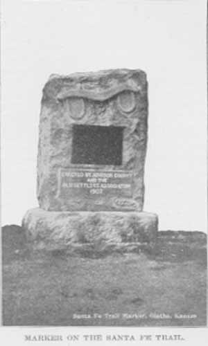
MARKER ON THE SANTA FE TRAIL.
The marking was done in the years 1906 and 1907, and the secretary of the State Historical Society, in his report for the biennial period ending on June 30, 1908, after giving a detailed statement of the expenditures, says: "These statements show that the funds raised by the Daughters paid for 89 markers. There are at different points on the trail six special markers paid for by individual chapters of Daughters or other local interests, making a total of 95 markers from the east to the west line of the state. But the following location of each marker in detail shows a total of 90 markers furnished by the Daughters, and receipted for, or a total of 96 markers along the whole line. This discrepancy has caused hours and hours of arithmetic and searching, and much exhaustion of temper, without avail. If I had lost one marker it could easily be settled by getting another, or going down in my pocket, but the state is one marker ahead. Such a condition of public business may excite a little curiosity, but not enough to warrant annoyance from it."
Each marker bears the inscription: "Santa Fe Trail, 1822-1872, Marked by the Daughters of the American Revolution and the State of Kansas, 1906." In a few instances a marker bears some special inscription in addition to the above. One case of this kind is at Council Grove, where the monument bears the regular inscription on the east side, and on the west side the following: "On this spot Aug. 10, 1825, the treaty was made with the Osage Indians for the right of way of the Santa Fe Trail."
The placing of these monuments has marked through the State of Kansas one of the historic highways of the nation—a highway whose complete history would fill a volume.
|
"It wound through strange scarred hills Down cañons lone Where wild things screamed, With winds for company; Its milestones were the bones of pioneers." |
Pages 645-650 from volume II of Kansas: a cyclopedia of state history, embracing events, institutions, industries, counties, cities, towns, prominent persons, etc. ... / with a supplementary volume devoted to selected personal history and reminiscence. Standard Pub. Co. Chicago : 1912. 3 v. in 4. : front., ill., ports.; 28 cm. Vols. I-II edited by Frank W. Blackmar. Transcribed July 2002 by Carolyn Ward.
![]()
TITLE PAGE / LIST OF ILLUSTRATIONS
INTRODUCTION
A | B | C | D | E | F | G | H | I
VOLUME II
TITLE PAGE / LIST OF ILLUSTRATIONS
J | K | L | Mc | M | N | O | P | Q | R | S | T | U | V | W | X | Y | Z
VOLUME III
BIOGRAPHICAL INDEXES
