 |
 |
 |
|
|
|
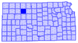
A LISTING OF GRAHAM COUNTY
CEMETERIES
The following table, copied
in part from the U.S. Geological Survey's National Mapping page, gives you a
listing of cemeteries the Survey has located in
We have altered the table below to
include directional locations of the cemeteries within
| Cemetery | Location |
USGS 7.5' Map |
|---|---|---|
| Anderson | N/W of Morland |
|
| Brush Creek | 3 miles S of Penokee Cem. |
Penokee |
| Buchanan Brown | S/W of Logan |
|
| Coleman | Hill City at intersection U.S.-24 & US-283 |
Bogue |
| Fagan | Bouge |
|
| Fairview | Located from stop light at intersection of U.S.-283 & U.S.-24; Go 12 miles north, 2 miles west,1 mile south, � mile west & 0.1 mile north |
Hill City North |
| Hill City | N of Hill City on on U.S. 283 |
Saint Peter |
| Leland | Take Red Line 8 miles W of US 283 & 1/2 mile S |
Bogue NW |
| McFarland | N/W of Bogue |
Hill City North |
| Memorial Lawn | New addition of Hill City Cemetery |
Redline Church |
| Morlan Township | south of Red Line |
Morland |
| Morland | S/E edge of Morland |
Bogue NW |
| Mount Olive | N of Nicodemus |
Nicodemus |
| Nicodemus | N of Nicodemus |
Penokee |
| Penokee | S edge of Penokee |
|
| Prairie Dale | SE of Logan |
|
| Prairie Home | At Togo, across the road from Prairie Home Methodist Church |
Hill City NW |
| Rock Creek |
3 miles N of Penokee |
Hill City North |
| Roscoe | N of Hill City |
Saint Peter |
| Saint Anthony | At Saint Peter |
Bogue |
| Samuels | At Bogue |
Hill City NW |
| South Star | N/W of Hill City |
|
| Whitfield | S/W of Logan |
Bogue |
| Wild Horse | Bogue | |
| Memorial Page | Listings not found on cemetery pages with Graham County connections |
 |
 |