

Rooks County
KSGenWeb


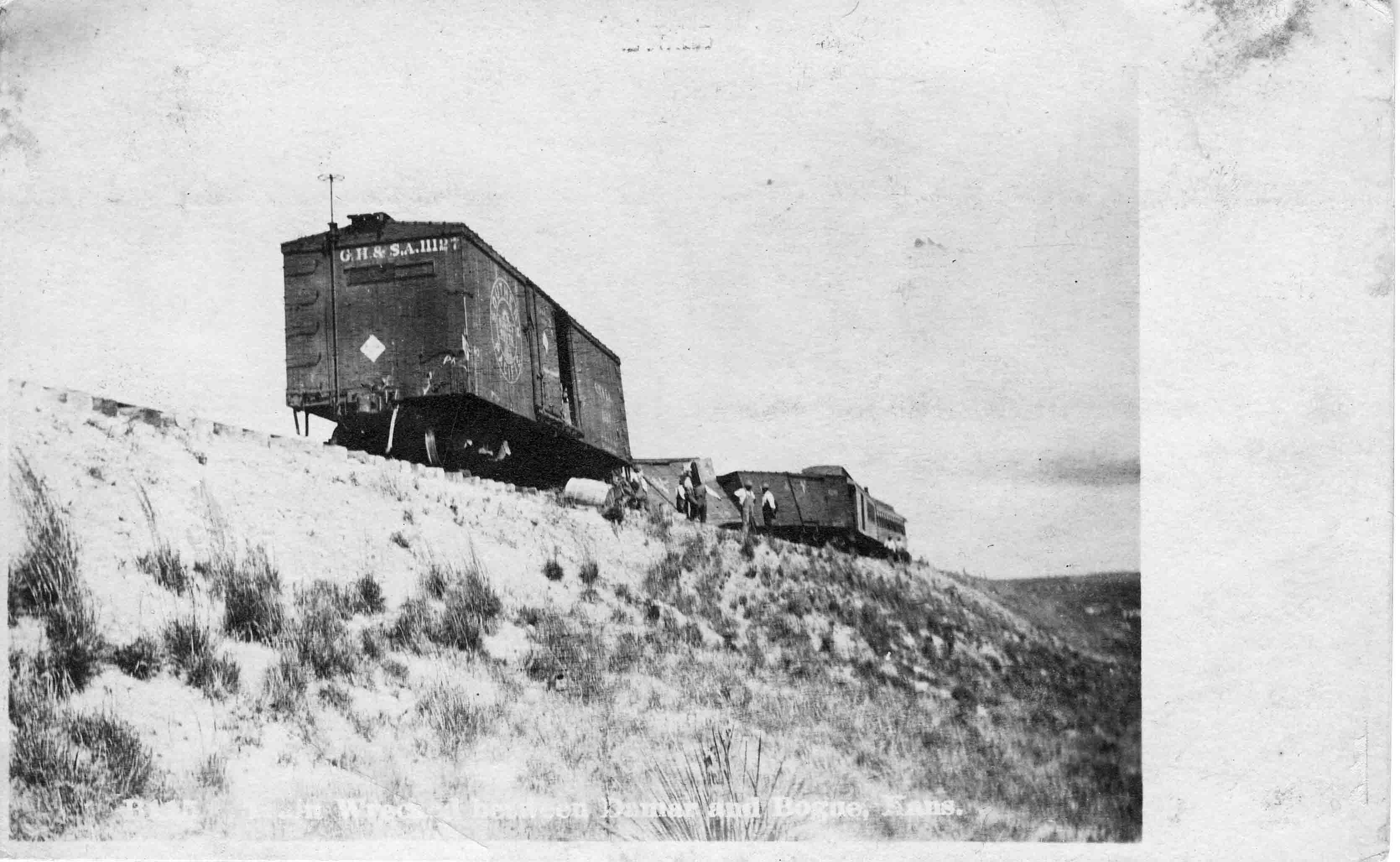
1911 Train Wreck
between Damar and Bogue
If you can translate the message for us, please let us know.
Submitted by Brenda Reeder
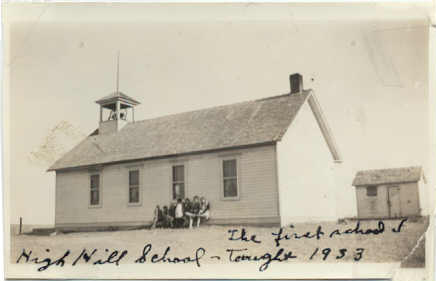
High Hill School 1933
Left to Right: __ BITTLE, Delaine TURNBULL about 5th grade, and Eldon ANDREWS, 3rd grade.
Submitted by Gaylyn Andrews
2004 June
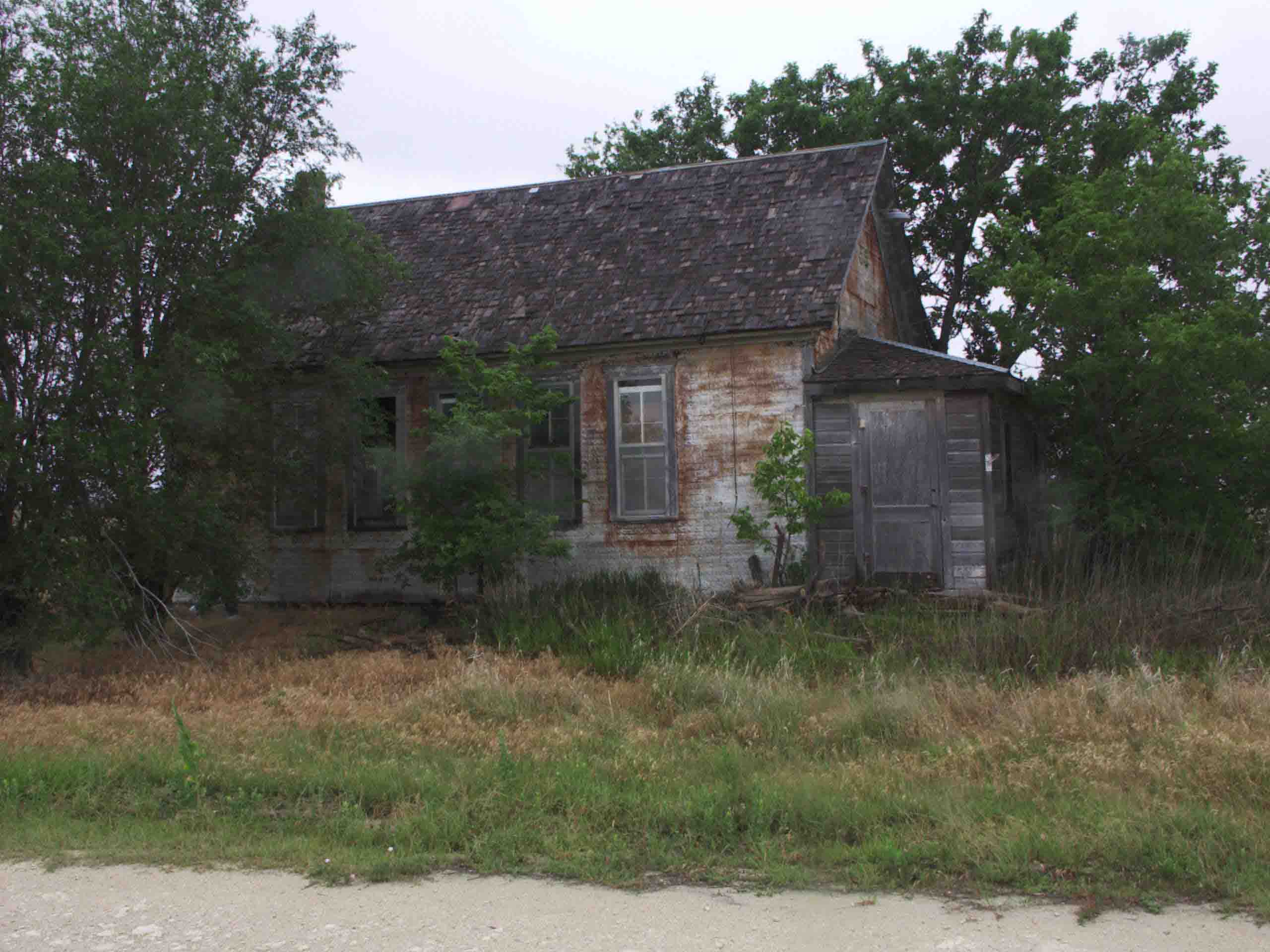
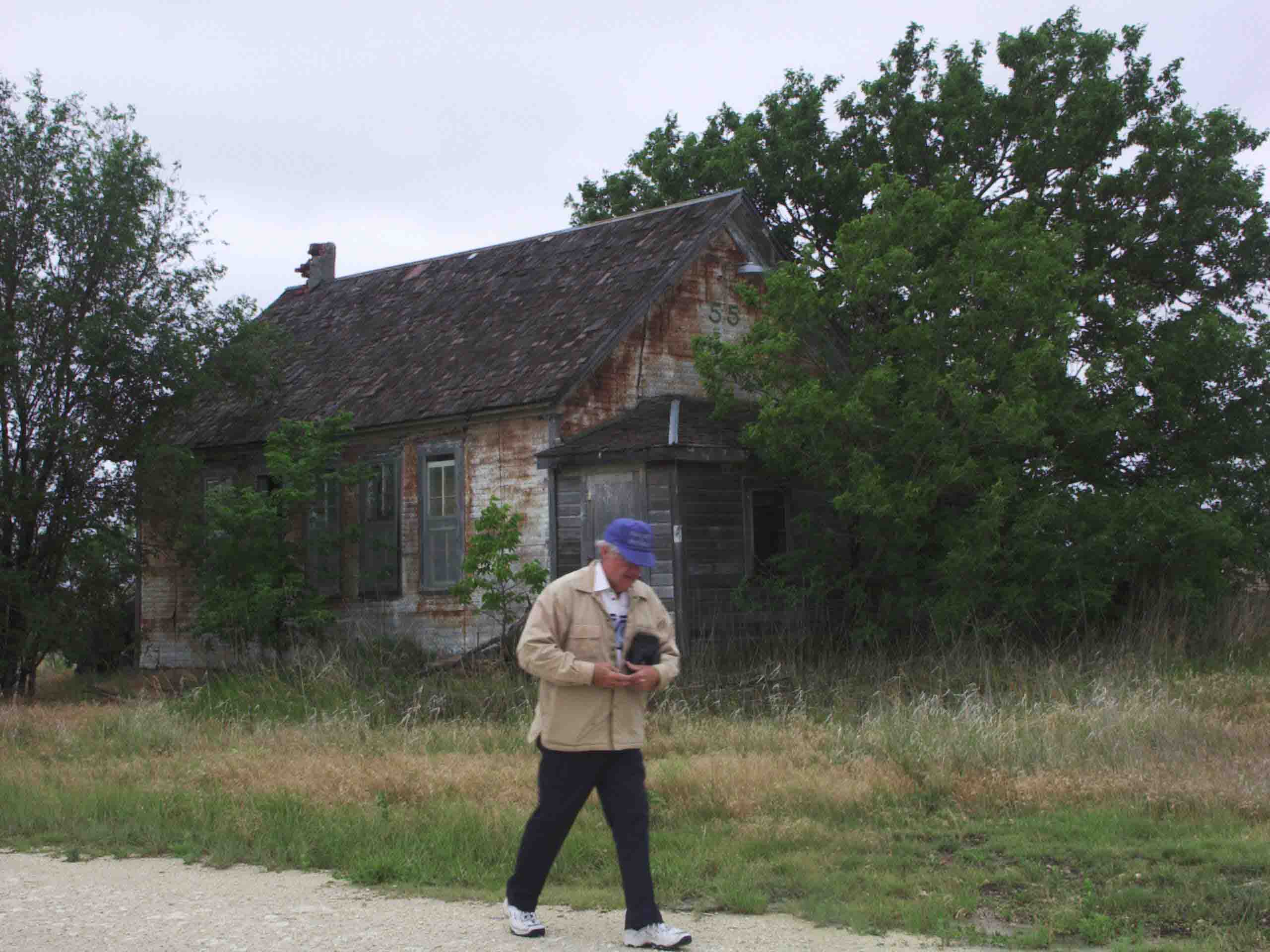
Bob Rader at Elm Creek Schoolhouse, the land for the school was donated by J. G. Coldiron
2004 June
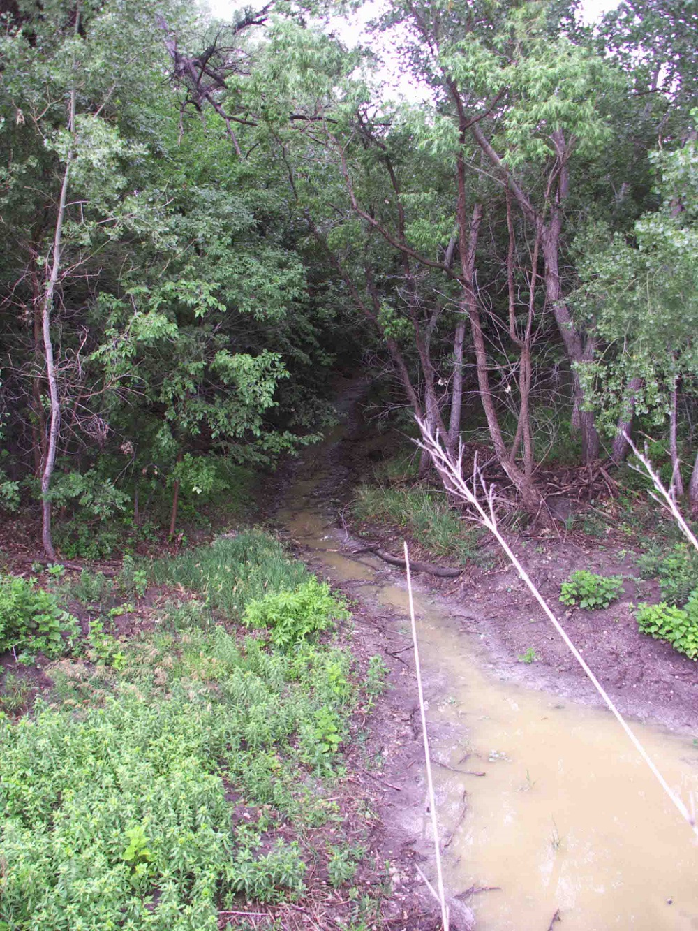
Elm Creek running through Harriet Applegate Reeder Farrier land
Rooks County, in the northwestern section of the state, is in the second tier
south of the Nebraska line, and the fifth county east from Colorado. It is
bounded on the north by Phillips county; on the east by Osborne; on the south by
Ellis, and on the west by Graham. The legislature defined the boundaries in 1867
as follows: "Commencing where the east line of range 16 west intersects the 1st
standard parallel; thence south to the 2nd standard parallel; thence west to the
east line of range 21 west; thence north to the 1st standard parallel; thence
east to the place of beginning."
It was named in honor of John C. Rooks
of the Eleventh Kansas cavalry. Settlers did not begin coming into the county
till 1871. By the fall of the next year there was sufficient population for
county organization, which took place on Nov. 26, 1872. Gov. Harvey in his
proclamation named Stockton as the temporary county seat, and appointed as
commissioners, Lyman Randall and Lewis Stults. The commissioners chose George W.
Beebe as clerk. The first election was held Dec. 31, 1872, when the following
officers were elected: Probate judge, M. Drake; sheriff, John Russell; county
clerk, L. C. Smith; treasurer, Joseph Brossard; surveyor, Albert Cooper; clerk
of the district court, Thomas Boylan; superintendent of public instruction, John
M. Park; attorney; D. K. Dibble; register of deeds, L. C. Smith; coroner, D. W.
Gaun; commissioners, Lyman Randall, D. O. Adams and Lewis M. Stults;
representative, Joseph McNulty. For county seat Stockton received 95 votes and
Lowell 52. The whole number of votes cast in the election was 147.
Among
the early events was the killing of two young men named Roberts by a desperado
by the name of Johnson. In 1873 a cattle dealer from Kentucky was murdered and
robbed, his body being hidden in the sand 12 miles east of Stockton, where it
was found by some children. In June, 1875, two men with 35 head of Texas ponies
came to the south fork of the Solomon river not far from Stockton, where they
camped and gave notice that their stock was for sale. One of the strangers went
to town to make some purchases and the people gathered to inspect the ponies.
While they were doing so sheriff Ramsey of Ellis county, accompanied by sheriff
Joseph McNtilty of Rooks county, rode up heavily armed and announced that the
ponies had been stolen. Ramsey ordered the thief to throw up his hands. Instead
of doing so, the man jumped behind a pony and prepared to shoot. Both Ramsey and
the thief were armed with needle guns. They both fired and simultaneously
dropped dead. The other stranger was hunted up and wounded in the jaw by a shot
but he managed to escape.
The first newspaper was established in Jan.,
1876, by J. W. Newell. It was a Greenback labor paper and was called the
Stockton News. The county agricultural society was formed in 1879. Until 1881
the county offices occupied rented quarters. A $5,000 court-house was built that
year, the city of Stockton contributing $3,000 of this amount. A strong jail of
cottonwood logs, strengthened by tons of iron, was built near the court-house. A
number of flour mills were built in the '70s.
The county is divided into
22 townships, viz.: Alcona, Ash Rock, Belmont, Bow Creek, Corning, Farmington,
Greenfield, Hobart, Iowa, Lanark, Logan, Lowell, Medicine, Northampton,
Paradise, Plainville, Richland, Rush, Stockton, Sugar Loaf, Twin Mound and
Walton. The postoffices are: Alcona, Codell, Damar, Palco, Plainville, Stockton,
Webster, Woodson and Zurich. A line of the Union Pacific R. R. enters in the
southeast and crosses northwest into Graham county. A branch of the Missouri
Pacific enters in the northeast and terminates at Stockton.
The general
surface of the county is rolling, with high bluffs along the south fork of the
Solomon river and Paradise creek. One-fifth of the surface is almost level, and
about three-fifths are undulating prairie. The bottom lands along the Solomon
are about one and one-half miles in width, and those of other streams from
one-half to one mile in width. The streams are lined with thin belts of native
timber, and some artificial plantings have been made. The south fork of the
Solomon river enters on the west and flows eastward through the county. Slate
and Sand creeks are tributaries from the northwest and Spring Lost, Box-Elder,
Elm and Medicine from the south. Other creeks are Paradise, Wolf, West and East
Eagle and Bow. Magnesian limestone of a superior quality underlies the entire
county, with quarries at Iago and on Elm and Medicine creeks. Sandstone, gypsum
and potter's clay are also found.
In 1878 the number of acres under
cultivation was 5,211. In 1882 the value of farm products was $634,077. In 1910
the total value of farm products was $3,403,171. Wheat was worth $1,463,950;
corn, $399,543; oats, $142,038; Kafir corn, $110,075; tame grass, $220,671; wild
grasses, $113,694.
The population in 1875 was 567; in 1880 it was 8,112.
In the next decade there was a decrease of 94, the population in 1890 being
8,018. In the next ten years there was a decrease of about 60. In 1910 the
population was 11,282, showing an increase of 3,322, or nearly 50 per cent. The
assessed valuation of property in 1910 was $16,351,545.
Contributed 2002 by Carolyn Ward, transcribed from Kansas: A Cyclopedia of State History, embracing events, institutions, industries, counties, cities, towns, prominent persons, etc. ... / with a supplementary volume devoted to selected personal history and reminiscence. Standard Pub. Co. Chicago: 1912. 3 v. in 4.: front., ill., ports.; 28 cm. Vols. I-II edited by Frank W. Blackmar, Volume II, Pages 604-606.
Sept 30, 1878 Monday
Started for
Kansas this morning between 10 and 11 o'clock, several friends with whom we
hated to part came to see us off, perhaps we will never never meet again.
We dined at Jonesburg after which we traveled on without incident, except
that while passing through High Hill a man handed us a map (guess the object of
which was to advertise the Rockport Ferry), we also met three covered wagons
going east, and tonite we are camped at the western edge of Danville having
traveled about 23 miles. A party having 3 wagons a plenty of crying children
(but I cannot blame the children) are camped just across the road they are bound
for southern Kansas, and so ends our first days experience as one of the many
homeless wanderers who are wending their way westward to seek a home.
Oct
1 Tuesday
We left Danville about sunup after having spent an almost
sleepless night. Our situation was so novel and our beds so uncomfortable, we
made 14 miles before dinnertime and stopped 2 miles west of Williamsburg where
we had our dinner.
The most of the road between Danville and
Williamsburg was very rocky and hilly, met several wagons coming from Kansas,
said they didn't like the country AT ALL, not very encouraging, camped tonight
10.5 miles west of Williamsburg, 22-1/2 miles for the day, we are now 45 miles
from the place that was our home for 13 years. Encamped in a lovely place by a
large country church where we get excellent water from a well in the church
yard. I don't think I would like to live in Calloway Co.
Oct 2 Wednesday
Started this morning just a little after sunup, it was a most lively morning
just cool enough for wraps, traveled 12 miles and stopped for dinner 7 miles
west of McCreedie. A gentleman and little boy that live near came to camp and
stayed until we left, he was a great talker, traveled 9 miles after dinner, and
we are now camped in Boon County 5 miles east of Columbia.
During all the
day we have been passing through beautiful country that has redeemed Calloway
County in my estimation and I think if I was only the happy possessor of one of
the beautiful homes we passed today, I should be content to live and die in
Calloway Co., but this evening we are camped in a gloomy and desolate place and
we have hears since camping that the neighborhood does not have a good
reputation. I don't think any of us will sleep much tonight, one of the family
besides our selves are camped here and we fear him as much as the reported horse
thieves.
Oct 3 Thursday
I passed the night very well but the boys
slept very little, got quite an early start this morning, one mile east of
Columbia we struck the gravel road where we had to pay .80 cents to ride in our
two wagons over the roughest road I ever traveled, we stopped for dinner 7 miles
west of Columbia, after dinner we traveled on to Rockport on the Missouri River
bottoms of Cooper County, where we have plenty of wood and water traveled 24
miles today.
Oct 4 Friday
Arrived at Boonville about 12 m. stopped
there long enough to have a horse shod and where I was for the first time amused
since we have been on the road. The town is very picturesque and seems to be a
lively business place, I noticed the handsome monuments in the cemetery, also
two extensive earthenware factories. WE traveled 19 miles and camped just after
crossing the Lamine Bridge.
The first rain we have had since we started
began, while we are getting supper with a prospect for an all night rain, but
one good thing our wagons are perfectly waterproof.
Oct 5 Saturday
A wet damp morning did not get away from our camp on the Lamine River until
quite late, just before starting a family by name Higgins came to our camp to
get acquainted, they were going to nearly the same place in Kansas as ourselves.
Was not very much prepossessed with their appearance. We passed through Arrow
Rock a little after dinner, owing to the many bad hills we have traveled only
about 20 miles today. We are now camped 8 miles east of Marshall and 7 miles
from Arrow Rock in a very pretty country. Saline is a very different from Cooper
County, this is a very beautiful moonlight night.
Oct 6 Sunday
A
beautiful Lord's Day but not a day of rest for us, for owing to the heavy
expense we are on for feed and the lateness of the season we have concluded that
we cannot afford to stop, we have today been traveling through the most
beautiful country I have ever seen I would never wish to see a lovelier country
than that between Marshall and Malta Bend. We have traveled today 27 miles if
not more, the roads were splendid and we made a better time then we have since
leaving. We camped tonight 2 miles west of Malta Bend on the road side.
To the north of us is a large swamp where we have the benefit of a spring, there
has been a bad drouth here this spring but never the less the crops are
splendid.
Oct 7 Monday
Another damp foggy muddy morning rained
most of the night, left our camp about an hour by sun, after going 9 miles
passed Waverely and 11 miles farther on we passed thru the small town of Dover.
Today we are traveling over the roughest and most hilly we have had as yet, the
road runs on the edge of a bluff country being at all times within 2 miles of
the river so of course we cannot judge Lafayette Co. by the part we have seen,
not withstanding the mud and the hills we have traveled today 23 1/2 miles and
have camped tonight on the banks of a large creek 7 1/2 east of Lexington, the
county seat of Lafayette Co.
Oct 8 Tuesday
We had a terrible storm
of wind hail and rain last night and with all that thieves were prowling around,
so all in all we passed a very uncomfortable night. We got a very late start
this morning passed thru Wellington and are now camped 4 or 5 miles from Jackson
Co. line, there have been several depradations committed of late by horse
thieves and emigrants are considerably frightened and very cautious tonight. We
are camped tonight with three other families and will keep watch all night. Only
traveled about 20 miles today. Are traveling along the Kansas City and Eastern
RR. This eve is very windy and would not be surprised if we had another storm
tonite. The folks we are camped with tonight are by name Cunningham and Drake.
Oct 9 Wednesday
We started very early this morning and soon after
passed thru the small town of Napoleon and also several small RR stations of
which I didn't get the name of, had very good roads most of the time and during
this day our wagon wheels have revolved over a distance of 25 miles and have
camped tonite in the suberbs of Independence Jackson Co. Mo. This is a large
camping ground and a great many emigrants have camped here tonite. I have
written 2 letters on to Nora and one to Morris will mail them at Kansas City in
the a.m. One of the mules is sick tonight.
Oct 10 Thursday
About
ten thirty a.m. we arrived in K.C. where I mailed my letters, this seems to be a
great place for business and a good market, the streets were so blocked we were
w/ a long time getting through, crossed the Kansas River on a bridge, the Kansas
is a very narrow stream, but the water looks as clear as crystal where it
mingles with that of the Missouri, where we crossed the line and stopped at
Wyandotte Kans for dinner our first repast on Kansas soil and a terrible wind
arose to greet us as we entered the state where our future home will be, this
afternoon we had a hard road to travel among the hills of Wyandotte Co. as soon
we reached the summit of we go down the other side and then up on the other and
they are really tremendous. We have traveled today between 25 and 30 miles and
have camped tonight south of the main road in a grove where there is a spring, I
think we are about 2 miles east of White Church. As soon as we reached camp the
rain that has been threatening for some time commenced falling and we could not
get our supper until very late.
Oct 11 Friday
The rain last night
was of short duration, we got an earlier start then usual, but oh, such roads
regular mountains. We all had to get out of the wagons and walk up hills. We
traveled 25 miles today passed by White Church and thru Tonganoxie and we are
now camped about one mile west of the last name place by a school house where
the road turns north toward Diamon City. This evening we bought hay at .20 ct a
cwt and corn for .20 ct. bu. We have been paying .30 and .50. What I have seen
of Kansas I like splendid, it is a beautiful country and this is a lovely night.
Oct 12 Saturday
After a 12 mile drive this a.m. we arrived at the
small town of Dimon, where we were told we had taken the wrong road that if we
had taken the river road we would have escaped all those terrible hills. We
thought never too late to do better and are now on our way to the river road. If
we have good luck will pass Topeka tomorrow. Fell in with a family by name Skank
who live at Silver Lake 11 miles west of Topeka, they came to Kansas last spring
from Ind. Are camped about 20 miles east of Topeka on an open prairie, have
traveled 25 miles today.
Oct 13 Sunday
Another Sunday passed on
the road traveled all day arrived at the river long before noon ferried across
the Kansas at Grantville, passed thru Topeka the capital of the state about an
hour by sun, crossed the Kansas again on a bridge where I was very much pleased
with the scenery liked the appearance of the city and populace very much except
that are too many niggers.
One mile west of Topeka we camped for the
night, heard today that the Indians are playing hobb in the west, but heard
later that the trouble didn't amount to much, hope not.
Oct 14 Monday
Left our camp near Topeka this a.m. and made a drive of 15 or 16 miles
before dinner passing thru Silver Lake and Kingsville. The Kaw Valley is a
beautiful country and such corn field I have never seen in my life before. I
think they will average 75 bu to the acre.
This afternoon we passed thru
Rossville and St. Mary's Mission, the latter a Catholic town the convent is a
very nice building, I saw no churches in the place but what were Catholic. I saw
one Indian there, the Indian reservation is not far from there. We camped
tonight 3 miles west of St. Mary's near the K.P.R.R. a little school house is
upon the hill to the west of us. Lost our wash pan this eve, think we have
traveled about 26 miles today do not feel very well satisfied with our camping
place, do not feel very safe will try to reach Manhattan tomorrow evening.
Oct 15 Tuesday
The wind blew so terrible that we had to take our
canvas off in order to travel at all, we are all quite sick of Kansas. The clay
hills of little Warren Co. are preferable to this, traveled about 26 miles thru
Pottowatomie Co. and I hope the lost souls may not be more punished than we were
by wind and sand. Oh, how tired I am of this life. Have camped tonite on the
outskirts of Manhattan in a draw about 50 ft from the Big Blue River. Sixteen
other wagons besides ourselves are camped here. Passed thru the towns of St.
George and Louisville. Have a good prospect of a hard storm of wind ad rain
tonight.
Oct 16 Wednesday
Began our days journey by crossing the
Big Blue. We had a hard hard storm of wind and rain last night and the roads
this morning were very slippery making the traveling very hard on the horses,
traveled about 20 mi today which is about half way to Clay Center. Manhattan is
built mostly of stone and is a very nice looking town. Have camped tonite one
mile west of Riley Centre on Wild Cat Creek, today has been very cold and windy,
the first cold day we have had.
Oct 17 Thursday
Oh, how cold, we
had to be wrapped in bed quilts all day, got somewhat out of our way today and
traveled a mile or so to no purpose. Arrived at Clay Center (which I renamed
Shanty town) about 3:30 p.m. had a shoe put on one of the mules and drove about
5 miles this side of Clay Center. Passed where Republican City was, all that is
left of the town is an old store and a church. We crossed the Republican River
on a bridge at Clay Center, we have been traveling thru a country destitute of
fences, since noon, traveled 25 miles today.
Oct 18 Friday
We
traveled from sunup till sun down in all about 30 miles, and from the time we
started till we camped we did not so much as see a tree we asked what they used
for fuel and they replied CORN, such is Cloud Co. Most of the habitations are
dugouts and sod houses we are camped tonight 5 1/2 miles from Meridth in company
wit five other wagons got off of the right road again today which is getting to
be an almost daily occurrence, very hard traveling here especially for broad
tired wagons, the roads are like the country very much contracted, the fither I
go in Kansas the less I like it.
Oct 19 Saturday
Commenced our
daily journey today but soon parted company with our comrads of last night some
stopping to visit acquaintances others taking a more southerly route ourselves
taking the course to Beloit stopping to dine on a creek where we found a few
trees, not far east of the Solomon River, the country we passed through today in
Cloud County is far superior to that of yesterday, the improvements are of a
better class and more thickly settled, we passed this morning through the small
town of Meridth and this eve through Glascoe and have camped this eve in
Mitchell Co. on the Solomon River, twelve miles from here is Beloit. Traveled
today 25 miles.
Oct 20 Sunday
Another Sunday and we are still
traveling have been traveling all day in Mitchell Co., like the looks of the
country very much have seen several people today from Rooks Co., they say it is
a fine county. Arrived at Beloit about noon it is a very thriving lively
business place. I was very much impressed with the place have had splendid roads
all day, traveled about 25 miles and have camped for the night about 7 miles
east of Waconda Springs where we will cross the north fork of the Solomon River,
the wind has been blowing very strong all day and is still blowing.
Oct
21 Monday
Left our camp this morning near Glen Elder arrived at Waconda
Springs at noon where we stopped for dinner, the roads were splendid all day the
wind has been blowing very cold and piercing all day and tonight is freezing
cold we are camped one mile west of Osborn City which is a very handsome little
town, it has a beautiful site and the buildings are all neat and nice looking.
We expect to arrive at our destination day after tomorrow before noon, traveled
29 miles today.
Oct 22 Tuesday
Left camp very early this morning
passed through the small town of Tilden and Bull City at which place we took
dinner and camped tonight 6 miles east of Stockton at the Reno crossing of the
South Fork traveled 31 miles.
Oct 23 Wednesday
Arrived at Stockton
at nine o'clock, after making some purchases and viewing the town which we liked
very well we took the Elm Creek Road and arrived at Tom's at 11 o'clock in good
time for dinner, found all well and felt ourselves as though we were weary and
would like to rest, so ends the terrible trip.
Addie C. Reeder
Contributor unknown
Post Office 1878 - 1930 First postmaster - Royal W. Barett
Minety PO 1882-1885 First postmaster - Charles Newth
Post Office 1876 - 1885 First postmaster - Mr. Olds
Mount Pleasant PO 1878
Liberty PO 1878
Spring Branch PO 1878
Webster PO 1979 First postmaster - John Stephenson
Bradford PO 1879 First postmaster - M. J. Coolbaugh
Adamson PO 1875 - 1891 First postmaster - Daniel White
Slate PO 1880 - 1903 First postmaster - Lewis K. Meyers
Portage PO 1880 - 1892 First postmaster - Clark P. Riley
Eagle Creek PO1878 - 1884 First postmaster - Samuel N. Prichard
Laton (aka Eagle Creek) PO 1884 - 1904 First postmaster - Chris C. Hall
Hoskins PO 1880 - 1888 First postmaster - J. L. Hoskins
Motor PO 1888 -
Natoma PO 1904 - First postmaster - Charles McFadden
Amboy PO 1882 - 1894 First postmaster - William P. Baker
Palco PO 1894 - (aka Cresson) (See Northampton Township Below for links)
Rockport PO 1873 - 1905 First postmaster - J. T. Stroup
Earnest PO 1882 - 1889 First postmaster - John L. Bearnes
Frankton (defunct)
PO 1879 - 1884 First postmaster - Asa Bullock
Vertner PO 1879 - 1880 First postmaster - Vertner J. Megowan
Chandler PO 1880 - 1892 First postmaster - Benjamin Hill
Zurich PO 1880 - First postmaster - Amanda Webb
Rooks Centre PO 1872 - 1886 First postmaster - John Shorthill
Raceburg PO 1875 - 1886 First postmaster - George Race
Igo PO 1877 - 1904 First postmaster - Frank Gager
Survey PO 1880 - 1890 First postmaster - Dave Sollenbarger
Letts PO 1904 - 1904 First postmaster - Daniel C. Worden
Cresson PO 1879 - ? First postmaster - William J McLaughlin
Palco PO 1888 - ? First postmaster - Elijah S. Beavers
Villisca PO 1880 - 1881 First postmaster - Dennis Eddy
Codell PO 1889 - ? First postmaster - Jasper Parks
Florreyville PO 1875 - 1879 First postmaster - Andrew J. Florey
Motor PO 1879 - 1889 First postmaster - Jasper Parks
Plainville PO 1878 First postmaster - W. I. Griffin
Plainville Public Library
Plainville Times 400 W. Mills, Plainville, KS 785-434-4519
McHale PO 1880 - 1891 First postmaster - James McDonald
Enfield PO 1888 - 1894 First postmaster - Charles F. Budd
Damar (aka Enfield) PO 1894 - First postmaster - Fred Hamilton
Webster (aka Belmont) PO 1882 - 1953 First postmaster - Hiram L. Oyer
Stockton PO 1872 (first post office in county!) First postmaster - John O'Brien
Cedar PO 1874 - 1874 First postmaster - Abraham F. Surfus
Ash Grove PO 1876 - 1880 First postmaster - William B. Fulkerson
PO 1878 - 1904 First postmaster - Charles H. Dewey
Rooks Centre PO 1886 First postmaster - James Wilson
High Hill (defunct)
Nyra (defunct)
Contributed by Brenda Reeder
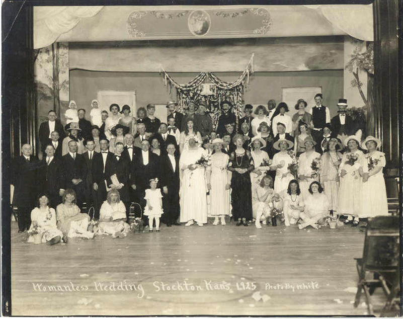
"Womanless Wedding, Stockton, Kans 1925, Photo by White"
A womanless wedding is a traditional community "ritual of inversion" performance, popular in the United States in the early 20th century. In this comic ritual, the all male cast would act out all roles of a traditional wedding party – including those of bridesmaids, flower girls, and the mother of the bride – while dressed in gowns and dresses.[3] The event often raised money for charities, civic organizations, and churches. The performances were so popular that scripts were developed around the idea, and the do-it-yourself theatrical productions were passed along from city to city. --Wikipedia
Photo contributed by Gaylyn Andrews
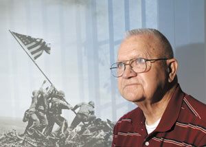
By Kim Schmidt, Nov 11 2006, kearneyhub.com, Nebraska
KEARNEY — Nearly 62 years after one of World War II’s bloodiest conflicts,
images of the battle of Iwo Jima still play in Don Richmond Sr.’s head.
“It’s
just as familiar to me as if it were yesterday. I might forget a lot of things,
but not that,” said Richmond, 81, of Kearney, his eyes red and welling with
tears. There was a bite in his voice as he said, “The first 150 years are the
worst, they say. You don’t forget.”
U.S. Marine with the 5th Jasco, 26th
Regiment, 5th Division, Richmond landed at Red Beach 2 at the southeastern edge
of Iwo Jima on Feb. 19, 1945, near Mount Suribachi. As a communications
specialist, his unit was in charge of setting up radio transmissions for
soldiers invading the Japanese-held Pacific island.
Richmond’s unit was
supposed to be on Iwo Jima for only three days. The plan was to then move on to
Okinawa to establish similar radio communications.
They never made it.
By
the end of the third day at Iwo Jima, his unit still was being bombarded by
Japanese soldiers dug in at the top of Mount Suribachi and in pillboxes
(bunkers) scattered across the island.
The high number of casualties forced
Richmond’s unit to disband. He then was attached “to whatever unit would take
me,” going from the company command post to the front lines to keep
communication lines open.
The battle of Iwo Jima was fought between the
United States and Japan during February and March of 1945 as part of the war’s
Pacific Campaign. In the end, the United States gained control of the island and
two airfields.
By the fifth day of the battle, Richmond began marching up
Mount Suribachi.
“I didn’t think I had a chance to get off that island
alive,” he said. “I gave up on that when finally I decided that was the only way
to think. I made up my mind I was not going to be captured and was going to
fight my way, and I did.
“I must have been pretty good at it because I’m
still here.”
The battle was made famous by an image captured by Associated
Press photographer Joe Rosenthal of American troops raising the U.S. flag atop
Mount Suribachi, a 560-foot high volcanic mountain.
It was the second flag
raised on Feb. 23, 1945, and Richmond and other Marines were in charge of
keeping an eye on photographers.
“The last time I saw Colonel (Harry)
Liversedge (battalion commander), he said, ‘Rich, get up on that damn hill and
try to see that the photographers don’t do something dumb and get themselves
killed,’” Richmond recalled, laughing at the memory. “When he (Rosenthal) took
the picture, I was probably within 20 feet of him.”
As he thumbed through a
faded 1950-copyrighted book about the 5th Marines that he purchased after the
war, Richmond recognized many faces and scenes, and recalled numerous stories.
There is a picture in the book that shows Richmond’s back as he stands on top of
top of Mount Suribachi holding his Browning automatic rifle.
“A lot of those
old boys I kind of remember,” he said, studying the book.
Richmond also is
pictured in some original movie footage of the battle of Iwo Jima.
He escaped
Iwo Jima with minor injuries to his back and left hand, damage to both eardrums,
and shrapnel wounds in his buttocks and head.
Richmond returned home to
Codell, Kan., in 1946. He later graduated from Fort Hays State University and
became a schoolteacher and superintendent.
Although some Iwo Jima veterans
have returned to the island, Richmond doesn’t care to. He’s unsure if he’ll see
the newly released movie “Flags of Our Fathers,” that’s based on the battle.
Today (Saturday), Richmond will break his tradition of going hunting on Veterans
Day and honor fellow vets as he rides in his son, Don Jr.’s, 1975 red Alpha
Romeo convertible in the parade through Downtown Kearney: The Bricks.
The
modest Richmond seems a little uncomfortable with all the attention. “I don’t
know who did all this planning to get me in to the parade,” he said. “But I
guess it’s all right.”
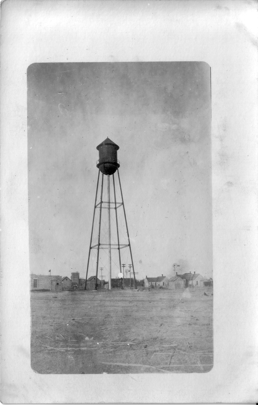
Watertower about 1908
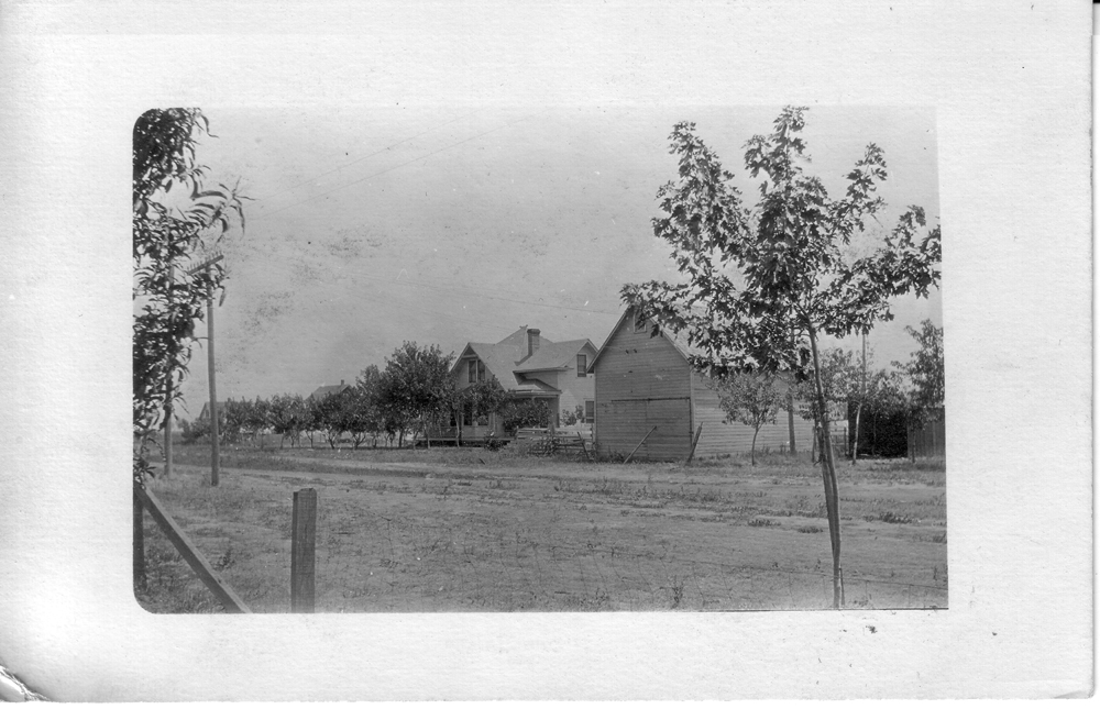
Unidentified Farmhouse and Barn
about 1908
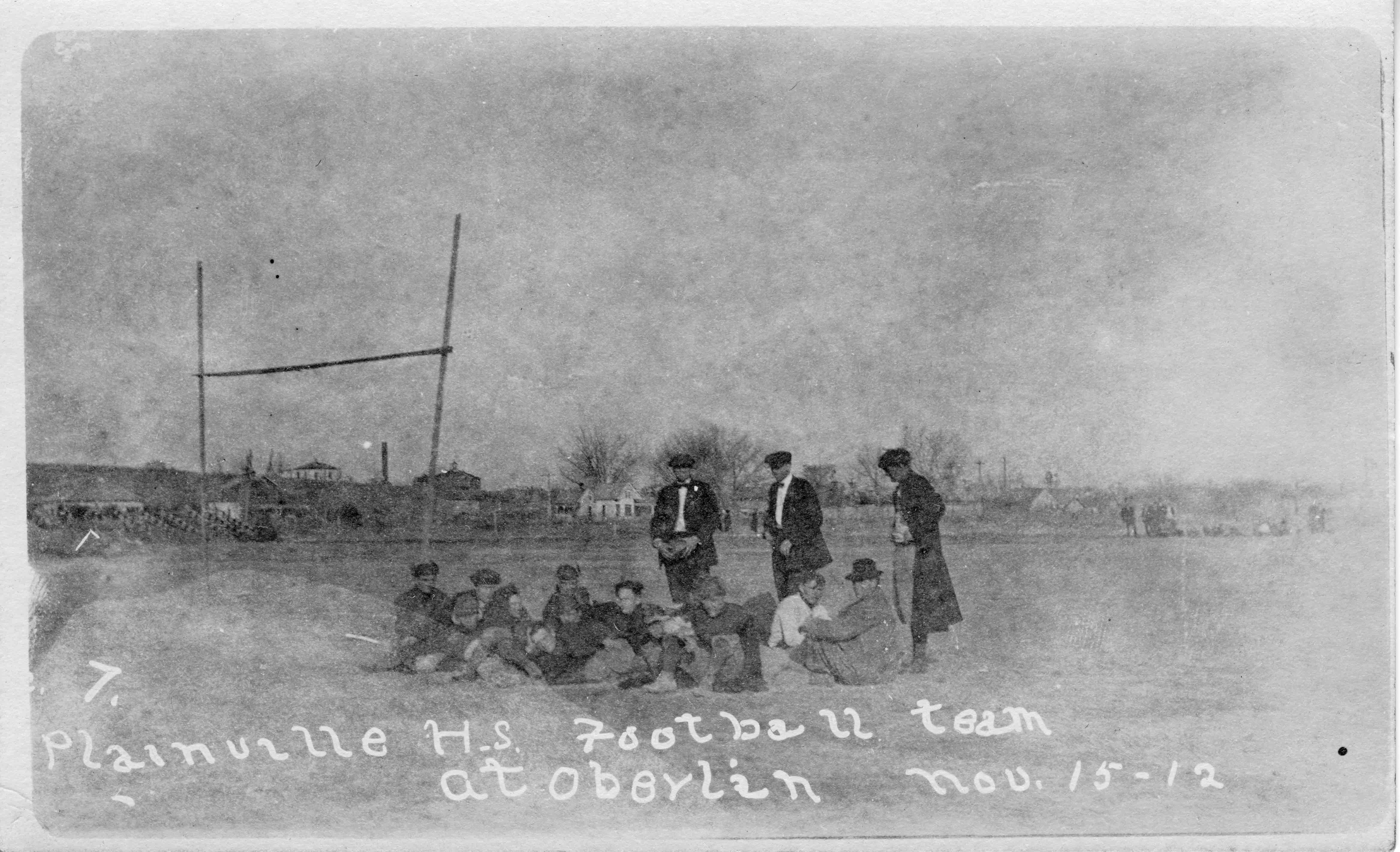
1912 Nov 15
Plainville High School Football Team
at Oberlin
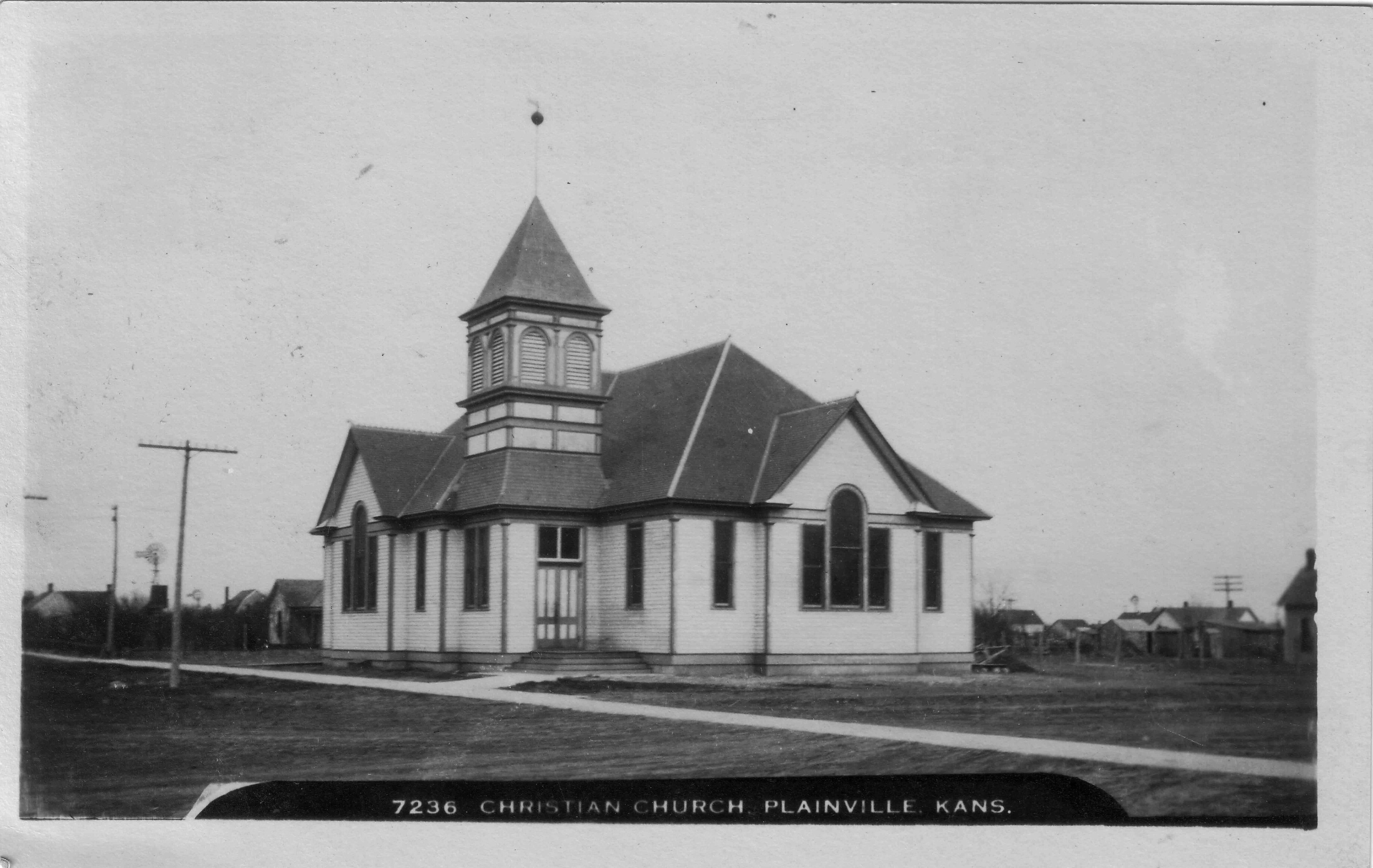
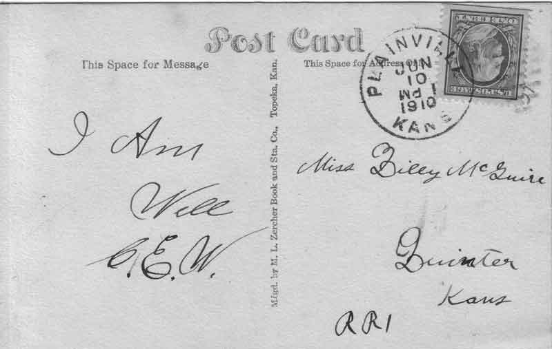
This is a used postcard cancelled in Plainville Kans June 10, 1910, 1 PM. It is addressed to Miss Lilly McGuire, Quinter, Kans RR1. The message is short and sweet "I am well C. E. W." It was manufactured by M. L. Zercher Book and Sta. Co., Topeka, Kan. It is number 7236 Christian Church Plainville, Kans.
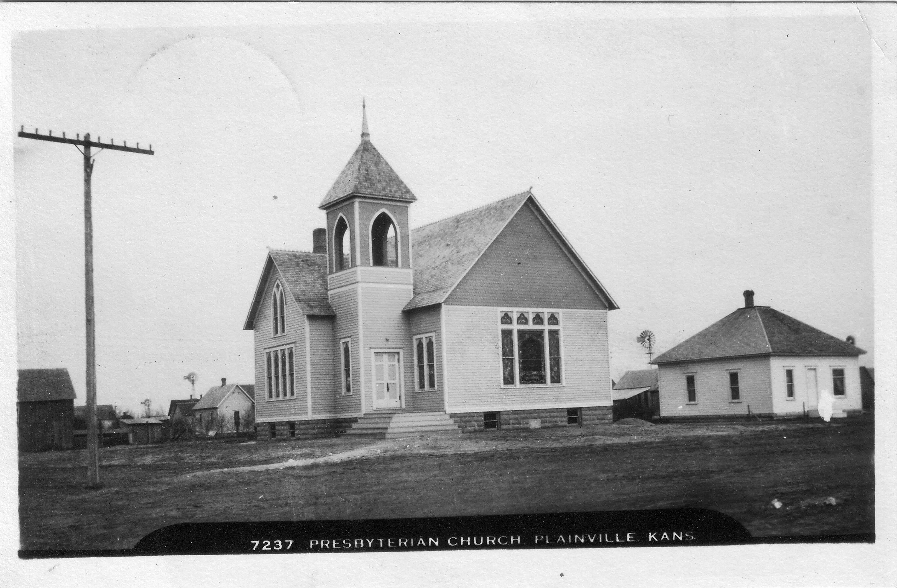
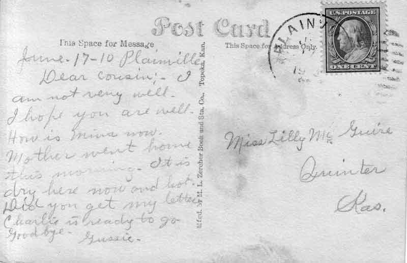
This is a used postcard. The postmark date is not very clear but Plainville. It is hand dated June 17, 1910, Plainville. It is addressed to Miss Lilly McGuire, Quinter Kas. The message is "June 17, 10 Plainville, Dear Cousin:-I am not very well. I hope you are well. How is Mina now. Mother went home this morning. It is dry here now and hot. Did you get my letter. Charlie is ready to go. Goodbye. Gussie." It is number 7237 Presbyterian Church, Plainville Kans. It was manufactured by M. L. Zercher Book and Sta. Co., Topeka, Kans.
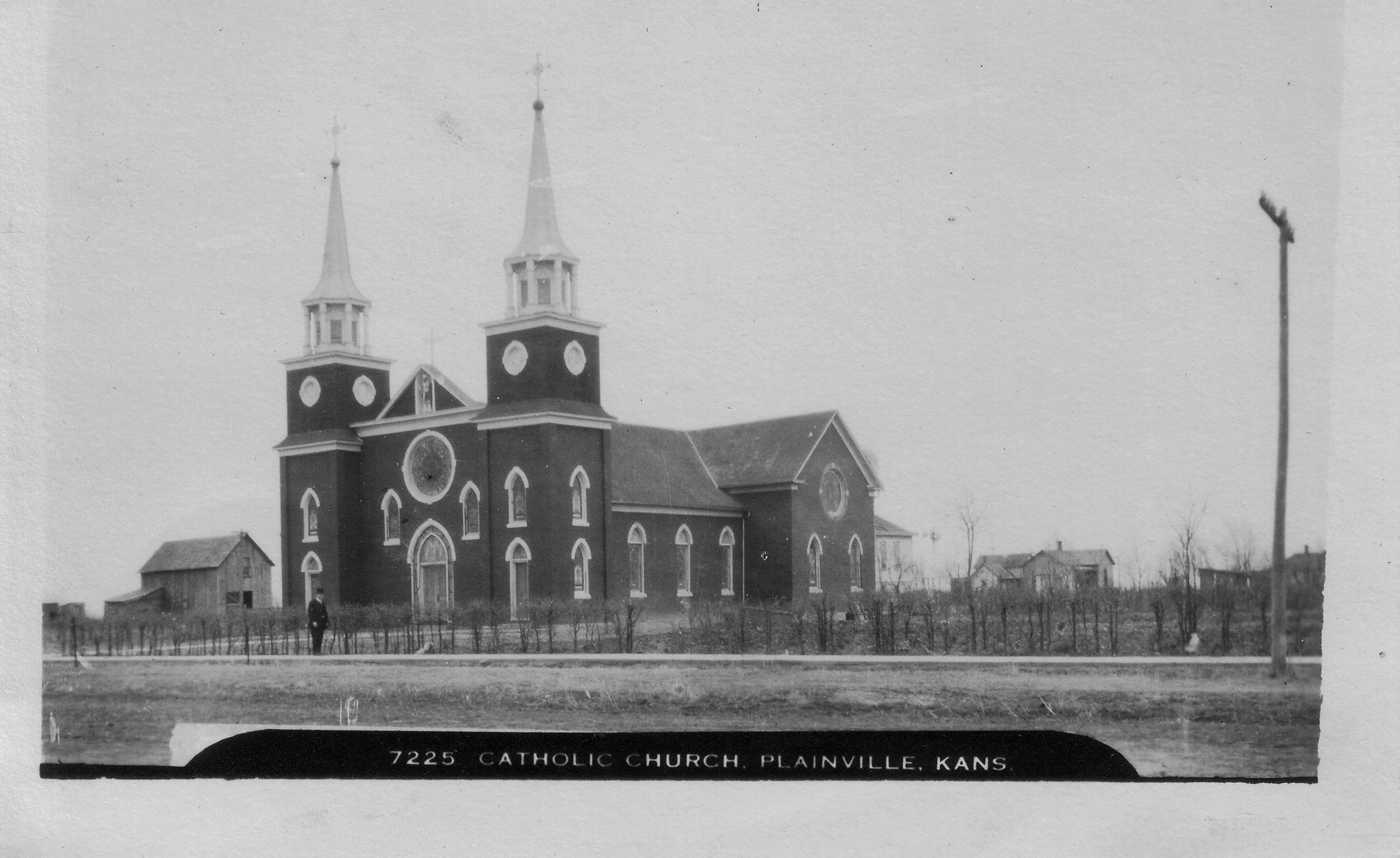
This is a used postcard but not postmarked but dated by the sender June 27, presumably 1910 like the other two. It is addressed to Miss Lily McGuire, Quinter, Kas. The message is "Plainville, June 27, Dear Cousin:- Will send you this card-I expect you are busy getting ready to go up to Hoxie Wensday. I wish it was so I could be there but I don't want to scare them. I have been feeling pretty well for me the rheumatism is bothering me some today-C. E. is out 5 miles east of town harvesting. Well I will close hope to hear from you soon. Gussie." The postcard is manufactured by M. L. Zercher Book and Sta. Co. Topeka, Kan. They sold 2 for $.05. This is number 7225 Catholic Church Plainville, Kans.
Submitted by Brenda Reeder
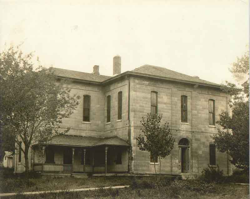
Old Courthouse
located at about 608 North Second
John and Roma Smith's home is where the old courthouse once stood. John has passed away, but Roma, age 92, is still living there and owns the Smith's Furniture store on Main Street in Stockton. Gaylyn Andrews, who submitted the photos, has worked at the Smith's Furniture for 21 years.

New Courthouse being build in 1922
at its present location
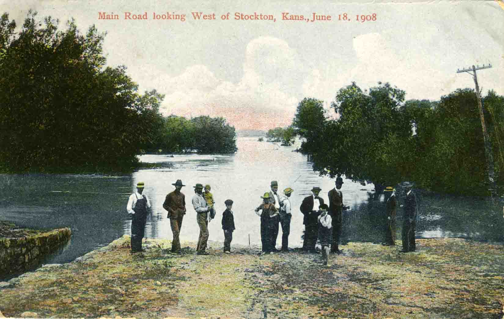
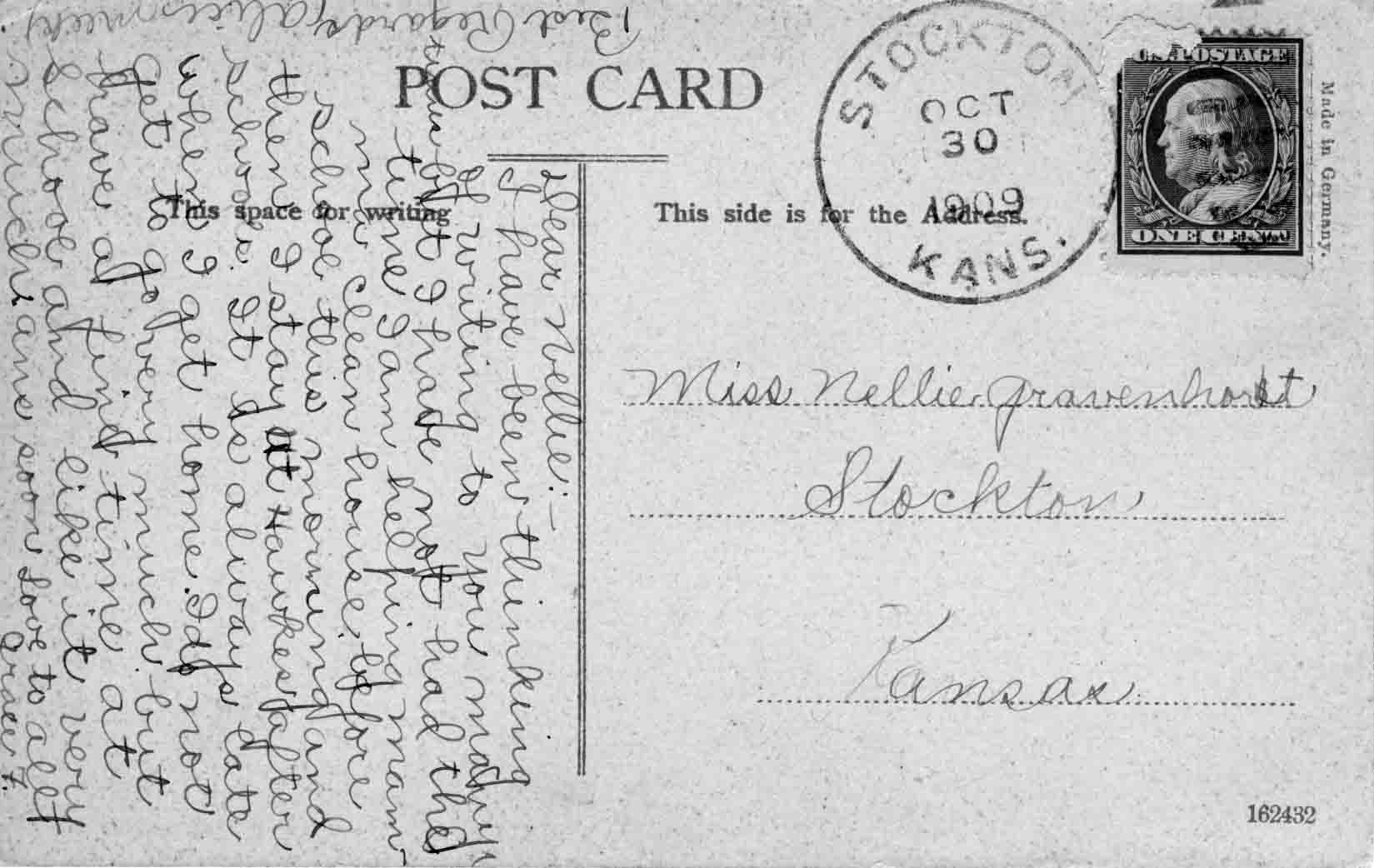
Main Road Looking West of Stockton, Kans., June 18, 1909
Postmarked Stockton, Kans. Oct 30 1909.
Addressed to Miss Nellie Gravenhorst,
Stockton, Kansas.
The message reads: Dear Nellie: I have been thinking of
writing to you many times but I have not had the time I am helping mamma clean
house before school this morning and then I stay at Hawkes after school. It is
always late when I get home. I do not get to go very much but have a fine time
at school and like it very much ans soon Love to all Grace F.
Best Regards
Alice Meek
Submitted by Brenda Reeder
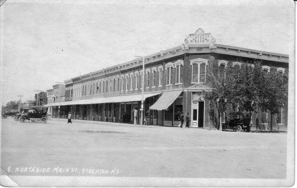
"E Northside Main St. Stockton KS" Bank Building
As of 2004, this building was partially demolished.
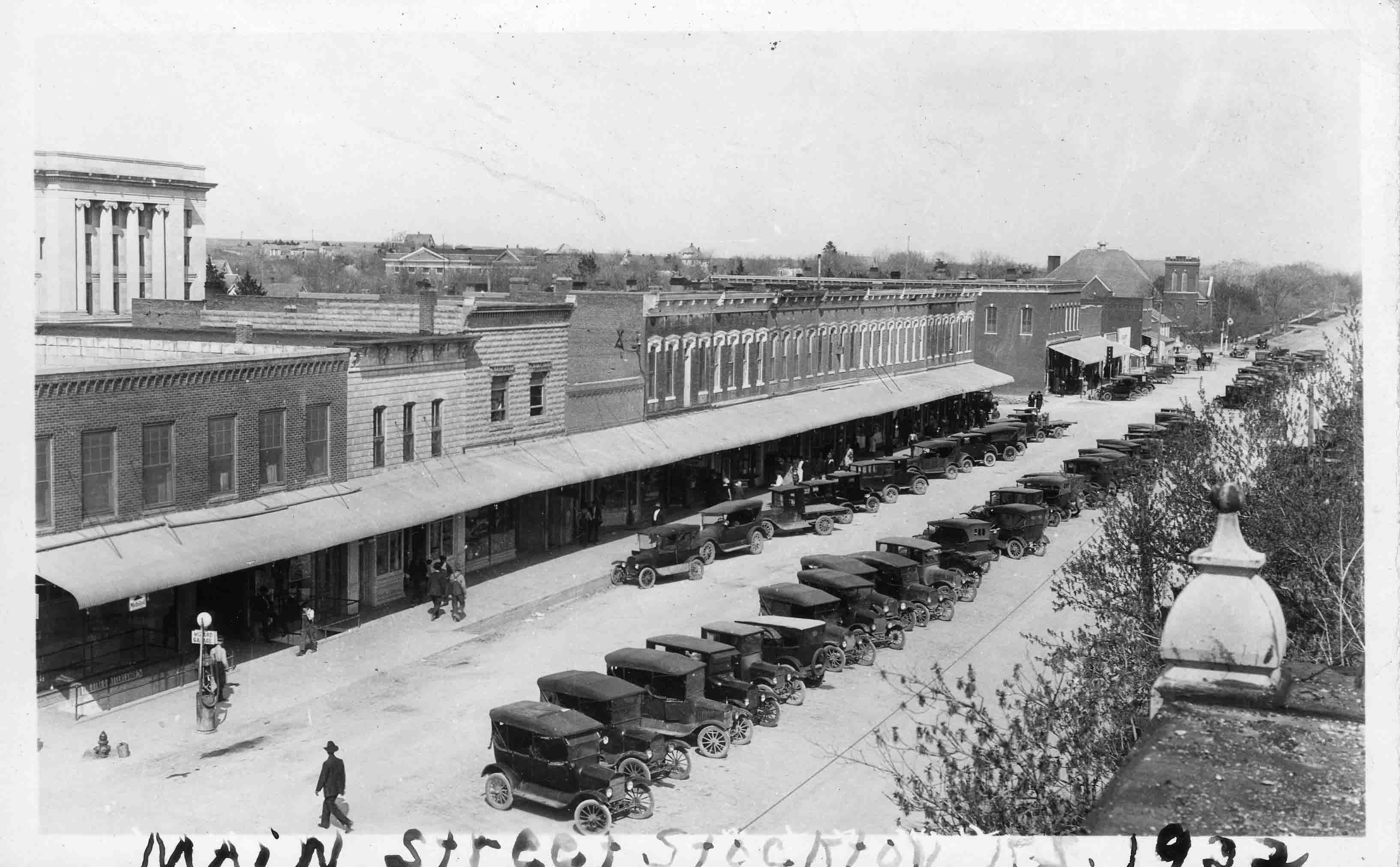
Main Street 1922, submitted by Brenda Reeder
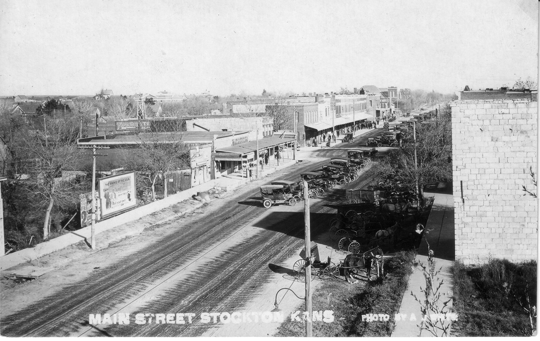
Main Street Stockton Kans. circa 1912 postcard by A. J. White Photographer
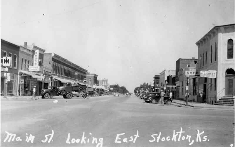
Stockton Main Street, looking east, about 1920. Postcard submitted by Brenda Reeder
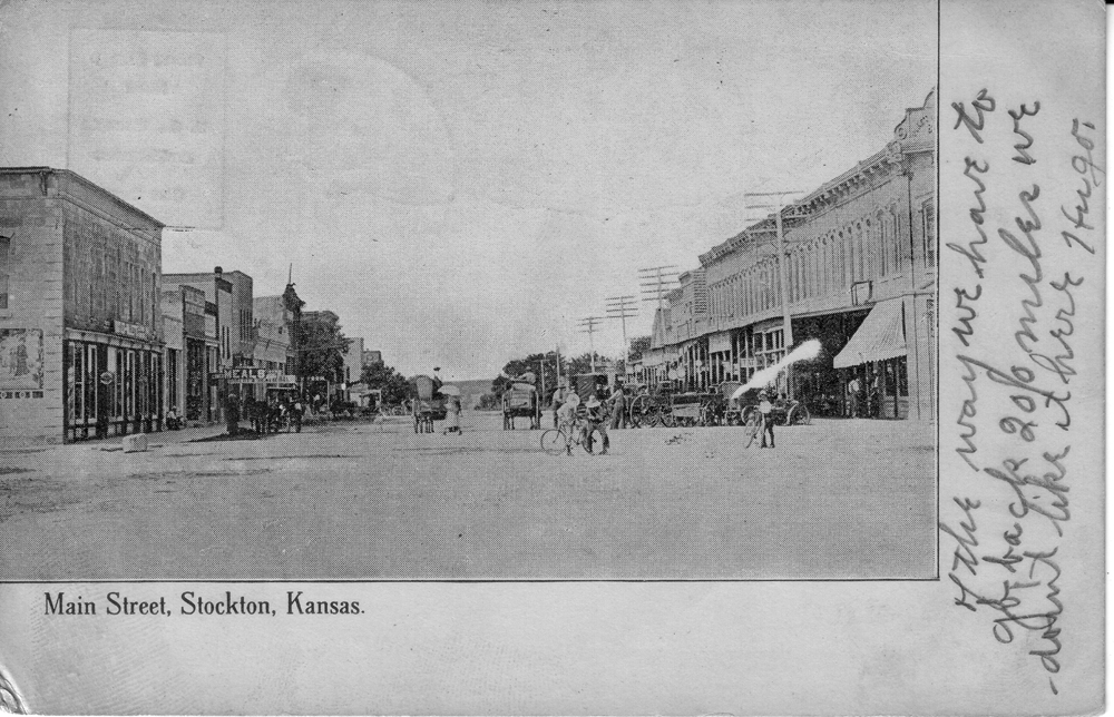
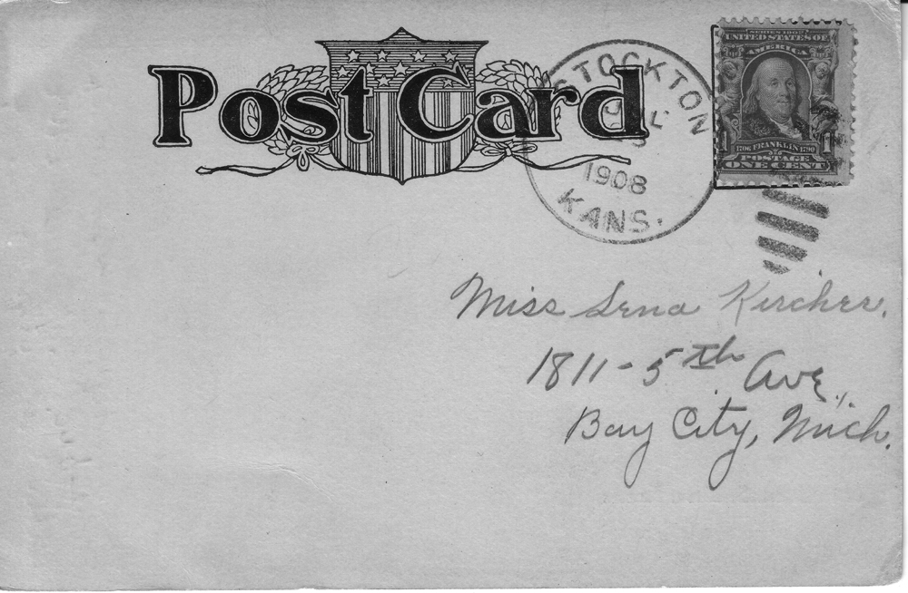
"Main Street, Stockton, Kansas."
Handwritten message on the front reads "of the
way we have to go back 200 miles we don't like it here Hugo."
The back is
postmarked "Stockton Kans. Jul 23 1908" and is addressed to "Miss Sena Kircher,
1811 - 5th Ave., Bay City, Mich."
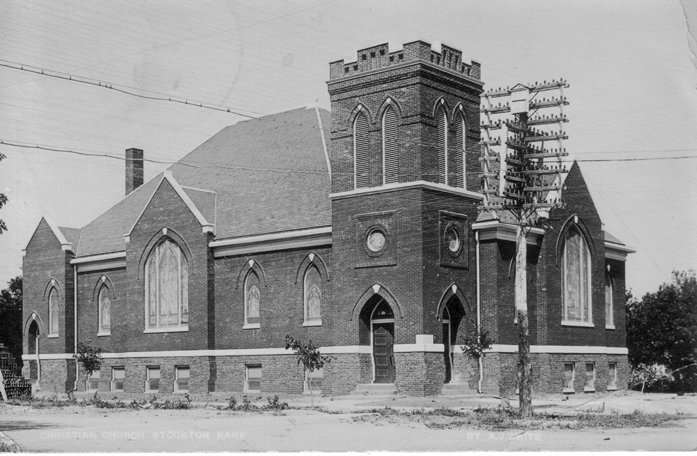
"Christian Church Stockton, Kans. by A J White"
Located on Main Street
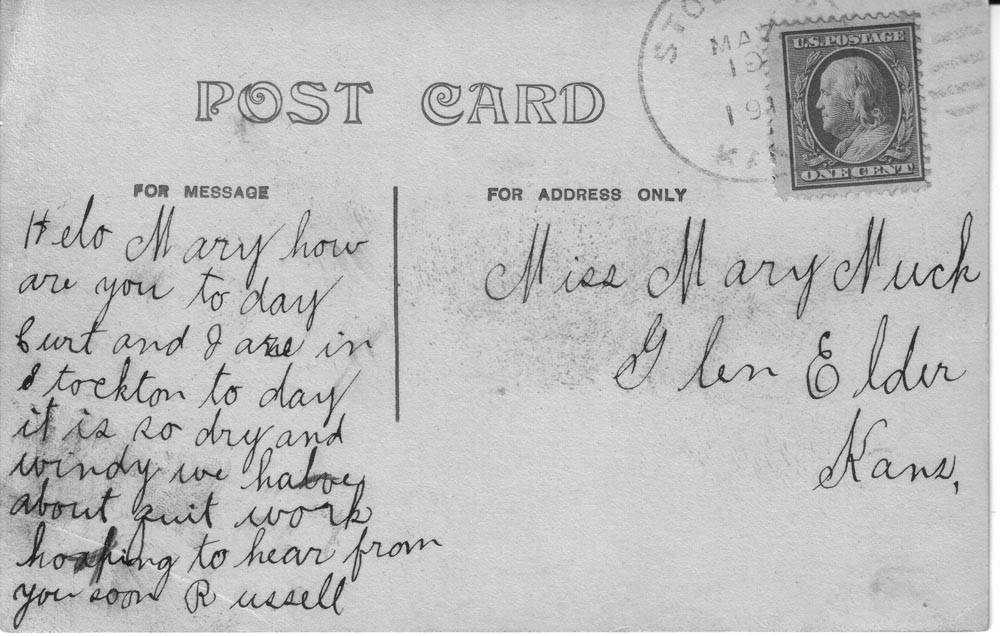
The message reads "Hello Mary how are you
today Curt and Jane in Stockton today it is so dry and windy we have about quit
work hoping to hear from you soon Russell."
It is addressed to Miss Mary Much,
Glen Elder Kans.
Postcard postmarked from Stockton, May 19, 1911
Submitted by Brenda Reeder.
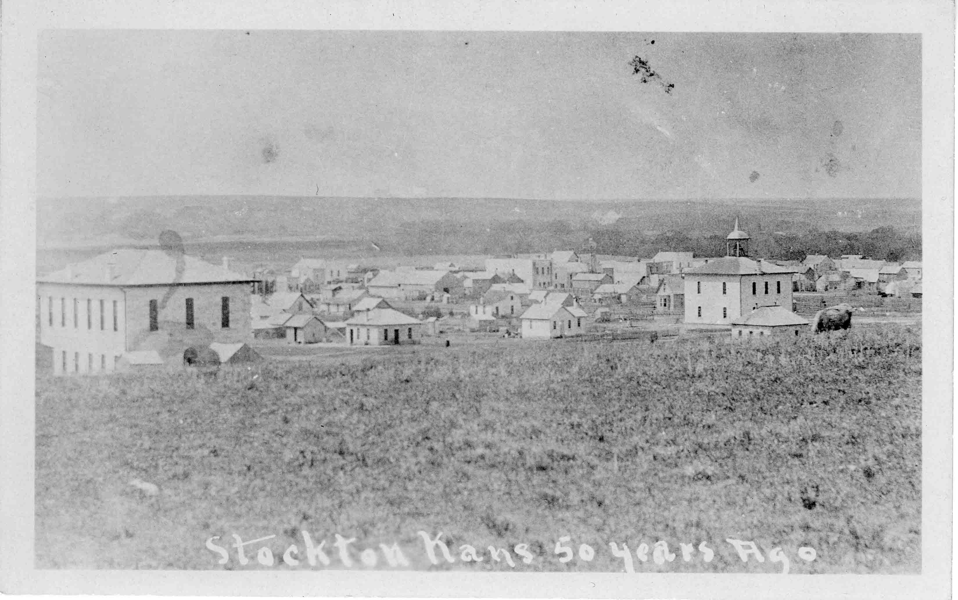
"Stockton, Kansas 50 Years Ago" submitted by Brenda Reeder
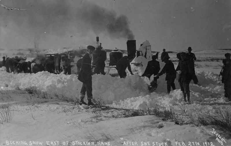
Bucking snow east of Stockton, Kans "After She Stuck" Feb 27th, 1912, Jepson Photo, submitted by Brenda Reeder
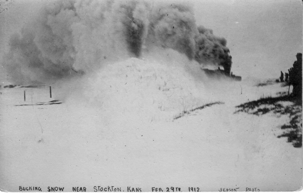
"Bucking Snow Near Stockton, Kans Feb 29th 1912 Jepson Photo" submitted by Brenda Reeder

"High Water West of Stockton Kans June 3 1918" submitted by Brenda Reeder
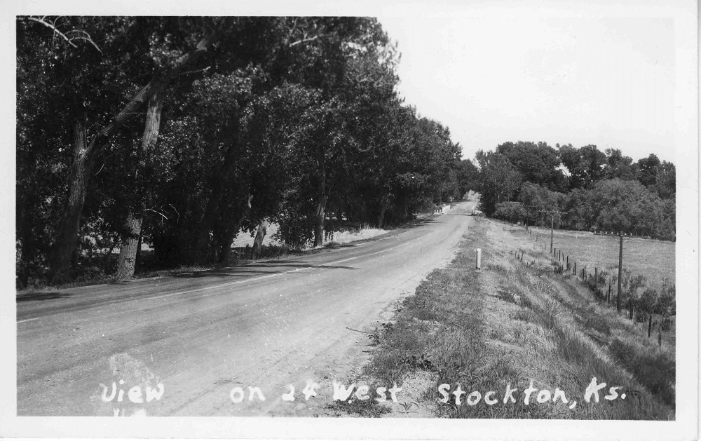
Flooding, view on 24 West Stockton, submitted by Brenda Reeder
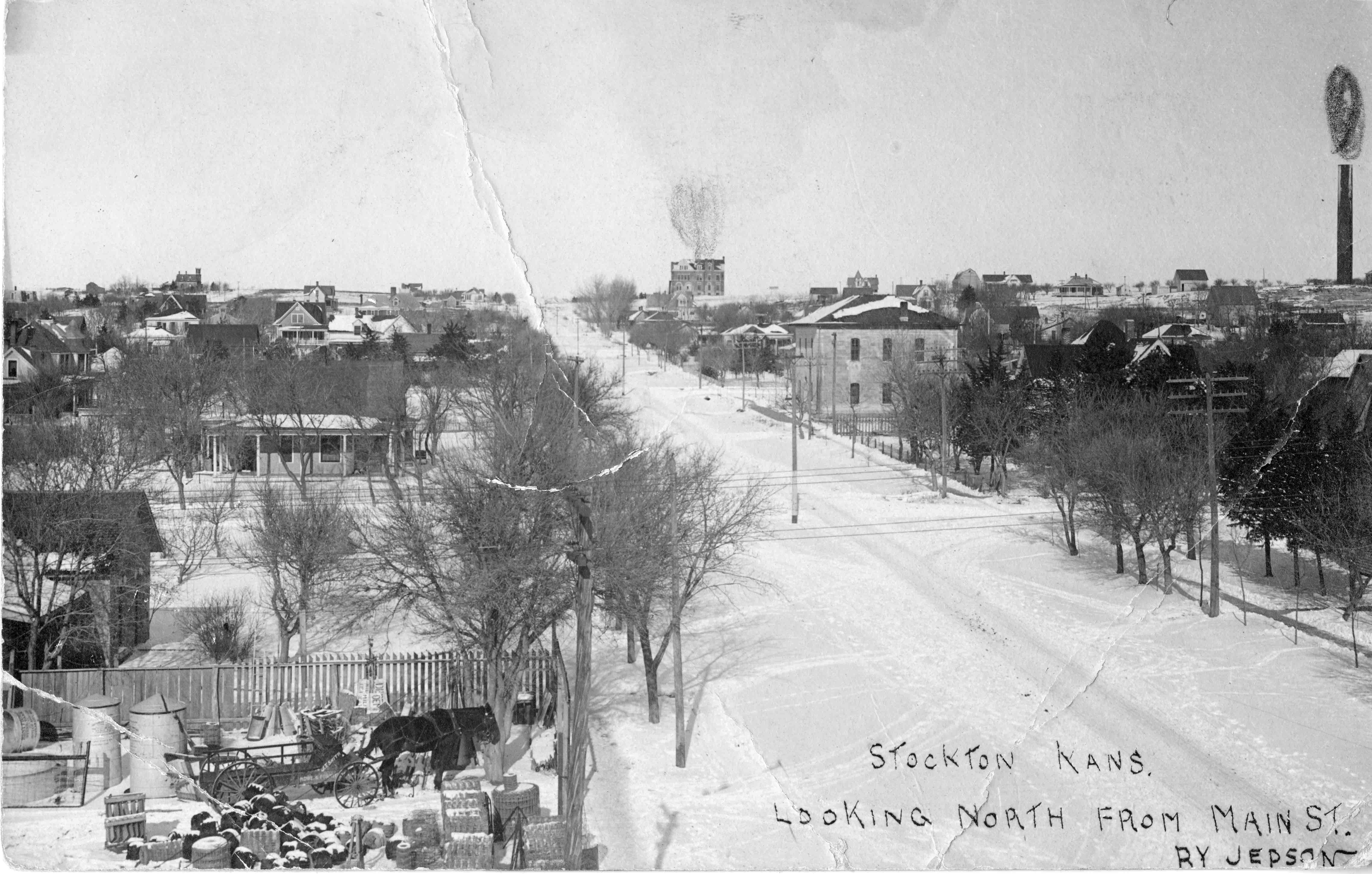
Stockton Kans. Looking North from Main St by Jepson, "J T Smith Hdwe & Furniture ..." on wagon, submitted by Brenda Reeder

"Birds Eye View of Stockton, Kans Photo by White"
Note the Beck Hotel in the upper left corner and the Courthouse in the center. Submitted by Brenda Reeder.
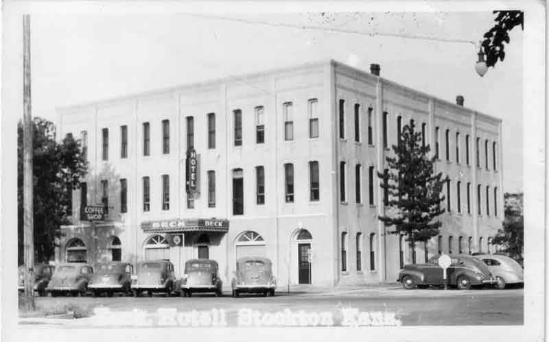
Beck Hotel and Coffee Shop, submitted by Brenda Reeder
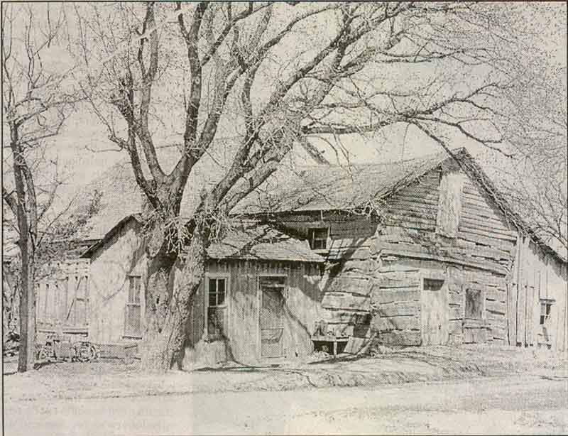
Hicks Motel
possibly Stockton's first motel, located in the vicinity
of South Sixth Street and Cypress, submitted by Eldon Andrews
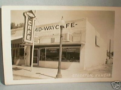
Midway Cafe
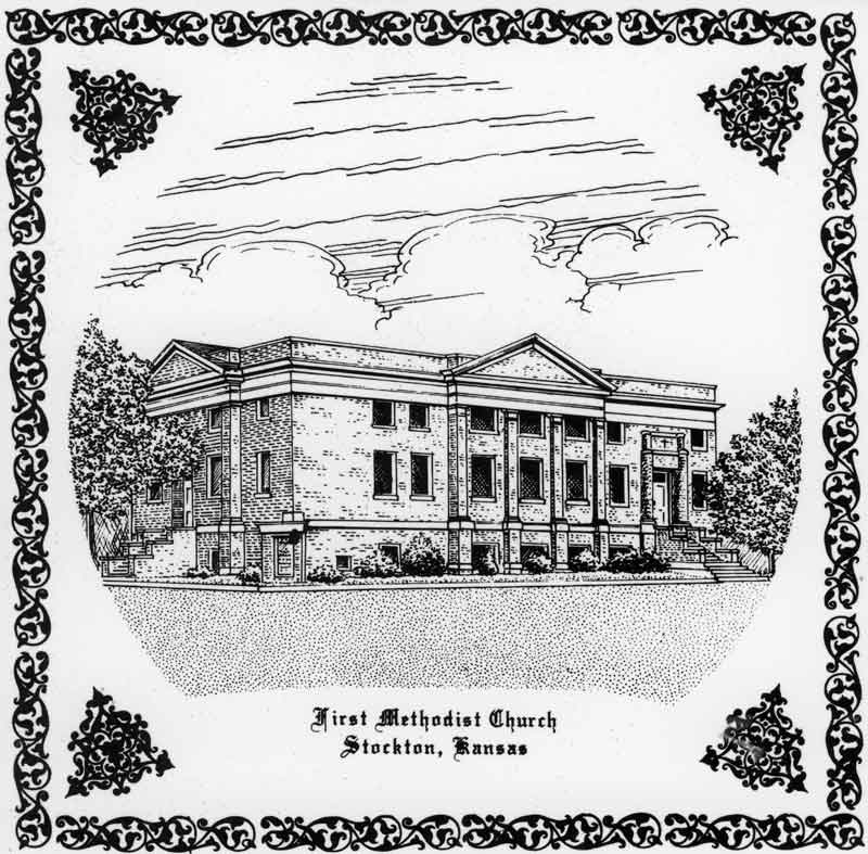
Stockton's First Methodist Church on a ceramic tile, possibly sold as a fund raiser during the 1970s. Submitted by owner, Brenda Reeder.
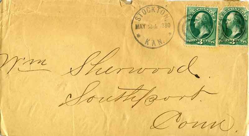
Envelope postmarked in Stockton, Kan., May 24 1880, submitted by Brenda Reeder
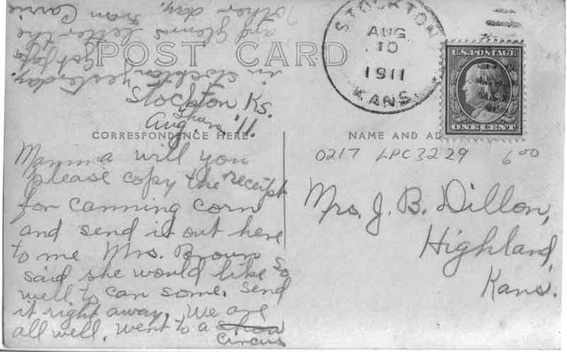
Postmarked Stockton, Kans. 10 Aug 1911.
Addressed to Mrs. J. B. Dillion, Highland, Kansas.
The message reads: Mama will you please copy the receipt for canning corn and send it out here to me Mrs. Brown said she would like so well to can some. Send it right away. We are all well. Went to a circus in Stockton yesterday. Got ___ and Glens letter the other day. From Carrie.
Submitted by Brenda Reeder
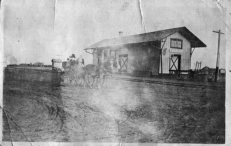
Train Depot
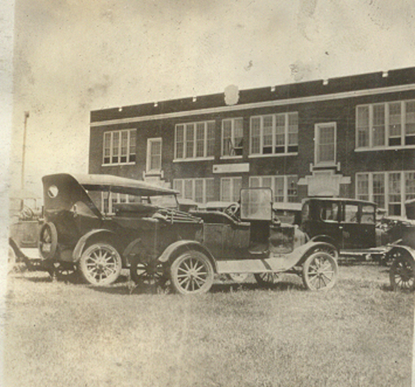
Woodston Rural High School
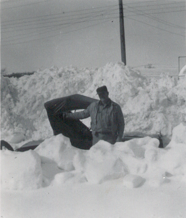
1950s Snow Storm
(top of Ford Model T)

2000
Main Street, looking east

Main Street, south side
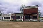
Main Street
K. L. Orr Building
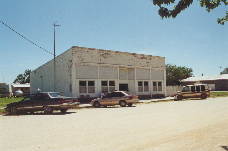
Main Street south side, opposite the post office
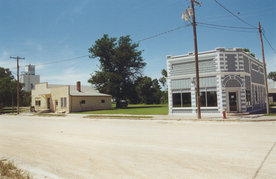
Main Street Post Office (left) and Rooks Co. Bank (right)
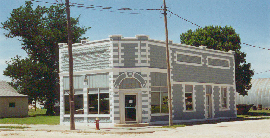
Rooks County State Bank
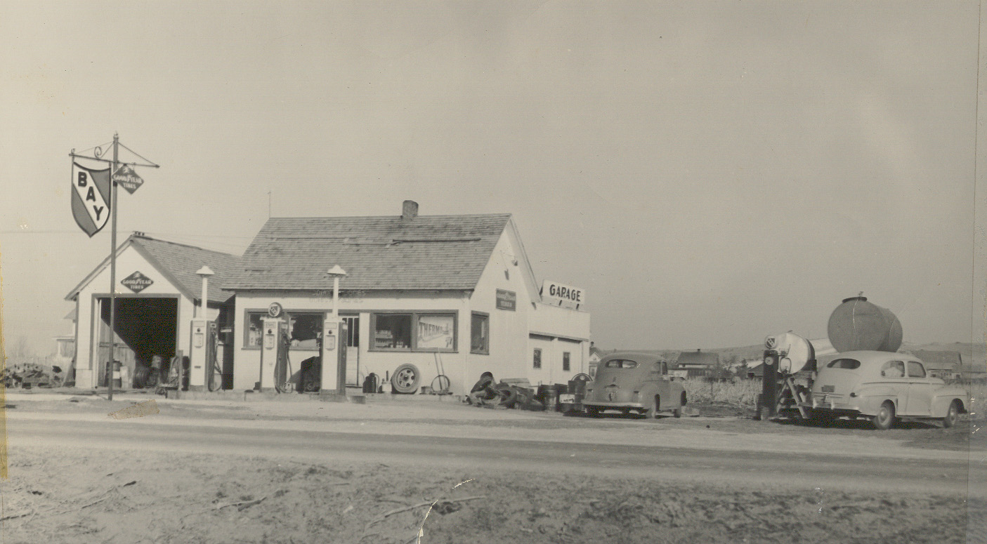
1943 "home oil company" filling station on Hwy 24 going through Woodston.
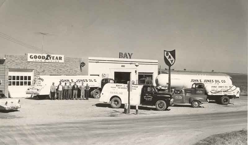
1950s "home oil company" filling station on Hwy 24 going through Woodston.
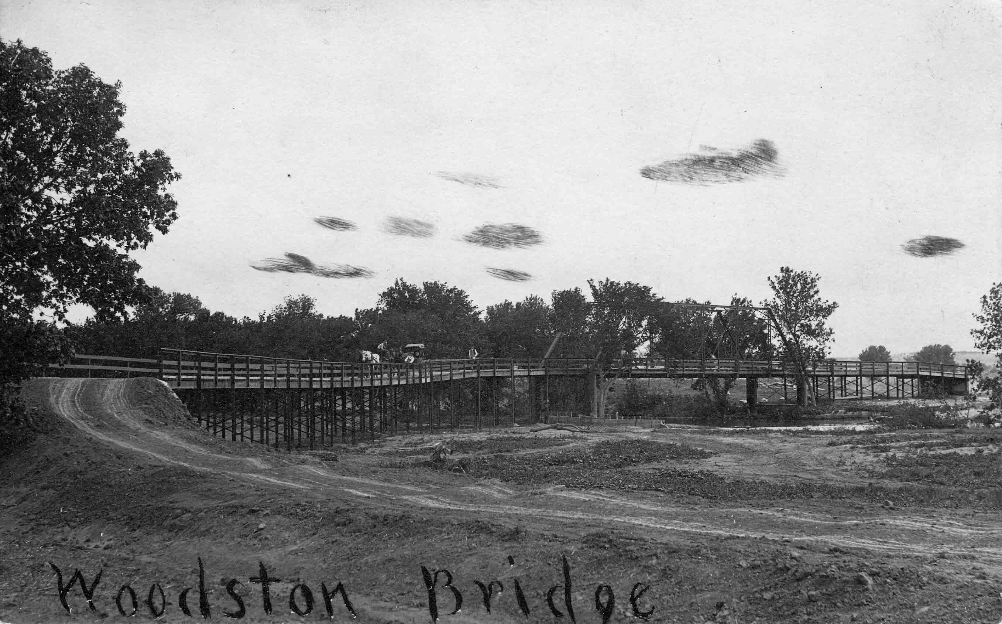
Early 1900's Postcard of Woodston Bridge
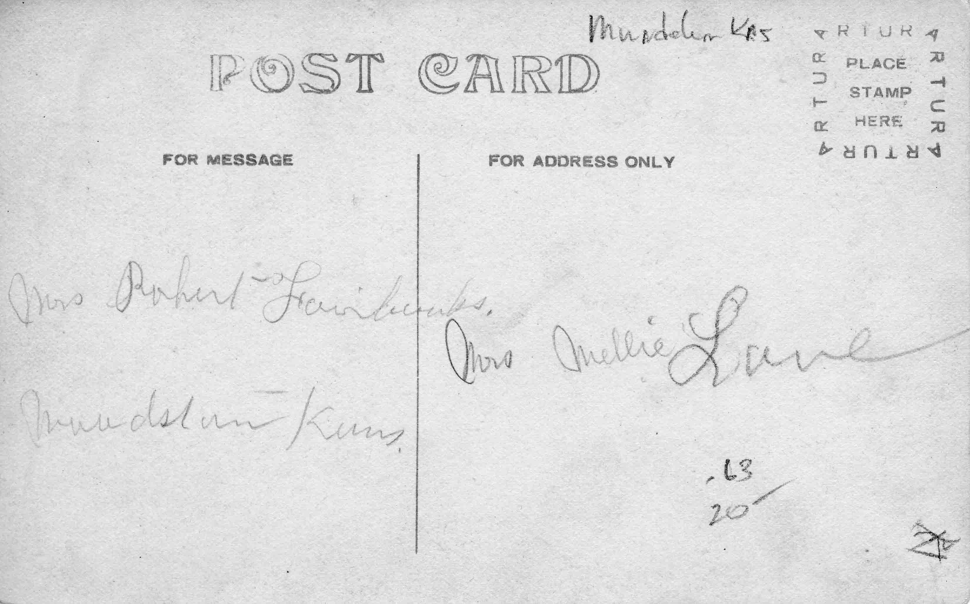
Backside of Woddston Bridge postcard mailed from Mrs. Robert Fairbanks in Woodston to Mrs. Mellie Lane
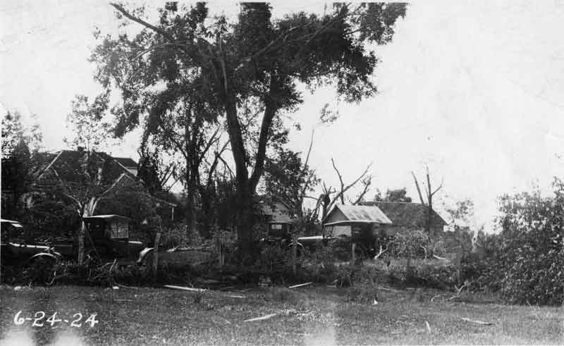
24 Jun 1924
Woodston after the cyclone
Copyright © 1996 - The USGenWeb® Project, KSGenWeb, Rooks County

This page was last updated
03/07/2025