

Saline County
KSGenWeb

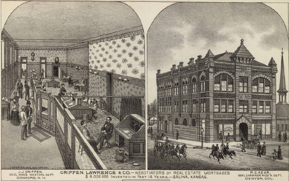
1887 Crippen, Lawrence & Co.
Salina
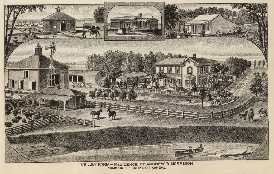
1887 Valley Farm
Residence of Andrew R. Morrison
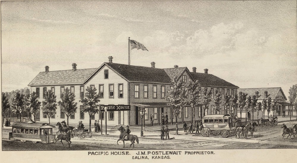
1887 Pacific House
J.M. Postlewait, Proprietor
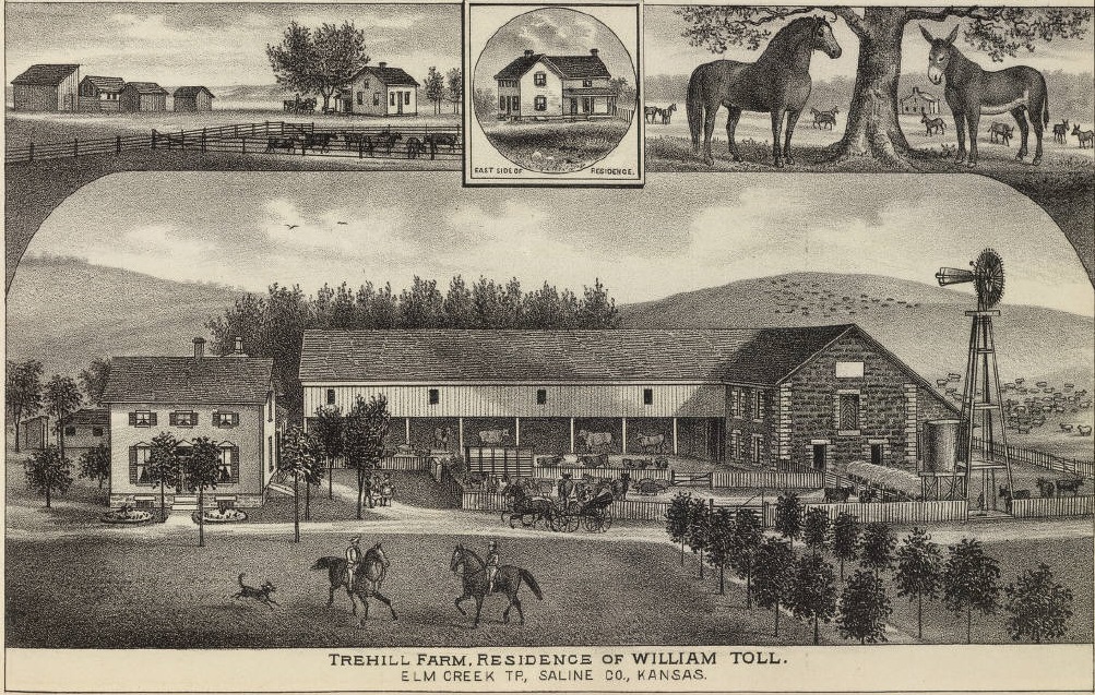
1887 Trehill Farm
Residence of William Toll
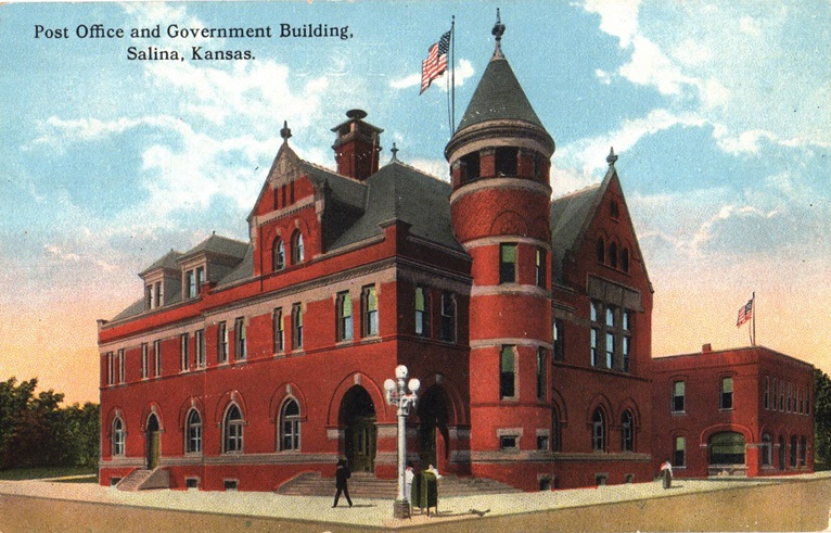
Salina Post Office &
Government Building
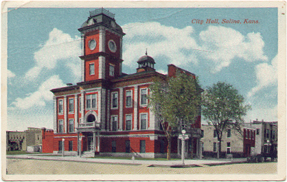
Salina City Hall
Saline County, one of the central counties of the state, is the fourth county
south from Nebraska, and the eighth from the Missouri river, the 6th principal
meridian forming its eastern boundary line. It is bounded on the north by Ottawa
county; on the east by Dickinson; on the south by McPherson, and on the west by
Ellsworth and Lincoln. The name Saline was given to the river, and later to the
county on account of the salt marshes in this section.
The earliest
settlements were not permanent. The first one of which there is any authentic
account was made by Preston B. Plumb, afterwards United States senator. He came
into the county in 1856 with a Mr. Hunter and Maj. Pierce and the three
projected a town at the mouth of the Saline river which they called Mariposa.
The place was soon afterward abandoned, a cabin and a well being the extent of
the improvements. In the same year the territorial legislature chartered what
was known as the "Buchanan Town company," of which Richard Mobley, a pro-slavery
man and later a member of the Lecompton constitutional convention, was
president. This company was to have several thousand acres of land. A site was
selected near the mouth of the Solomon river in Saline county, and a town was
laid off in 1857. Eight log cabins were built, but only two were ever occupied.
On the death of his child, Mr. Mobley abandoned the town project and Saline
county was without a settler. However, a permanent settlement was made the next
year by Col. W. A. Phillips, who in 1857, with a companion by the name of Smith,
had made a tour into the valleys of the Saline and Solomon rivers on foot. In
Feb., 1858, he returned with A. M. Campbell and James Muir. Passing the sites of
the two former settlements, they made their way up the Smoky Hill river to where
the stream turns due south, and there founded the town of Salina. The next month
two brothers named Schipple, who had erected a cabin on the Saline that winter,
came and settled on their claim. The first merchant in the county was George
Pickard, who built a store and brought a small stock of goods to Salina. The
latter was an arduous task. On arriving at the Solomon river with his goods he
found the government bridge had been washed out by the floods, as were the
bridges over the Saline and Smoky Hill. He constructed a raft of skins and
timbers, with which he succeeded in getting his goods over, but not without
considerable damage. A number of new settlers arrived during the year, most of
them settling in or near Salina. Among them was a Dr. Graw, a German from
Illinois, who in the absence of any other method of surveying, measured off with
a string a piece of land, which he supposed to be a mile square, on the Saline,
and proposed to build a town by the name of Grawville, but abandoned the idea.
At this time all the territory west of the 6th principal meridian was called
the "Arapaho district." Saline county was included in this unorganized territory
until Feb., 1859, when the legislature passed an act organizing and defining the
boundary lines of five counties, of which Saline was one. The same act
designated as a board of commissioners A. C. Spiliman, Israel Markley and
Charles Holtzman. These men met in April, 1860, elected Charles Floltzman,
chairman; A. C. Spillman, clerk; and the officers were sworn in by Hugh M.
Morrison, the first justice of the peace. Salina was named by the act as the
temporary county seat. In May, the commissioners met again and divided the
county into two townships—Elm Creek and Spring Creek—and ordered an election to
be held in July, 1860. At this election the following officers were chosen: D.
L. Phillips, Israel Markley and Charles Holtzman, commissioners; Jacob Cass,
treasurer, and L. F. Parsons, sheriff.
In the year 1859 many improvements
were made in Salina, Israel Markley being the prime mover in building
enterprises. That spring a perfect stream of emigrants for Pike's Peak passed
through the county. The stage line for New Mexico also came this way, and Salina
being the farthest town west became quite a supply station for travelers. A
hotel was built by Col. Phillips, with lumber which he hauled from Kansas City.
The settlers being very much in need of a grist mill and a sawmill, Col.
Phillips set up a combination grist and sawmill at a great financial loss to
himself.
When the Civil war broke out, nearly all the able-bodied men in
Salina enlisted on the Union side. Among those who entered the army W. A.
Phillips rose to the rank of colonel; L. F. Parsons went in as second lieutenant
and came out as captain; and D. L. Phillips was mustered in as a private and
mustered out as first lieutenant. During the war two raids were made into Saline
county. The first was by the Indians in the early part of 1862. The settlers
heard of their coming in time to gather at Salina, where a stockade had been
built. The red men had determined upon killing every settler in the Smoky Hill
valley. A number of ranches west of Salina were attacked and the ranchmen
killed, but when the Indians reached Salina and found the settlers ready for
them they changed their course without molesting the stockade. The second raid
was by a band of white desperadoes in the fall of that year. They rode into
Salina, taking the citizens by surprise, and not meeting with any resistance,
limited their outrages to pillage. They destroyed everything in the way of
fire-arms that they could not take with them; appropriated everything of value
they found in residences and business places; and took 20 horses and 6 mules,
the property of the Kansas Stage company. One horse was accidentally overlooked
and this one was used by R. H. Bishop to carry the news of the raid to Fort
Riley. A detachment of soldiers was sent out but the bushwhackers had escaped
"to parts unknown."
The first election at which a full county ticket was
chosen was held under the state law in Nov., 1861, and resulted as follows:
Commissioners, Henry Whitley, G. Schippel and R. H. Bishop; probate judge, A. A.
Morrison; sheriff, John McReynolds; treasurer, Ransom Calkin; county clerk, H.
H. Morrison; register of deeds, H. H. Flagg; assessor, Robert McReynolds;
surveyor, James R. Mead; coroner, Robert Crawford; justices of the peace, Daniel
Alverson and Peter Giersch.
During the war Saline county, in common with
other parts of the state, made no progress. As soon as the soldiers returned,
however, new life came into the western settlements. Up to that time the
settlement of Saline county was limited to the vicinity of Salina. In 1865 Ernst
Hohneck located about 9 miles west of Salina and established a ranch store where
Bavaria now stands. In April, 1869, a large colony from the Western Reserve in
Ohio settled at this point. They were under the leadership of John Thorp, and
the township was named after their state. By 1868 there were settlers in every
part of the county, and that year saw a large increase in the population. In
August word reached Salina of the Indian raids in the Republican, upper Saline
and Solomon valleys, where they were murdering and outraging settlers on every
hand. Gov. Crawford was telegraphed and arrived on the next train. A company of
60 men was raised as fast as they could be armed. Gov. Crawford took command and
proceeded to the seat of trouble. He went north into Ottawa county, visited
Minneapolis and Delphos, where he sent out a scouting party of 2 men—M. J. Mills
and M. D. Simpson—the main body retiring to Asherville. The scouts went as far
as Fort Sibley in Republic county, and then, seeing no Indians, joined the main
body at Asherville. After burying several men who had been scalped, and several
children whose bodies had been fastened to the ground by arrows, the company
returned to Salina and disbanded.
Two large colonies—one of Swedes
numbering 75, who bought 20,000 acres in the southern part of the county, and
another of Illinois people numbering 60, who located in Smoky View and Smolan
townships—were added to the strength of the frontier, and enabled Saline county
to make rapid strides in improvements. The next year the Ohio colony came, and
in 1870 a colony of 75 under the leadership of Eric Forse, located in Falun
township. Three new postoffices were established in that year: Brookville, in
Spring Creek township, J. W. Hogan, postmaster; Falun, Eric Forse, postmaster;
and Salemburg, in Smoky View township, J. P. Clarkson, postmaster. Hohneck, in
Ohio township, had been established in 1867, with Ernst Hohneck as postmaster,
and Salina in 1861, with A. M. Campbell, postmaster. Before the postoffice was
established at Salina, there was no office west of Fort Riley. The Saline county
people had their mail forwarded from Lawrence, and it never reached them oftener
than once in two weeks.
The first Saline county people to be married were
A. M. Campbell and Christina A. Phillips, in 1858. There being no minister or
justice of the peace in the vicinity, they were obliged to travel 60 miles to
Riley county to be married. The first white child born in the county was their
daughter, Christina Campbell, born in Oct., 1859.
Saline county is
divided into 19 civil townships, the dates of organization being as follows: Elm
Creek, 1860; Spring Creek, 1860, disorganized in 1862 and reorganized in 1869;
Cambria, 1878; Dayton, 1877; Eureka, 1860; Falun, 1873; Glendale, 1880; Greeley,
1879; Gypsum, 1871; Liberty, 1872; Ohio, 1871; Pleasant Valley, 1875; Smoky
Hill, 1871; Smoky View, 1874; Smolan, 1874; Solomon, 1867; Summit, 1880; Walnut,
1869; Washington, 1874. Some of the early towns which have disappeared from the
map were Crown Point, Dry Creek, Gypsum Creek, Pliny, Poheta and Torry. The
towns and postoffices in 1910 were Salina, Assaria, Bavaria, Bridgeport,
Brookville, Falun, Gypsum, Kipp, Mentor, New Cambria, Salemsburg, Smolan,
Strickler and Wonderly.
The surface of the county is level bottom lands,
rolling prairie and highlands, having about an equal area of each. The Saline
and Smoky Hill rivers meet near the eastern line and the bottom lands along
their banks form a basin through the central part of the county, the sides of
which are much higher on the north than on the south. There is a range of high
hills near the southern boundary called "Smoky Hill Buttes"; an elevation on the
north called "North Pole Mound,"; one 8 miles east of Salina known as "Iron
Mound," and in the west rises "Soldier Cap." Limestone, sandstone, gypsum and
salt are found in considerable quantities. The Solomon river flows across the
northeastern part of the county; the Saline enters on the northern boundary and
flows southeast; the Smoky Hill enters from the south, flows north to Salina and
from there east about 8 miles, where it is joined by the Saline. The smaller
streams are the Gypsum, Hobbs, Dry, Spring, Mulberry and Buckeye creeks.
The area is 720 square miles, or 460,000 acres, about two-thirds of which are
under cultivation. The total value of farm products for 1910 was more than
$4,000,000. The corn crop was worth $1,250,000; wheat over $500,000; animals
marketed amounted to over $1,000,000; the assessed valuation of property was
about $42,000,000. The population in 1910 was 20,338, which makes the wealth per
capita about $2,000.
Saline county is well supplied with railroads. The
first one built was the Union Pacific, which reached Salina in 1867. The main
line enters in the northeast and crosses the county into Ellsworth, passing
through Salina, where two branches diverge, one going south; and the other
northwest. A branch of the same road passes through the northeastern corner. The
Atchison, Topeka & Santa Fe and the Chicago, Rock Island & Pacific enter from
Solomon and terminate at Salina. The Missouri Pacific enters in the southeastern
part of the county and diverges at Gypsum, one branch running to Salina and the
other southwest into McPherson county. Another branch of the Missouri Pacific
enters in the southwest and crosses northeast to Salina.
Contributed 2002 by Carolyn Ward, transcribed from Kansas: A Cyclopedia of State History, embracing events, institutions, industries, counties, cities, towns, prominent persons, etc. ... / with a supplementary volume devoted to selected personal history and reminiscence. Standard Pub. Co. Chicago: 1912. 3 v. in 4.: front., ill., ports.; 28 cm. Vols. I-II edited by Frank W. Blackmar, Volume II, Pages 635-639.
| Name of Applicant | Place of Business | Address |
|---|---|---|
| Gus Bens | The Owl Lunch | 535 N. Santa Fe |
| M.W. Anderson | Anderson’s Lunch | 510 ½ N. 9th St. |
| Edward Carlson | Rainbow Lunch | 105 S. 5th St. |
| A.H. Brockman | Brockman’s | 117 S. 5th St. |
| C.O. Flamme | Eagle Grill | 104 E. Pacific |
| Fred Hill | Hill’s Buffet | 217 N. Santa Fe |
| Ray Tidrick | TipTop Café & Serv. Sta. | 310 E. Pacific |
| Mrs. Marie Hallady | Popular Care | 109 W. Ash St. |
| H.J. Weightman | The Alley | 111 E. Iron Ave. |
| Lee Marr, et al | Barbee Café | 114 W. Ash St. |
| Clara Smith | Oke Doke Inn | 121 E. Walnut |
| Harry Hoffman | Harry’s Café | 505 N. 9th St. |
| Mrs. L.A. Bartlett | Bart’s Bar | 142 ½ N. Santa Fe |
| Avis Mary Knight | Uptown Lunch | 332 N. Santa Fe |
| C.W. Lamer | Lamer Pharmacy | 203 N. Santa Fe |
| J.S. Moether & Wife | Jack’s Lunch | 119 N. 5th St. |
| P.M. Richardson | Richardson Stores Co. | United Life Bldg. |
| Ralph H. Irey | Irey’s Lunch | 114 N. 5th St. |
| R.S. Cahill | Cahill Food Store | 211 W. Ash St. |
| Dan Shore | Ur-Way Sandwich Shop | 636 N. Santa Fe |
| W.H. Curry | Curry’s Farmers Home | 118 E. Iron Ave. |
| Elks Club | Elks Club | 120 N. 7th St. |
| W.E. Smither, et al | Warren Coffee Shop | 217-219 W. Ash St. |
| Geo. Holsmeister | Holsmeister Rec. Parlor | 116 S. 5th |
| Cleo C. Bryan | Paramount Bar | 225 N. Santa Fe |
| John H. Anstey | Shorty’s Place | 121 S. 5th |
| John S. Gordon | Gordon Smoker | 340 N. Santa Fe |
| A.E. Evans | Dixie Tourist Camp | 805 W. North St. |
| R.A. Kinkel | Cozy Inn | 108 N. 7th St. |
| H.W. Hutchins | Standard Café | 118 E. Pacific |
| Emma Catlin | Follow-the-Swallow | 801 N. Santa Fe |
| Mary French | Frenchie’s Lunch | 212 N. 7th St. |
| Earl Stagg | Mack’s Café | 154 N. Santa Fe |
| P. Morton | Q no Q | 317 S. Santa Fe |
| V.B. Lemon | Lemon Drug Store | 118 W. Ash |
| L.H. Nelson | Irish Tavern | 124 S. 5th |
| K.A. Slaughter | Klondyke Bar | 156 S. Santa Fe |
| R.L. Johnson | Johnson Café | 122 S. 7th St. |
| Geo. S. Paul | Edelweiss Bar & Sand. Shop | 151 S. Santa Fe |
| Louis Paul | Paul’s Café | 136 N. Santa Fe |
| Steve Maduros | Manhattan Café | 118 W. Iron Ave. |
| Arthur Herman | Jayhawk Café | 600 N. Santa Fe |
| Paul Martin | Chicken Sand. Shoppe | 211 E. Walnut |
| A.E. Hart - R.C. Jason | Wayside Inn | 400 W. Euclid Ave. |
| Chadwick- J.E. Wilhelm | Rex Smoker | 150 N. Santa Fe |
| Virginia Guest | Sunflower Barbeque | 720 N. Santa Fe |
| Dwight Putnam | Red Hen Grill | 229 S. Santa Fe |
| W.J. Carrol - Fred Clar | Club Royal | 115 S. Santa Fe |
| Walter V. Emmons | Station Smoker | 717 Bishop St. |
| Robt. E. Thomas | Tommy’s Place | 347 N. 5th St. |
| W.A. Wilhelm | Wilhelm’s Smoker | 129 S. Santa Fe |
| Albert E. Taylor | Taylor’s Grocery | 808 N. Santa Fe |
| M.M. Gibson | The Old Heidelberg Inn | 223 N. 5th St. |
| Eagles Lodge | Eagles Lodge | 146 ½ N. 7th St. |
| OFFICE | ESTABLISHED | DISCONTINUED | NAME CHANGED |
|---|---|---|---|
| Appin | 24 Apr 1873 | 8 Nov 1875 | |
| Assaria | 3 Sep 1879 | From Oban (Location Changed) | |
| Bavaria | 8 Jan 1880 | From Honek | |
| Berwick | 5 Apr 1881 | 10 Nov 1885 | |
| Black Warrior | 21 June 1871 | 22 Aug 1871 | |
| Bridge | 6 Nov 1877 | 27 Apr 1886 | To Chico |
| Bridgeport | 30 Sep 1879 | ||
| Broadview | 19 Aug 1875 | 10 Oct 1879 | To Torry (Location Changed) |
| Brookville | 2 Feb 1870 | ||
| Crown Point | 26 Mar 1879 | 15 Dec 1892 | From Ohio Grove, Ottawa Co |
| Digby | 21 Oct 188 | 1 Oct 1887 | From Gypsum Creek |
| Dry Creek | 17 Aug 1877 | 14 Feb 1887 | |
| Falun | 18 Feb 1870 8 June 1887 | 16 May 1887 | |
| Gypsum | 21 Oct 1886 | From Pliny | |
| Gypsum Creek | 6 Jan 1869 | 21 Oct 1886 | To Digby, Est in McPherson Co |
| Hebron | 20 Jan 1873 | 28 July 1873 | |
| Honek | 8 July 1867 | 8 Jan 1880 | To Bavaria |
| Iron Mound | 3 Oct 1866 | 10 Aug 1868 | |
| Kipp | 18 Sept 1890 | 19 Oct 1957 | |
| Lesterville | 20 Dec 1872 | 15 Jan 1875 | |
| Marietta | 23 Jun 1874 | 10 Nov 1874 | |
| Marydel | 12 Aug 1885 | 15 Apr 1891 | |
| Mentor | 3 Oct 1881 2 June 1882 | 14 Mar 1882 | |
| Mulberry | 1 Dec 1871 | 28 Feb 1890 | |
| Nasby | 12 Aug 1885 | 29 Apr 1887 | To Trenton |
| New Cambria | 25 June 1873 | ||
| Oasis | 5 May 1873 24 Feb 1879 | 15 Mar 1875 24 Aug 1880 | |
| Oban | 24 Feb 1879 | 3 Sept 1879 | To Assaria |
| Pliny | 16 Nov 1869 19 Dec 1871 | 19 Dec 1871 21 Oct 1886 | To Prescott, From Prescott to Gypsum |
| Poheta | 14 Dec1870 | 21 July 1887 | |
| Prescott | 11 Dec 1871 | 19 Dec 1871 | From Pliny to Pliny |
| Sabra | 9 Jan 1867 | 14 July 1870 | |
| Salemsburg | 28 Apr 1875 | 31 Jan 1902 | |
| Salina | 14 Nov 1861 | ||
| Saline Valley | 15 Apr 1870 | 10 June 1872 | |
| Shipton | 29 Mar 1890 | 15 Oct 1895 | From York |
| Smolan | 15 June 1887 | ||
| Strickler | 6 Dec 1899 | 31 Jan 1901 | |
| Torry | 10 Oct 1879 | 3 Nov 1886 | From Broadview (Location Changed) |
| Trenton | 29 Apr 1887 15 May 1897 | 31 Oct 1895 15 Sept 1898 | From Nasby |
| York | 29 Feb 1888 | 29 Mar 1890 | To Shipton |
| Name | Start Date | End Date |
|---|---|---|
| Hugh Osburn | December 25,1867 | November 12, 1868 |
| Charles L. Hussey | December 29,1868 | April 20, 1869 |
| O. P. Hamilton | May 07, 1869 | June 14, 1870 |
| E. S. Norton | May 31, 1870 | Novemeber 12, 1870 |
| A. M. Beebe | December 01, 1870 | December 31, 1872 |
| Henry Sogan | January 13, 1873 | September 11, 1874 |
| F. A. Wildman | September 12, 1874 | November 13, 1874 |
| H. Cunningham | November 14, 1874 | January 05, 1877 |
| August Bondi | January 13, 1877 | January 08, 1879 |
| Jonathan Weaver | January 15, 1879 | January 06, 1887 |
| W. H. Bishop | January 13, 1887 | January 12, 1889 |
| A. C. Pattee | January 16, 1891 | January 07, 1891 |
| C. E. Lamkin | January 15, 1889 | January 05, 1895 |
| W. F. Musser | January 16, 1895 | January 07, 1907 |
| L. J. Supple | January 14, 1907 | January 11, 1913 |
| C. W. Wilson | January 14, 1913 | January 06, 1917 |
| C. H. Ford | January 09, 1917 | January 10, 1925 |
| will F. Miller | January 13, 1925 | April 30, 1939 |
| Fred. D. Joy | May 17, 1939 | June 16, 1954 |
| J. Herb Wilson | June 19, 1954 | January 09, 1973 |
| John Weckel | January 10, 1973 | unknown |
Contributors Unknown
Copyright © 1996 - The USGenWeb® Project, KSGenWeb, Saline County

This page was last updated
03/07/2025