
a proud part of USGenWeb®

Below are the links to the cemeteries in Lincoln County, as well as some additional information about those cemeteries. If you do not see the cemetery linked to a page, I do not have any additional information. Please note: Most of the County cemeteries are only partially transcribed. If you do not see Lincoln ancestors listed on the pages, you can submit the information for addition to that cemetery.
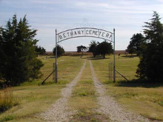 BETHANY BAPTIST
BETHLEHEM LUTHERAN
Township: Pleasant
Location: NW 1/4 of NE 1/4, Section 13, Township 12, Range 10
Directions: From Lincoln, go 14 miles west on Highway 18 to Highway 181 (the Sylvan Grove turnoff). Turn left (south) and go about a mile to Old K-18 Highway and turn left (east). Both Sylvan cemeteries are less than a mile down on the right (south) side of the road. Bethlehem Lutheran is in the west half and Sylvan City is in the east half.
 BEVERLY
Township: Colorado
Location: NE 1/4 of SW 1/4, Section 10, Township 12, Range 6
Directions: Go east from Lincoln on Highway 18 about nine miles to Highway 252 (the Beverly turnoff). Turn right; the cemetery is on that corner.
The land for the cemetery -- located in Section 10 of Colorado Township -- was deeded by Otis B. Green, Mary H. Green, Volany Ball and Margaret J. Ball and the plot was surveyed on 3 April 1886. The first burial, according to interment records, was J.P. Scott, on 19 November 1887. The oldest stone in the cemetery is for Katie Little, who died in 1880 and was likely moved into the cemetery when it was opened. More than 1,000 people are buried in Beverly Cemetery.
The gates are made of native sandstone.
DENMARK LUTHERAN
Township: Grant
Location: Section 13, Township 12, Range 9
Directions: Go west from Lincoln on Highway 18 for seven miles then turn right (north) on 120th Rd. and go three miles. Turn right on Pike Rd. The church is on the left (north) side of the road and the cemetery is directly behind it.
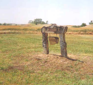
ELKHORN
Township: Salt Creek
Location: SW 1/4 of SE 1/4, Section 29, Township 10, Range 6
Directions: FROM BARNARD, go two miles east on Highway 284, then turn right (south) on 270th Rd. and go three miles. Turn right (west) on an unmarked road (Teal Drive) and go a half-mile. Cemetery is on the right (north) side of this road (Teal Drive).
There are 36 known burials in Elkhorn, in Salt Creek Township.
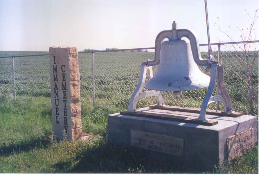
EMMANUEL
Township: Vesper
Location: SW 1/4 of NW 1/4, Section 25, Township 12, Range 9
Directions: Go west from Lincoln on Highway 18 for six miles to 130th Rd. Turn left (south) and go four miles to Iron Drive. Turn right (west) and go one mile, then turn left (south) on 120th Rd. for about half a mile. Cemetery is on left (east) side of this road.
This cemetery was once connected with Emmanuel Evangelical Lutheran Church, which was destroyed in a tornado in the 1950s and never reopened.
The bell from the old church is now located in the cemetery. Notice the spelling on the monument is "Immanuel," but in all references I've found to the church and cemetery, "Emmanuel" is the most common spelling.
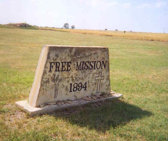
FREE MISSION
Township: Grant
Location: NE 1/4 of SE 1/4, Section 24, Township 11, Range 9
Directions: From Lincoln, go west on Highway 18 for six miles. Turn right (north) on 130th Road and go about 2 1/2 miles. Cemetery is on the left (west) side of 130th Rd. FROM DENMARK, go east on Pike Drive for one mile, then turn right (south) on 130th Rd. and go part of a mile to the cemetery, which is on the right (west) side of the road.
There are just shy of 100 burials in Free Mission, which is east of
Denmark in Grant Township.
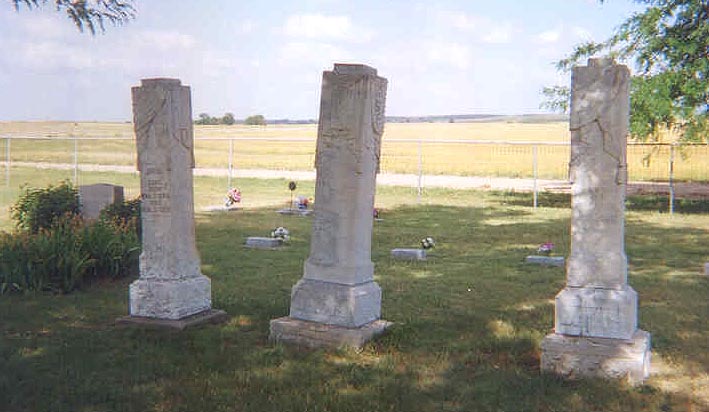
These impressive stones are for the Davis family, E.A., James W. and Joann.
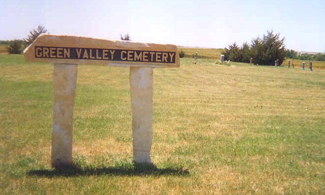
GREEN VALLEY
Township: Cedron
Location: NW 1/4, Section 5, Township 10, Range 10
Directions: Go west from Lincoln on Highway 18 for 14 miles, then turn right (north) on Highway 181 and go 14 miles, then turn left (west) on Y Road (Mitchell County line road) and travel four miles. Cemetery is on the left (south) side of this road. (Note: Y Road is dirt and would be difficult to maneuver in wet conditions.)
There are 21 known burials in Green Valley, the most recent in 1936. Green Valley is in Cedron Township, just south of the Mitchell County line.
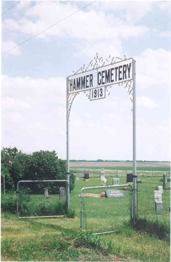
HAMMER
Township: Franklin
Location: NE 1/4 of NW 1/4, Section 3, Township 13, Range 7
Directions: Go east from Lincoln on Highway 18. Just over the bridge, turn right (south) on 220th Road. Go approximately five miles and turn left on Grain Drive. Cemetery is less than half a mile down this road on the right (south) side.
The gates are adorned with the year 1913 but the cemetery was deeded by Hiram Hammer in 1882. The first burial, however, was that of an infant named Allan McGinness in 1877.
Hammer, in which about 500 people are buried in its 156 lots, is located in Section 3 of Franklin Township.
Some of the Hammer family later became early settlers of Sedro-Woolley, Wash.
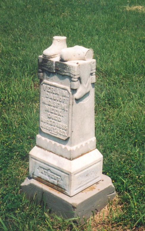 At
right is a lovely little tombstone at Hammer for a child named Vera
Meek. Her father had moved away from Lincoln County but had this
stone special ordered and shipped back to mark the grave of his
daughter, who died in 1895. The Lincoln Beacon of
23 December 1897 reported: "While living on a farm in Madison
township some two years ago Mr. and Mrs. Milford G. Meek lost their
little baby girl, Vera, then just past one year old. Afterwards, the
father went to Ohio, but he did not forget the precious spot where
lay his only child. He recently had a very pretty little white
marble monument made and sent on to his father to be put at the head
of the little grave. It came last week and the writer happened to be
present when it was unpacked. On its top is a pair of little shoes,
one standing in a natural position, the other laying on its side.
They suggest the age and size of the little sleeper whose death
meant so much to that home. The design and good workmanship make it
a very neat little stone. It shows the tender affection of the
father for his child and proves him to be a man of good impulses."
At
right is a lovely little tombstone at Hammer for a child named Vera
Meek. Her father had moved away from Lincoln County but had this
stone special ordered and shipped back to mark the grave of his
daughter, who died in 1895. The Lincoln Beacon of
23 December 1897 reported: "While living on a farm in Madison
township some two years ago Mr. and Mrs. Milford G. Meek lost their
little baby girl, Vera, then just past one year old. Afterwards, the
father went to Ohio, but he did not forget the precious spot where
lay his only child. He recently had a very pretty little white
marble monument made and sent on to his father to be put at the head
of the little grave. It came last week and the writer happened to be
present when it was unpacked. On its top is a pair of little shoes,
one standing in a natural position, the other laying on its side.
They suggest the age and size of the little sleeper whose death
meant so much to that home. The design and good workmanship make it
a very neat little stone. It shows the tender affection of the
father for his child and proves him to be a man of good impulses."
HEISER
Township: Indiana
Location: SW 1/4 of NW 1/4, Section 22, Township 12, Range 8
Directions: Go south of Lincoln one mile on Highway 14 and turn right (west) on Kiowa Drive. Go three miles, then turn left (south) on 160th Road and travel 1 1/4 miles. Cemetery is on the left (east) side of this road.
Located in Indiana Township, Heiser Cemetery contains more than 40
graves and is a well-maintained cemetery.
 HYNES
HYNES
Township: Highland
Location: NW 1/4, Section 11, Township 13, Range 10
Directions: From Lincoln, go west on Highway 18 for 14 miles, then turn left (south) on Highway 181. Go through Sylvan Grove and continue to follow Highway 181 toward Wilson Lake, including making a right-hand turn on 181. About a mile after making that turn, take a left (south) on 50th Road. The cemetery is about 1 1/4 miles down that road, on the left (east) side.
There are only eight known burials in Hynes, which is located in Highland Township. It is in need of work to repair stones; many are broken or completely out of the ground.
The last known burial was in 1904.
LINCOLN
Township: Elkhorn
Location: SE 1/2 of NE 1/4, Section 6, Township 12, Range 7
Directions: Go east on Lincoln�s Main Street toward Highway 18. Cemetery is on the right (south) side of Main just before the highway.
 MILO
MILO
Township: Salt Creek
Location: NE 1/4 of SE 1/4 of NW 1/4, Section 8, Township 10, Range 6
Directions: FROM BARNARD, go east on Highway 284 across the bridge. Take the first road (260th Road, although unmarked as of May 2006) on the left -- it is immediately after you leave the bridge. This road jogs west and then heads north again. Stay on it about three-quarters of a mile, turn turn right (east) (on Wolf Lane, but again, unmarked in May 2006) and go 1 1/3 miles. Cemetery is on the right (south) side of this road.
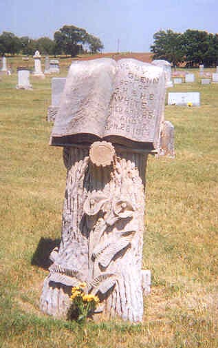
Milo, in Salt Creek Township, is one of the county's largest cemeteries.It was surveyed in 1878 and the first recorded burial is that of Silas Elliott in February of that year.
I like the tree-trunk style of stones, and I thought this one was
especially striking. The stone is for Glenn White, who died in 1917.
MONROE
Township: Colorado
Location: SE 1/4 of NE 1/4, Section 28, Township 12, Range 6
Directions: From Lincoln, take Highway 18 east to Highway 252 (the Beverly turnoff). Go through Beverly on Main St. until it ends. The road curves to the right and becomes Miller Dr., then Murray, then Monroe. Stay on that road as it leaves town. It becomes 280th Rd. outside of town. When the road forks, stay left (on pavement). The pavement will end once you cross the river. You�ll be heading straight south. The cemetery is on the right. It is about 3.3 miles from K-18 to the front gates.
Monroe, located in Section 28 of Colorado Township, was established in 1888 when lots went on sale for $1 each. The cemetery was surveyed on 18 October 1888 and the first purchaser was B.J. Harrenstine on 19 October.
The earliest tombstones date to 1874 (Mary Skinner and Eva Metcalf), but it appears those bodies were originally buried on homesteads and later moved in Monroe.
Monroe contains 48 blocks of four lots each and 2 blocks that include 49 individual spaces.
Colorado Township officials at the time the cemetery was founded were J.P. Webb, Trustee, J.J. Peate, clerk, and J.H. Tracy, Treasurer.
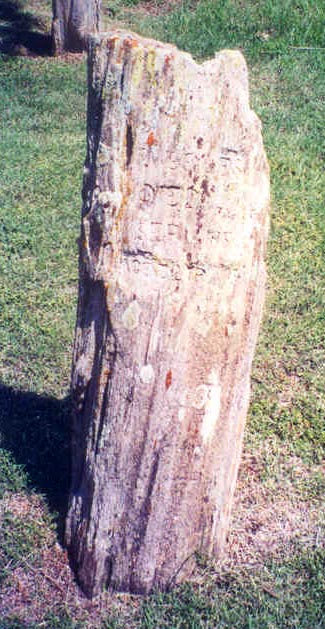 The
tombstone at the right is difficult to read, but it marks the grave
of Frank W. Broyles, who died 14 September 1888. The "stone"
actually seems to be made of petrified wood. Broyles, born in Ohio,
was 22 years of age and died of dropsy.
The
tombstone at the right is difficult to read, but it marks the grave
of Frank W. Broyles, who died 14 September 1888. The "stone"
actually seems to be made of petrified wood. Broyles, born in Ohio,
was 22 years of age and died of dropsy.
PATTERSON
Township: Orange
Location: SE 1/4 of SW 1/4, Section 16, Township 10, Range 9
Directions: From Lincoln, go north on Highway 14 for eight miles to Union Rd. Turn left (west) and travel 10 miles, then turn right (north) on 100th for about 1.5 miles (road turns to dirt from gravel). At Vine (also dirt; it was unmarked in May 2006 but is the first left you can take), turn left (west) and go about a half-mile. Cemetery is on the right (north) side.
See Dr Patterson's page
POTTERSBURG
Township: Grant
Location: NW 1/4 of Section 8, Township 11, Range 9
Directions: From Lincoln, go west on Highway 18 to 80th Rd. Turn north (right). Cross several unmarked roads, going nearly 6 miles. Pottersburg cemetery is on the east side of the road; there is a farm across the road and a feedlot behind the cemetery.
Located in Grant
Township, Pottersburg is the site of 41 known burials.
There are
63 lots, in different sizes and shapes.
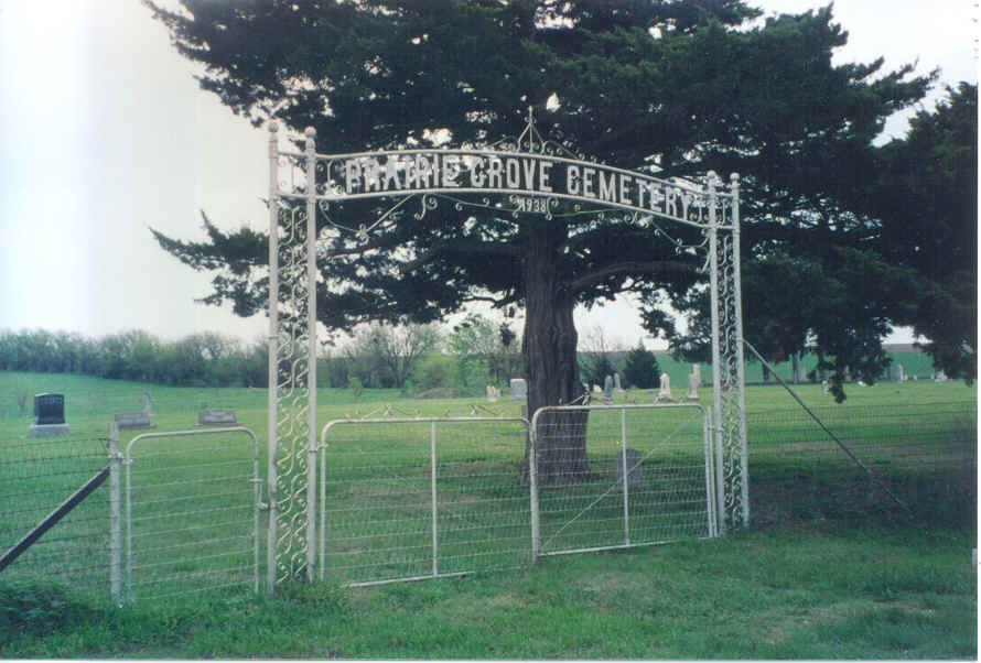 PRAIRIE GROVE
Township: Battle Creek
Location: SW 1/4 Section 28, Township 10, Range 8
Directions: From Lincoln, take Highway 14 north eight miles. Turn left (west) on Union Rd. and go four miles to 150th Rd. Turn left (south) and go 1 mile; the cemetery is on the left (east) side of the road.
There have been just shy of 200 known burials in Prairie Grove,
which is located in Battle Creek Township.
ROSETTE
Township: Hanover
Location: SW 1/4 of SE 1/4, Section 15, Township 11, Range 10
Directions: From Lincoln, go west on Highway 18 for 14 miles to Highway 181. Turn right (north) and travel four miles, turn left (west) on Pike Drive and go one mile. Cemetery is on the right (north) side of this road.
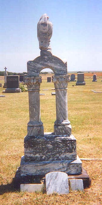
There are nearly 200 burials in Rosette, which is located in HanoverTownship. Rosette was known as Mt. Washington in the early days. The stone at the left is for a Sassaman.
The earliest known burial in Rosette is that of Jordan Bruster, a former slave and early Lincoln County pioneer. Mr. Bruster bought his freedom, then bought his wife's as well.
Mr. Bruster's grave is unmarked, but the Death Register at Lincoln's City Hall gives his burial site as Rosette.
 SHADY BEND
Township: Colorado
Location: SW 1/4 of NW 1/4, Section 18, Township 12, Range 6
Directions: From Lincoln, go east on Highway 18 for six miles and turn right (south) on 260th Rd. Follow it into Shady Bend. At the T intersection, turn left (east) and go to the first road south (on the right). Cross the concrete bridge and go a half-mile and turn right (west). Goa mile, making a jog north, then west againa dn turn left (south). Cemetery is on the left (east) side of this road.
An article in a
1977 edition of the Tree Searcher, a publication of the Kansas
Genealogical Society, reported that only four tombstones remained of
a reported 21 burials in unfenced, unmarked cemetery south of Shady
Bend.
The remaining
tombstones are those of David F. Bloomheart, Rhodella Smith,
Clarence Harrell and Amy Harrell.
Research
and old obituaries have led us to other burials, however. Those are
Clara (Gilmore) Bloomheart, three Cline children, Anna (Bloomheart)
Hines, Emma Hines, and Clara (Bloomheart) Moore.
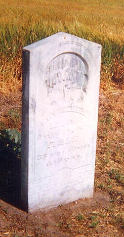
The remaining
tombstones, like that of Amy Harrell, who died 28 July 1879 at the
age of 38, are all beautiful examples of the carving of that period.
All are still readable and in excellent shape considering that the
cemetery is on the edge of a working wheat field.
SIMMONS
Township: Marion
Location: Section 31, Township 11, Range 8
Directions: From Lincoln, go west on Highway 18 for six miles. Turn right on 130th Road. Cemetery is on the right (east) side of the road. If it is not mowed, it can be difficult to spot. There is no sign or enclosure.
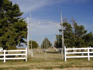
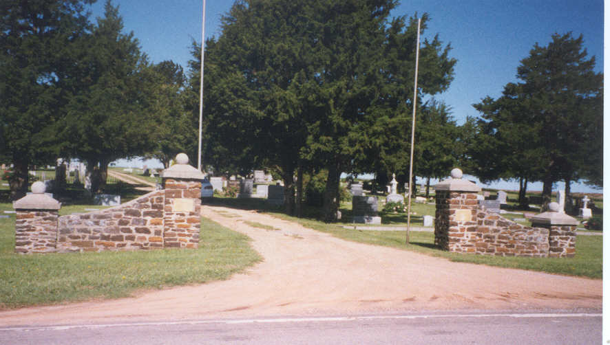
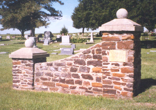
SPILLMAN
Township: Orange
Location: SW 1/4 of NW 1/4, Section 30, Township 10, Range 9
Directions: Go west from Lincoln on Highway 18 for 14 miles to Highway 181, turn right (north) and go nine miles to E. Union Rd. (road is marked with a sign for Spillman Cemetery). Turn right (east) and go one mile, then turn right (south) on 70th Rd. for a half-mile. Cemetery is on the left (east) side of this road. (A unique limestone double-arched bridge is located on 181 about a mile before the Spillman Cemetery turnoff and is worth a look.)
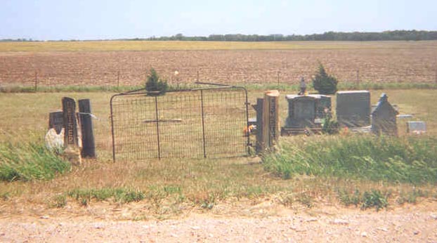
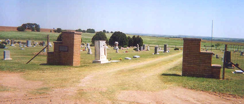
Spillman Cemetery is located in Section 30 of Cedron Township. The cemetery was surveyed on 4 May 1939 but was in use much earlier, of course.
The first burial appears to be that of the Thompson children, Effie and Francis, according to a tombstone transcription. However, there is a government military marker for a J.W. Payne, who died 10 July 1866. It is possible the date on the marker is wrong and it is also possible Payne's body was moved into the cemetery when it opened. He certainly was not buried in Spillman in 1866, when the county was sparsely populated and no cemeteries had been established.
Spillman is well-maintained and caretakers have taken the time and trouble to identify the unmarked graves. A homemade marker has been placed on each of those graves, with the name of the deceased engraved in the stone.
A full tombstone
transcription is available to read by clicking here.
(Thanks to Cheryl Lepisto for this photo to the entrance of one of the county's largest country cemeteries, with more than 540 burials.)
 SPRING CREEK
Township: Logan
Location: NE 1/4 of SW 1/4, Section 1, Township 11, Range 6
Directions: Go east from Lincoln on Highway 18 about 8 1/2 miles to the Barnard turnoff, which is 280th Road. Turn left (north) and go six miles, then turn right (east) on Rye Drive and go about two miles and turn turn left (north) on 300th Road (unmarked as of May 2006). Cemetery is on the right (east) side of this road.
Located
in Logan Township, Spring Creek is a small, well-kept cemetery with
about 70 burials.
For a list of Spring Creek burials and other notes about the cemetery, click here.
ST. JOHN CATHOLIC
Township: Indiana
Location: SW 1/4 of Section 7, Township 12, Range 8
Directions: Go west from Lincoln on Highway 18 for six miles to 120th Road, then left (south) about two miles to Kiowa Drive (Kiowa Drive is marked only on the west side of the road). Turn left, cross small bridge. Cemetery is at the top of the hill.
There are 120
known burials in St. John Catholic Cemetery, although there are
likely several dozen unmarked graves.
Located in
Indiana Township, east of Vesper, St. John Catholic served the Irish
Catholics who settled this part of Lincoln County and worshipped at St.
John Catholic Church.
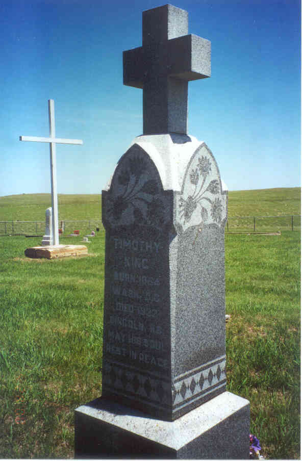
This is the tombstone marking the grave of my great-great-grandmother, Julia Kyne King Lafferty, and her sons Michael and Timothy. I recently had Timothy added to the stone once I could prove his grave was located there and confirm his date of death.
ST. JOHN LUTHERAN
Township: Indiana
Location: SE 1/4 of NE 1/4, Section 24, Township 12, Range 8
Directions: Go south from Lincoln on Highway 14 for 2 1/2 miles. Cemetery is on the right (west) side of this road just past the church.
More than
500 people are buried at the cemetery just south of St.
John Lutheran Church in Section 24, Indiana
Township.
The road into this
cemetery is marked by the tradition "post rock" formation. Post
rocks, or native limestone, were used as fenceposts in the early
days.
You can also learn about the history of the church here.
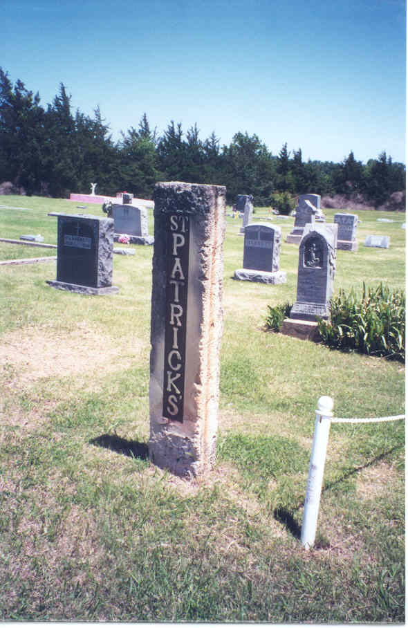
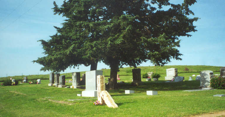
ST. PATRICK'S CATHOLIC
Township: Elkhorn
Location: SW 1/4 of Section 7, Township 12, Range 7
Directions: Go south from Lincoln on Highway 14 for one mile. Cemetery is on the left (east) side of the road.
The stone posts at
the entrance of St. Patrick's are fairly new. For many years an iron
gate stood at the entrance, but it was damaged and taken down.
The diocese
purchased the land for St. Patrick's Cemetery on 31 January 1891 for
$200. The cemetery is located in the southwest quarter of Section 7
in Elkhorn Township.
On 27
August 1891, the Lincoln Republican reported
that the "Catholic cemetery south of the old town site" would be
blessed by the very Rev. Father Maurer of Salina the following
Monday, 31 August.
The earliest date
of death of those buried in St. Patrick's is that of Mary Dillon,
who died 8 August 1879 but because the cemetery was not established
at that time, she must have been among those who were disinterred,
some from family plots on farms, and moved to St. Patrick's at a
later date.
The first burial
after the blessing of the cemetery apparently was that of Mrs. John
Swartzman, who died 19 December 1891. Her grave, however, is
unmarked. There are fewer than 200 marked graves in St. Patrick's
but many unmarked graves.
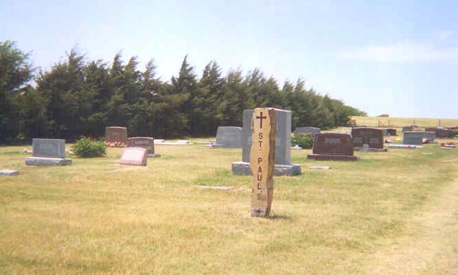
ST. PAUL'S LUTHERAN
Township: Franklin
Location: NE 1/4 of SE 1/4, Section 3, Township 13, Range 7
Directions: From Lincoln, go south on Highway 14 for 7.4 miles (to the Westfall turnoff; there is a sign for St. Paul's Church as well). Turn left (east) on 190th Rd. You'll come to a stop sign almost immediately. Turn left at the stop sign, onto Elk Drive. Go four miles, then turn left on 230th Rd. Cemetery is on the left (west) side of this road, past the church.
St. Paul's is located next to St. Paul's Lutheran Church in Franklin
Township. There are more than 220 burials in St. Paul's.
SUNNYSIDE
Township: Beaver
Location: NE 1/4 of Section 11, Township 11, Range 7
Directions: From Lincoln, go east on the golf course road (Milo Rd.) to 220th Rd. (a T intersection). Turn left (north). Go to Navajo Rd. and turn right (east). Stay on that road as it curves and goes north again, perhaps 2 miles. The next turn is near the top of a hill; it is Quail Rd. but there was no marker as of June 2007. Before the turn you'll pass several dead trees in the pasture on the east side of the road; they are white and very distinctive. Turn right (east) at that road and slowly follow it. About a mile down the road, there is a "road" on the left (north) side of the road. It will look more like a cattle feeding turnout than a road. Across the road on the south side is an abandoned limestone house so look for it. Turn onto this "road" and follow it up the hill and Sunnyside is at the top. This is not a very good road; I would not attempt this in a low-riding car. ALSO, I would not attempt to visit Sunnyside in wet weather or if it has recently rained, as Quail Road is mostly dirt and would be pretty unpassable when wet.
There are about 60 people buried in Sunnyside, which is located in Section 11 of Beaver Township. The oldest burial, according to tombstone records, in Mary J. Wray in 1881. The cemetery was surveyed, however, on 23 January 1892. The following people bought lots in Sunnyside but these lots have no burials in them:
SYLVAN GROVE
Township: Pleasant
Location: NW 1/4 of NE 1/4, Section 13, Township 12, Range 10
Directions: From Lincoln, go 14 miles west on Highway 18 to Highway 181 (the Sylvan Grove turnoff). Turn left (south) and go about a mile to Old K-18 Highway and turn left (east). Both Sylvan cemeteries are less than a mile down on the right (south) side of the road. Bethlehem Lutheran is in the west half and Sylvan City is in the east half.
There are just shy of 500 known burials in Sylvan Grove Cemetery,
which is east of Sylvan and sites side by side with Bethlehem
Lutheran Cemetery.Sylvan Grove Cemetery was not formed until 1896 --
the earliest burial I find mentioned is in late 1896 -- and lots
went on sale in March of 1897. Before that, Sylvan folks buried
their departed ones in Vesper Cemetery; after the Sylvan Cemetery
opened; some of those bodies were moved back to Sylvan.
 TRAIL CREEK
Township: Orange
Location: SE 1/4 of Section 25, Township 10, Range 9
Directions: From Lincoln, go north on Highway 14 for eight miles, then turn left (west) on Union Road and go six miles to 130th Road. Turn left (south) and go one mile, then turn right (west) on Teal Drive and go about a half-mile. Cemetery is on the right (north) side of this road a short way back.
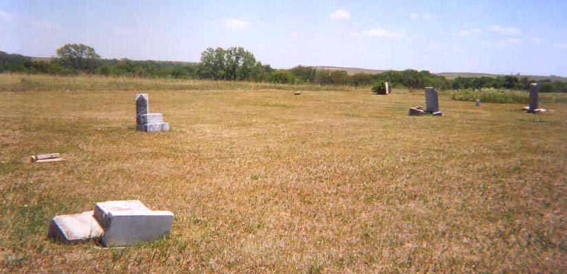
Trail Creek, a small cemetery, is located in Oramge Township. There
are 13 known burials in Trail Creek. It has no fences and no gates.
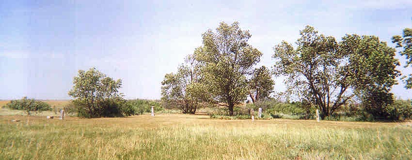
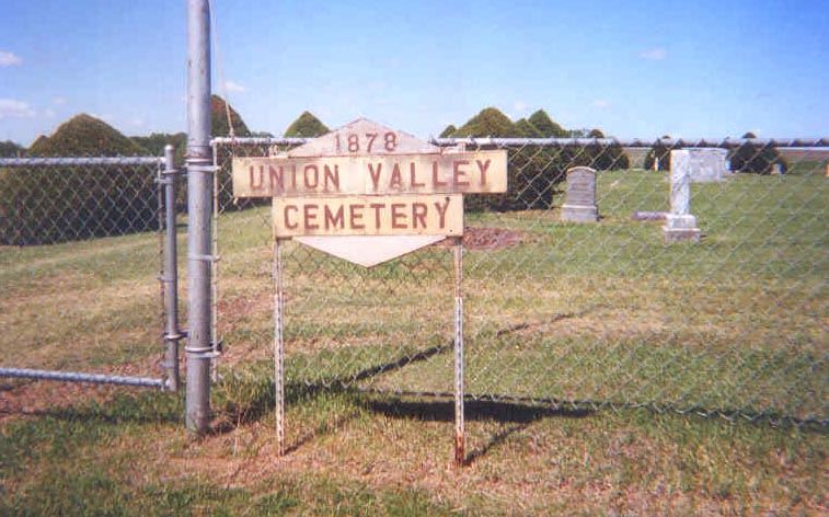 UNION VALLEY
Township: Scott
Location: NE 1/4 of Section 21, Township 10, Range 7
Directions: From Lincoln, go 9.5 miles north on Highway 14 to the Barnard turnoff. Turn right (east) and go 3 miles, then turn right (south) on 220th Road and go one mile; the cemetery is on the right (west) side of the road.
Union Valley, which has also been called Bridenstine and Pinon cemetery, is located in Section 21, Scott Township, west of Barnard.
A history of the
cemetery was published in the Lincoln Beacon of
8 April 1880:
"Five years ago, there had been but three persons buried in this vicinity; the wife and child of James Donovan, Esq., on his premises, and a child of James Hall, somewhere near his former residence. Mr. J.P. Morgan was buried near Mrs. Donovan. Immediately after the death of Mr. Morgan, some of our citizens, feeling the necessity of having a properly located graveyard, applied to Alex. Lewis for the donation of a site on the northeast corner of section 21, town 10, range 7, which is now the Center of Scott township, and on the way from Lincoln to Beloit; a handsome location, on a gentle elevation. It now contains the remains of a number of children and five adults; three males and two females. Mrs. Morgan had her husband remains placed there. The last one buried there, was that sterling Republican, and upright citizen, Dr. C.B. Mills. The two ladies, Mrs. Harper and Mrs. Feaks [Feakes], were both natives of England."
Mrs. Harper would be Alice B. Harper, who died 23 June 1879, and was the wife of J.L. Harper. Mrs. Feakes' full name was Mary A. Feakes. She was born 1 November 1857, and died 25 February 1880. Not long after this article was written, her twin daughters died and were buried at Union Valley as well. Mary Feakes' husband was Thomas, who died in 1938 and is also buried there.
There is a marker for a P. Morgan, with no dates. But a sign at Union Valley Cemetery indicates it was founded in 1878, which helps place the death of Mr. Morgan.
It is not known where the Donovans mentioned above, or the Hall child, are buried.
The cemetery was surveyed in May 1908.
This is a list of
lot-holders at Union Valley; I believe these are the original
lot-holders.
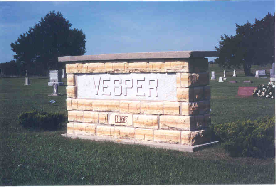 VESPER
Township: Vesper
Location: SE 1/4 of Section 4, Township 12, Range 9
Directions: From Lincoln, go west on Highway 18 for nine miles to 100th Road. Turn left (south). Cemetery is close on the right (west) side of this road.
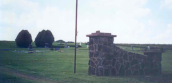
The entrance sign at Vesper Cemetery is made of native limestone, known in Lincoln County and the area as "post rock." This sign was not erected in 1878, but that is not when the cemetery was founded.
About 350 people are buried in Vesper Cemetery, which is in Vesper Township but more than a mile from the town of Vesper. The cemetery was begun next to the old Vesper schoolhouse -- you can still find the school steps to the south of the cemetery -- near the original townsite of Vesper. But when the railroad came through, the town moved in order to get a depot.
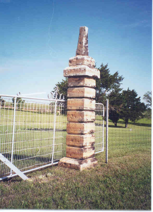 These
posts are original to the cemetery and are made of native limestone
as well. They stand on all four sides of the cemetery, halfway
between the corners, and were original intended to mark four
separate entrances to the cemetery. There is only one entrance now,
on the east side, but these original posts still stand.Read more
about the history of Vesper here.
These
posts are original to the cemetery and are made of native limestone
as well. They stand on all four sides of the cemetery, halfway
between the corners, and were original intended to mark four
separate entrances to the cemetery. There is only one entrance now,
on the east side, but these original posts still stand.Read more
about the history of Vesper here.
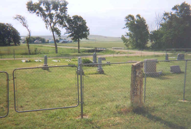 VOSS
VOSS
Township: Golden Belt
Locations: SW 1/4 of Section 1, Township 13, Range 9
Directions: From Lincoln, go west on Highway 18 for six miles, turn left (south) on 130th Road and go four miles. Turn right (west) on Iron Drive (there is a stop sign) and go one mile, then turn left (south) on 120th road and go three miles. Cemetery is on the left (east) side of the road near the end of the third mile.
The cemetery, located in Section 1 of Golden Belt Township, was
given by landowners Rudolph Voss and Frederika Voss. It is divided
into two blocks, one of 16 lots and one of 15 lots. Many of the lots
are odd sizes.
WASHAM
Township: Madison
Location: SW 1/4 of Section 8, Township 13, Range 6
Directions: From Lincoln, go south on Highway 14 for 7.4 miles to curve and turn left (east) on blacktop road toward Westfall. Go to the stop sign and turn left (you'll be on Elk Drive). Take the paved road seven miles to 260th Road; the cemetery on the right (east) side of 260th.
Washam is a large cemetery by country standards yet there are only 11 known burials. However, a witching of the cemetery indicates many unmarked graves. Records for Washam cannot be found so it is difficult to say how many are buried in this cemetery west of Westfall, in Franklin township.
Land for the cemetery was deeded to the Washam Cemetery Association on 5 August 1886, but the earliest known burial there was that of Minnie M. Washam in 1879.
Surrounding County Cemeteries that some Lincoln County folks are buried in
If you have questions, contributions, or problems with this site, email:
Temporary Coordinator - Rebecca Maloney
State Coordinators: Tom & Carolyn Ward
Asst. State Coordinators:
If you have questions or problems with this site, email the County Coordinator. Please to not ask for specfic research on your family. I am unable to do your personal research. I do not live in Indiana and do not have access to additional records.
