
You retain the rights to your submissions. |
Some cemeteries have not been updated for quite some time (except for recent submissions). It has come to our attention that there are some errors, so as with all genealogical information, document your own sources and use these transcriptions as guidelines only. If you find errors, please let us know so we can correct the information. (Tombstones have been known to have incorrect information also) We do not intentionally include incorrect information. We are only human and this information was transcribed by humans. If anyone is willing to rewalk a cemetery and submit current information, it would be most appreciated.
|
| The names and phone numbers listed below are people who have information about that particular cemetery. They have graciously agreed to do lookups. They cannot furnish lists for the entire cemetery. Please be courteous and do not call after 8:00 PM |
| CEMETERY | PHOTOS | LOCATION |
|
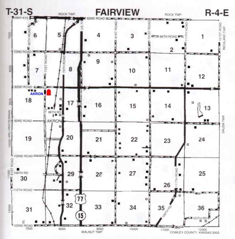
Akron/Green Valley/Pate Sunnyside/Walnut Valley TWP Map | Located 0.9 miles W of new US Hwy. 77 on CR 8 (Lake Rd) across old Hwy. 77 & the railroad tracks. CR 8 is 8.9 miles N of Winfield on US Hwy. 77 or 2.0 miles S of KS Hwy. 15 on US Hwy. 77. | |
| Andes TWP Map | ||
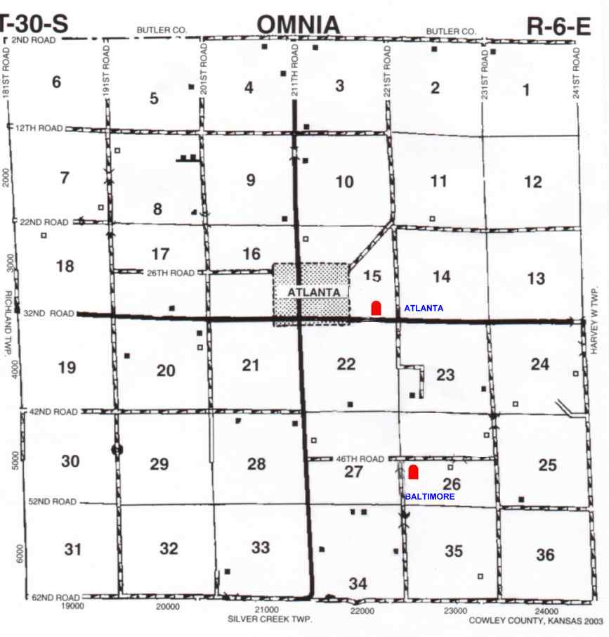
| Atlanta TWP Map | ||
| Baltimore TWP Map | 1 1/2 miles South of Atlanta on 211th. Rd, turn East onto 46th. Rd go 1 mile to 221st Rd, turn South, cemetery sits on East side very close to edge of road. | |
| Baptist TWP Map | ||
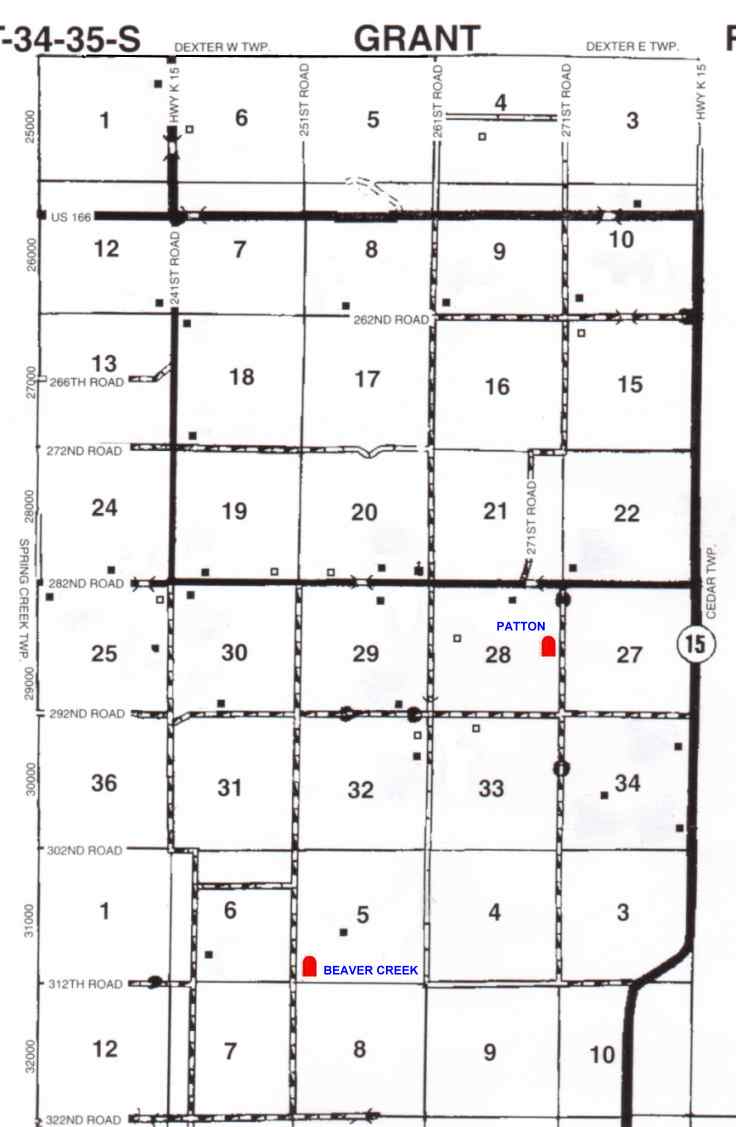
| Beaver Creek/Beaver/Kingsbury/Myers TWP Map | ||
| Box/Anderson/Armstrong | ||
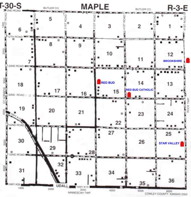
| Brookshire TWP Map | ||
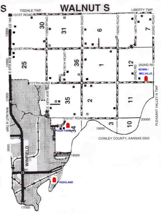
| Brown/Melville/Melville-Brown TWP Map | ||
| Burden TWP Map | ||
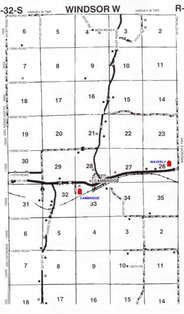
| Cambridge TWP Map | ||
| Cameron | ||
| Cedar Creek Cemetery | ||
|
Cedar Vale | ||
| Cowley County Poor Farm / Poor Farm TWP Map | ||
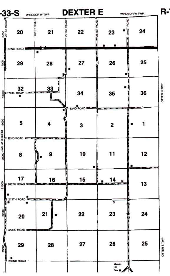
| Dexter/Old Dexter TWP Map | From Winfield go East on HWY 160, 10 miles will change to HWY 15 will curve to the South, go through Dexter aprox 1 mile, go to top of the hill, turn at the cemetery sign. This is aprox 18 miles from Winfield. | |
| Elliot (June) Grave | ||
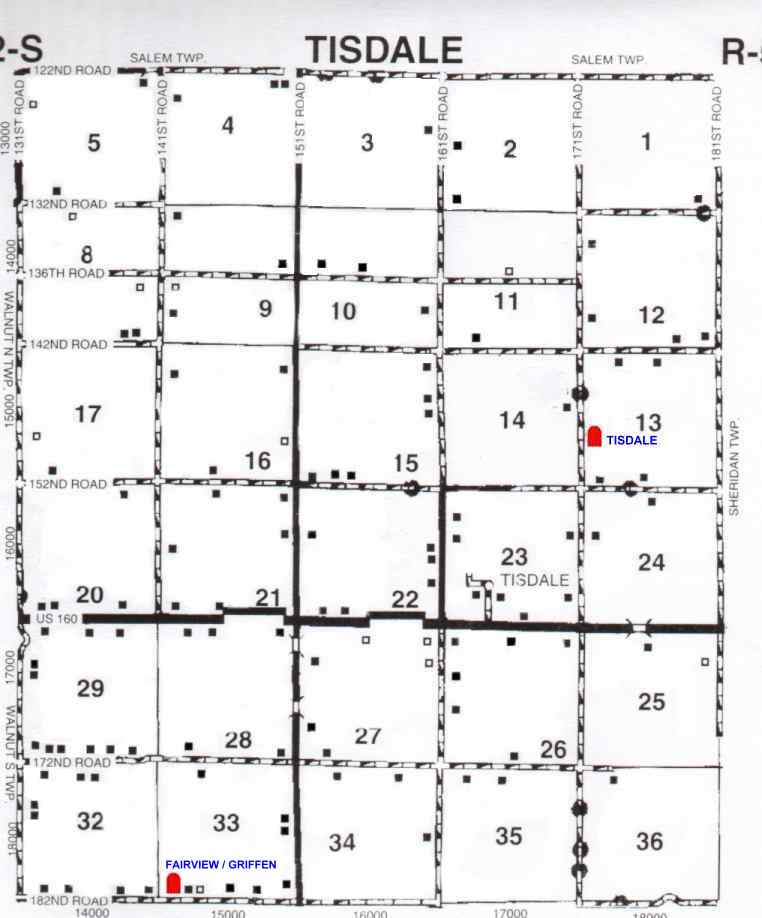
| Fairview/Griffith/Early Tisdale/Griffin/ Old Tisdale TWP Map | ||
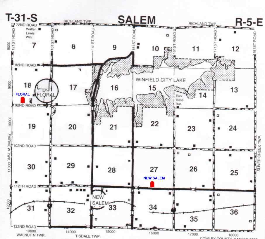
| Floral TWP Map | ||
| Foust | ||
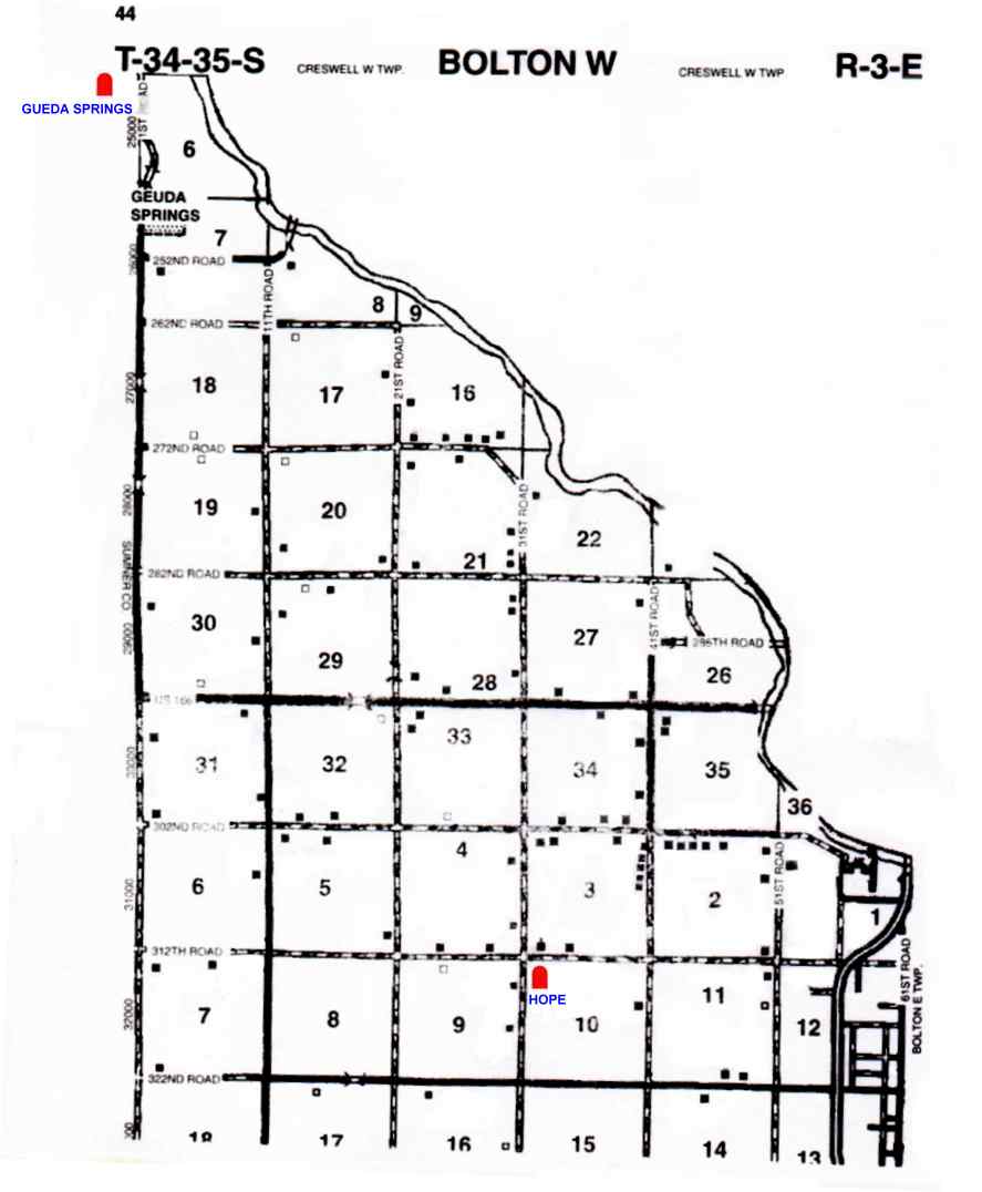
| Geuda Springs TWP Map | Actually sits about 1 mile into the Sumner County | |
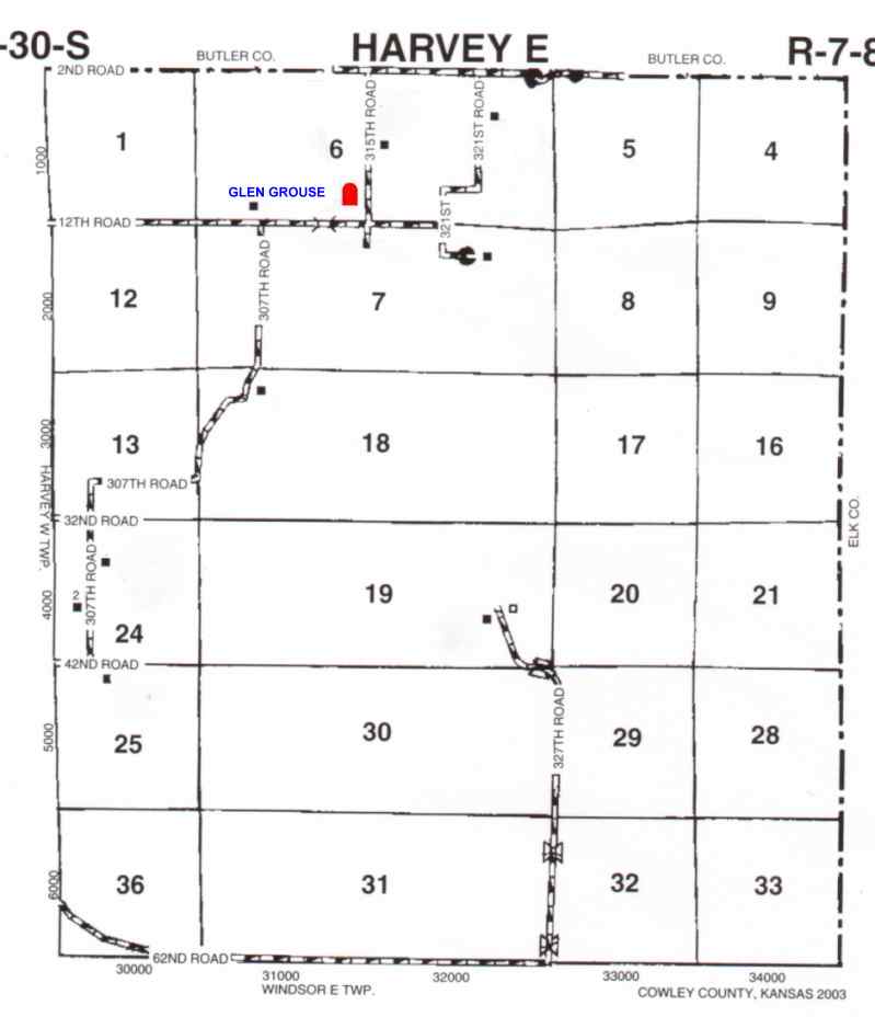
| Glen Grouse/Glen Grove TWP Map | Harvey TWP, SE 1/4 of Sec. 6, Twp. 30 S R SE.. The cemetery is located 5 miles S of Latham on black-top road running between Latham &Cambridge, then approx. 3 miles east, on N side of the road." | |
| Graham Cemetery TWP Map | In Winfield go N on College street to North St. then 2 blks W, cemetery is on Michigan St. | |
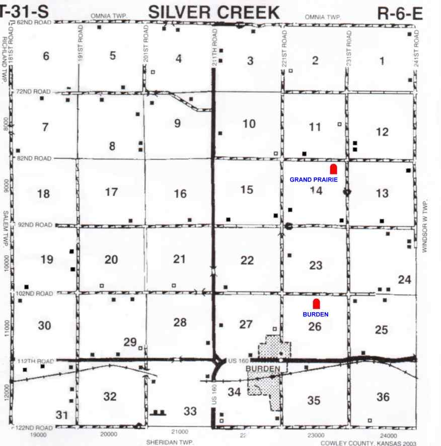
| Grand Prairie/Flottman/ North Prairie TWP Map | ||
| Gessler | ||
|
Highland/City/ New/South/Valley View TWP Map | located on the south edge of Winfield. The cemetery sits up on an hill just above the Walnut River over looking Winfield. | |
| Highland Abbey | ||
| Hilltop/Weaverling/Weaverly/Waverly TWP Map | ||
| Hooser | ||
| Hope/Mercer TWP Map Anthony Smith 620-442-7759 1843 S. Geuda Springs Road Geuda Springs, KS 67051
| ||
| Leete | ||
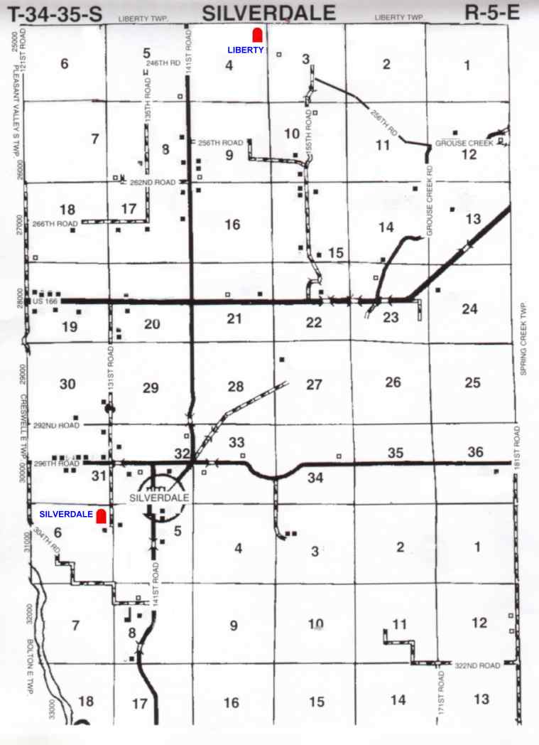
| Liberty/Silverdale Township TWP Map | ||
| Lollick | 1 mile into Sumner Co. from Cowley Co line - beside a driveway of a house. | |
|
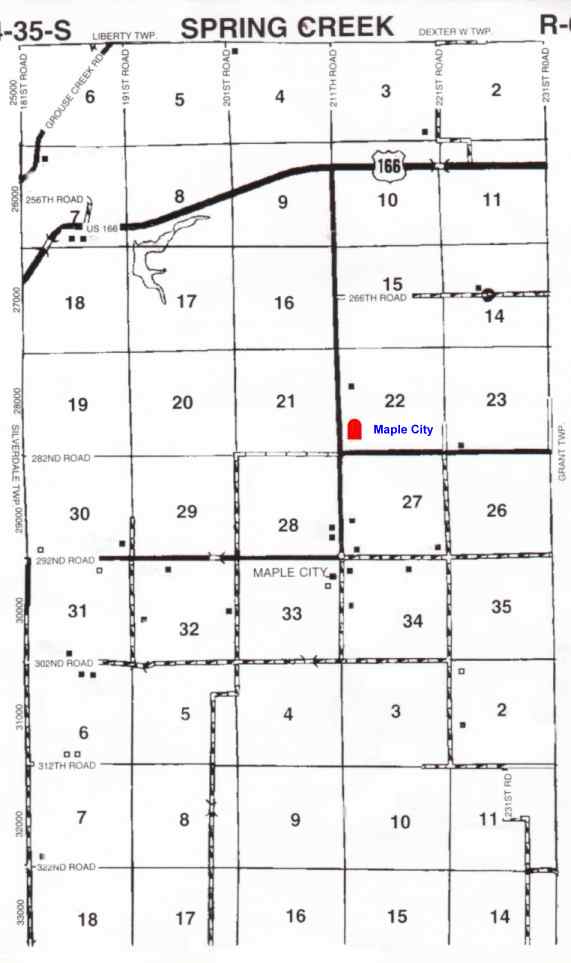
Maple City/Spring Creek A-J Maple City/Spring Creek M-Z TWP Map | ||
|
Memorial Lawn TWP Map | 24647 61st. Rd. Arkansas City | |
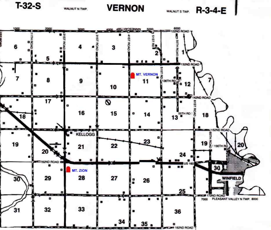
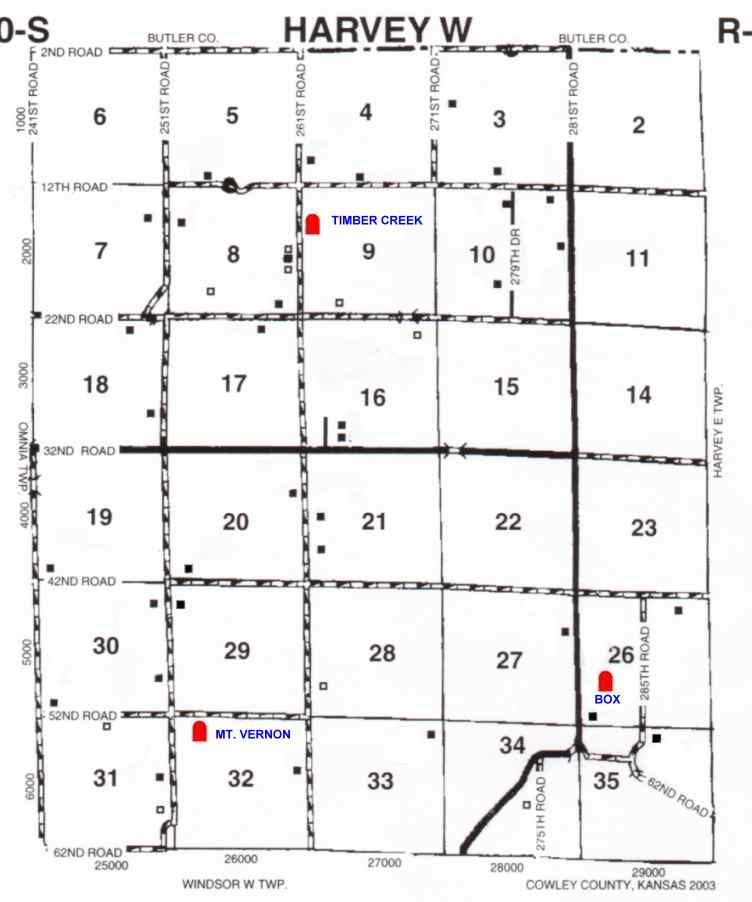
| Mount Vernon-Atlanta/North Vernon | ||
| Mount Vernon-Winfield/South Vernon/Fairview TWP Map | ||
|
Mt. Zion TWP Map | W out of Winfield on HWY 160 to 21st. Rd. sits on the jct. of 160 & 21st. on S side of HWY. | |
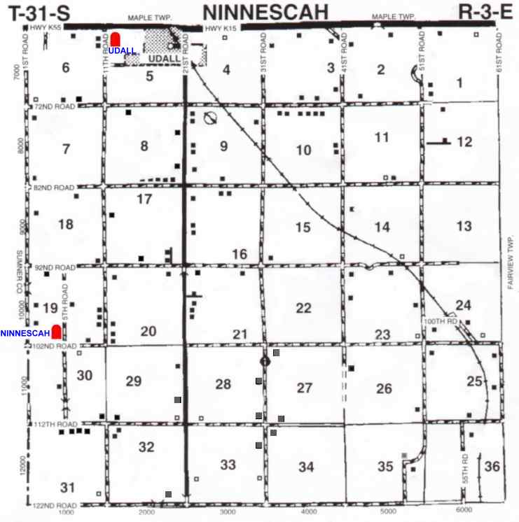
| Ninnescah TWP Map | ||
|
North Cedar Creek/Cedar Creek/Zimmerman North Cedar Creek/Cedar Creek/Zimmerman TWP Map | ||
|
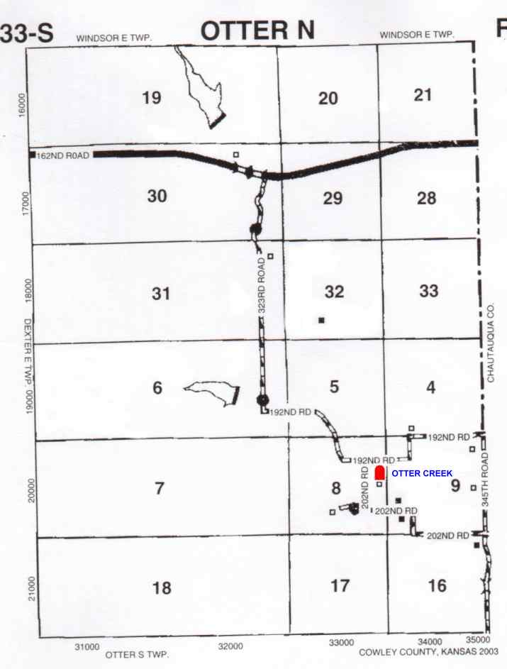
Otter Creek/Rockwell/Thompson Otter Creek TWP Map | ||
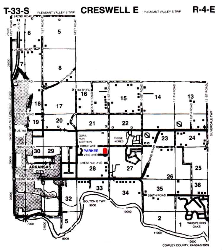
| Parker / Prairie View TWP Map A-C | D-F | G-J | K-M | N-R | S-V | W-Z | ||
| Patten TWP Map | ||
| Peck | ||
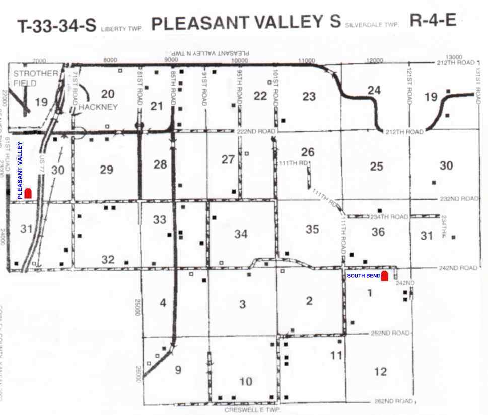
| Pleasant Valley/Hackney TWP Map | ||
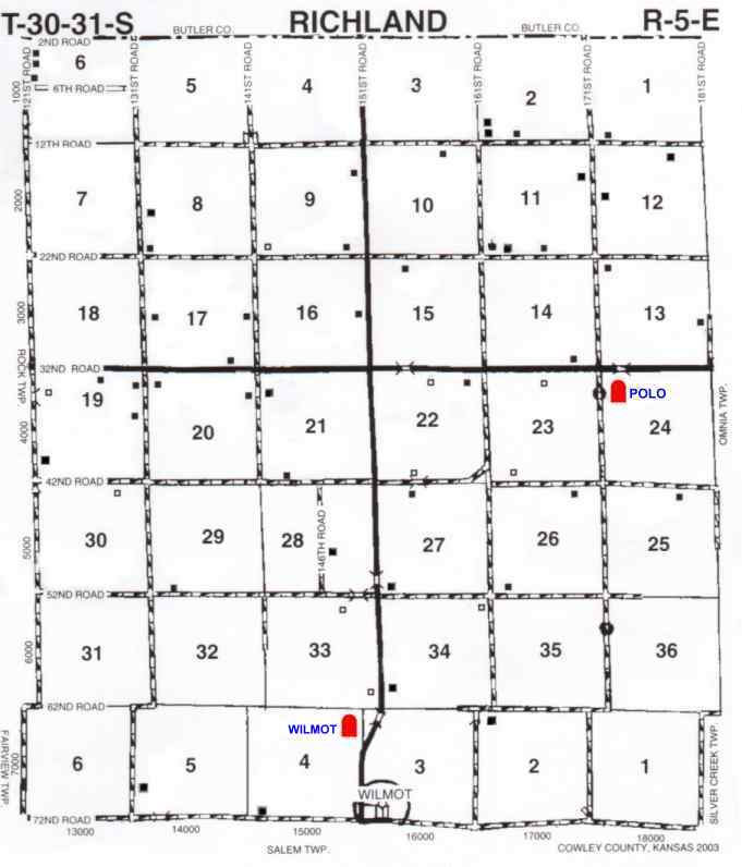
| Polo/Dutch Creek TWP Map | Maple TWP | |
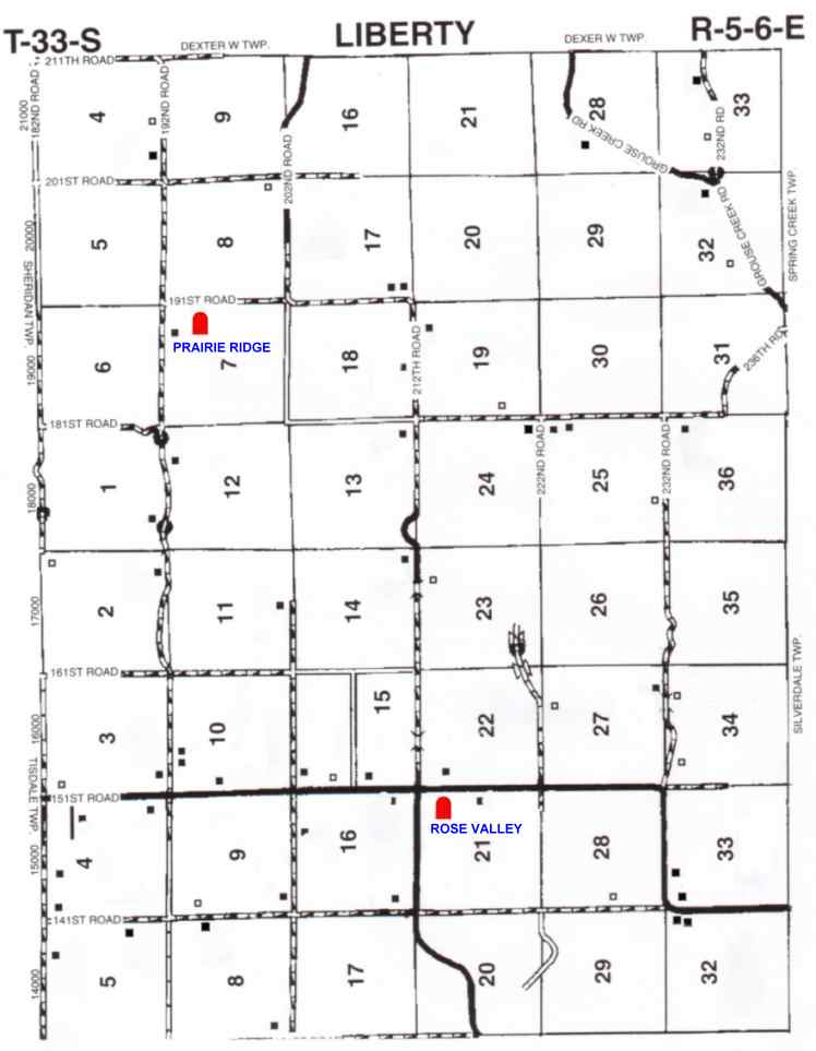
| Prairie Ridge / Red Valley TWP Map | ||
| Red Bud TWP Map | ||
| Red Bud Catholic TWP Map | ||
| Rick | ||
|
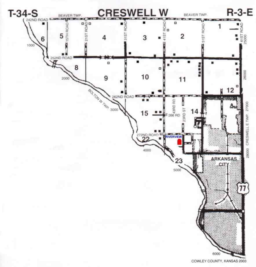
Riverview TWP Map | ||
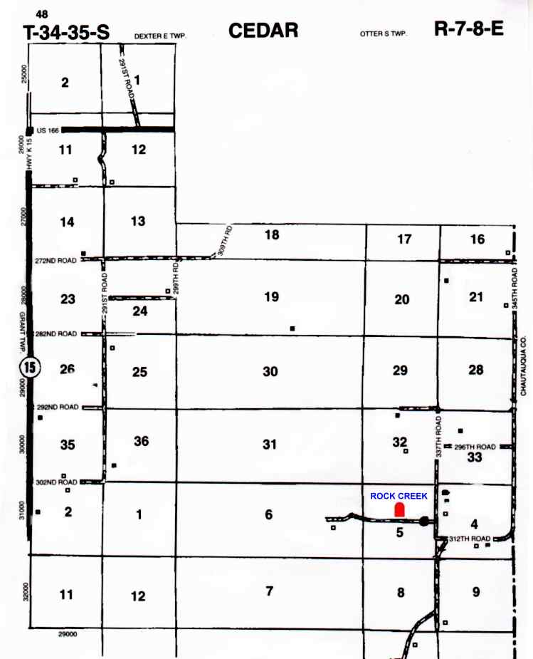
| Rock Creek/Courtright TWP Map Rock Creek | ||
| Rose Valley TWP Map | 10 miles South of 160 Highway on CCR 1. | |
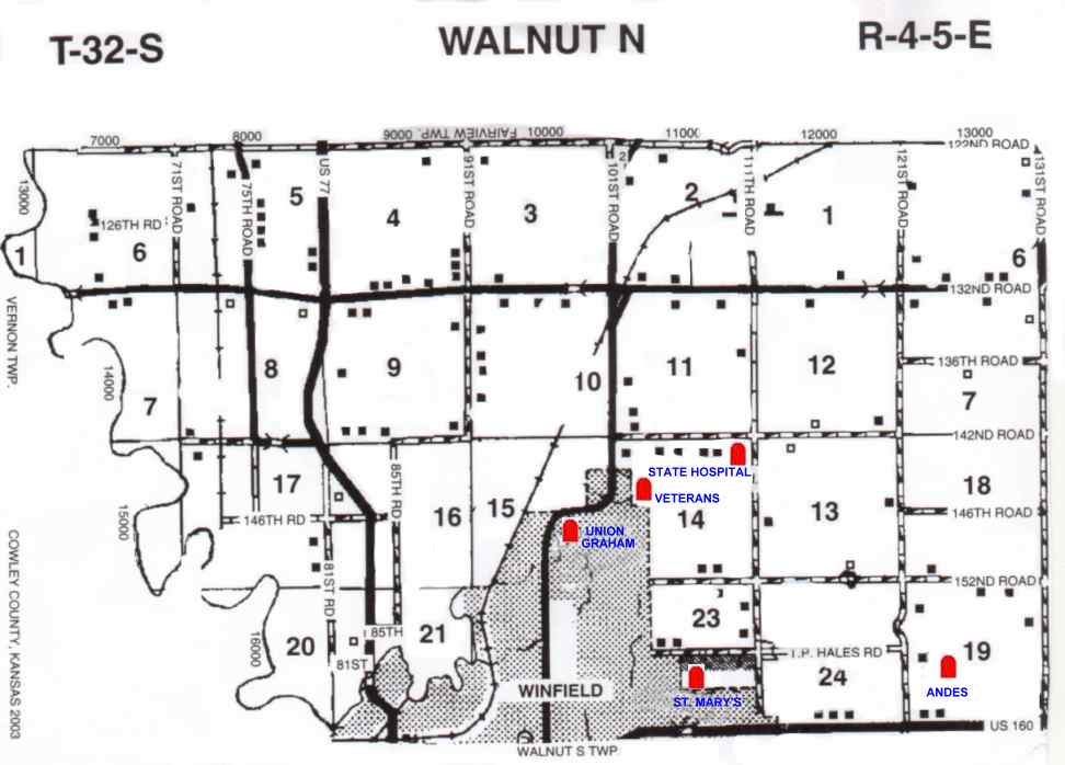
| Saint Mary's Catholic TWP Map | on 12th. street in Winfield about the 1000 blk | |
| Salem/New Salem TWP Map | 8 miles west of Burden on Cowley County Road #4 | |
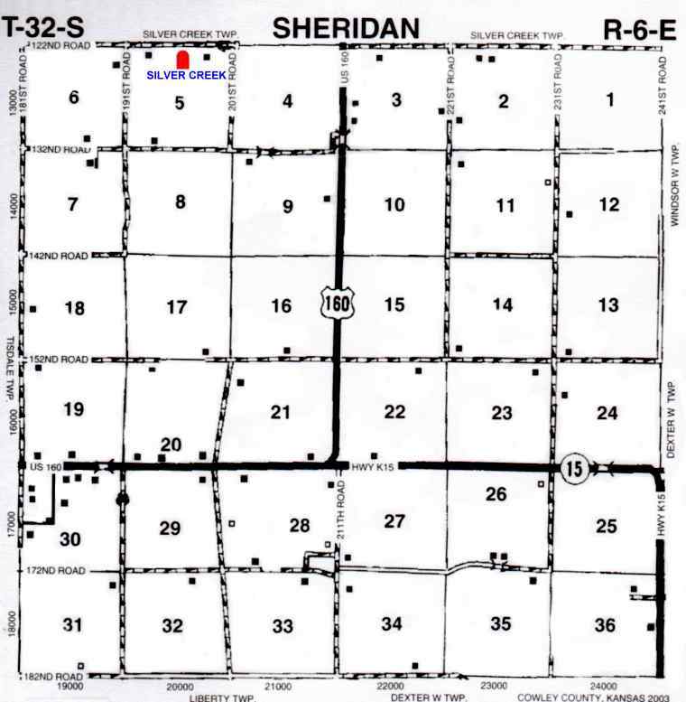
| Silver Creek TWP Map | Located west of Burden on hwy 160, S onto 201st. Rd 1 mile & W on 122nd. Rd aprox. 1/2 mile on S side of road. | |
|
Silverdale/Irons TWP Map | E of Arkansas City on Madison, to The Camp Horizon Sign, or 296th. Rd, stay on 296th. going tward Silverdale to 131st. Rd. about 4 miles, then turn South on 131st. and go aprox 1/4 mile cemetery on W side of road. | |
| Snyder | ||
| South Bend TWP Map | ||
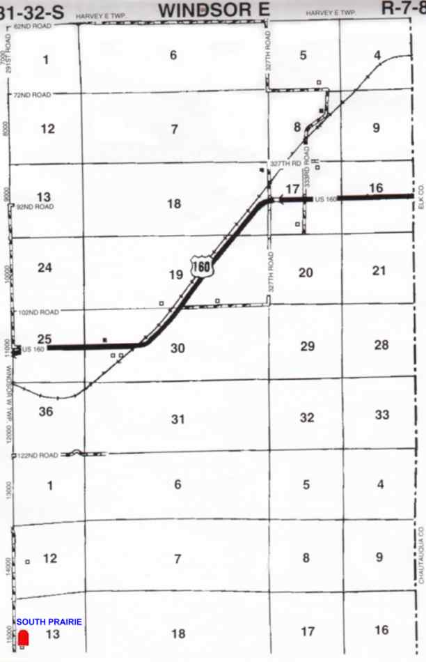
| South Prairie/Windsor/Gospel Ridge/Pleasant Ridge/Prairie/South Windsor TWP Map | ||
|
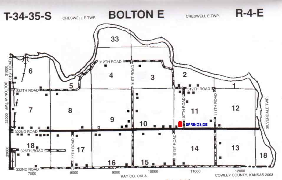
Springside TWP Map | ||
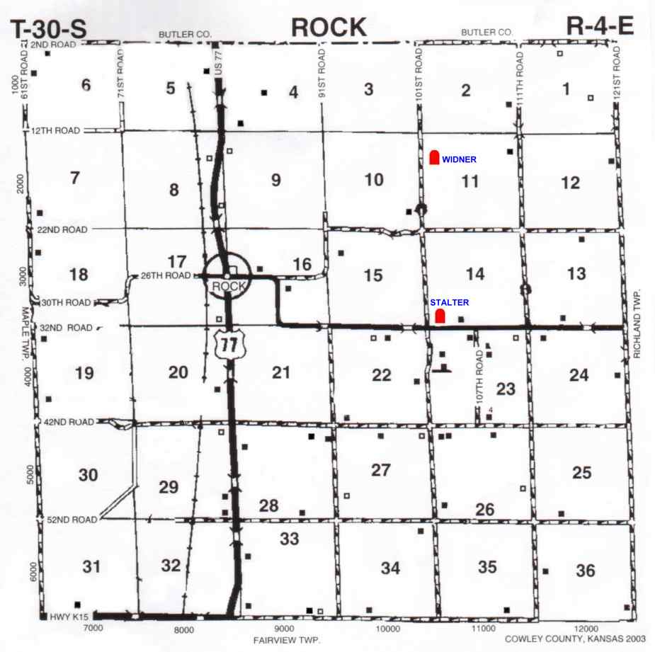
| Stalter/Rock TWP Map | ||
Star Valley TWP Map | Located 4 miles E & 1 1/2 miles N of Udall | |
|
Stalter/Rock TWP Map | ||
|
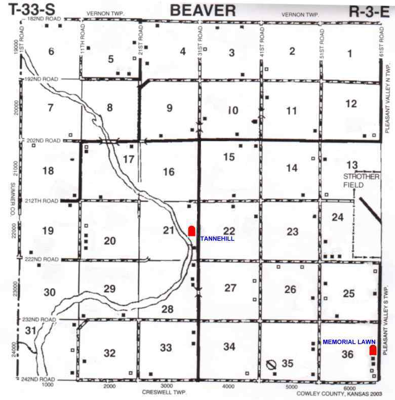
Tannehill/Beaver TWP Map | ||
| Thompson/Otter Creek/Rockwell | ||
| Timber Creek/Upper Timber Creek TWP Map | ||
| Tisdale TWP Map | ||
| Udall TWP Map | ||
| Union TWP Map | In Winfield go N on College street to North St. then 2 blks W, cemetery is on Michigan St. | |
| Veterans - New TWP Map | News Story | |
|
Widener TWP Map | Turn E on Williams St. or CCR# 2 in Rock, stay on paved road for 2 1/2 miles to 101st .Rd. to Statler Cemetery. On the west side of this cemetery, turn left on a narrow dirt road. Follow this road a few blocks, across the creek, leading to front gate of Widener. | |
| Wilmot TWP Map | Located north of Winfield City Lake | |
| Winfield State Hospital/State Home/State Hospital TWP Map | ||
| Yeager |
| CEMETERY | LOCATION |
| Blue School House | no longer there |
| Copple | no longer there |
| Davis Family | no longer there |
| DeVore | no longer there burials moved |
| Dressel | 2 graves/ no longer there |
| Fitzsimmon | 1 grave/ no longer there |
| Gessler | no longer there |
| Henderson | 2 graves/ no longer there |
| Hooser | exact location not known |
| Lazette/ Old Indian/ Old Soldiers | no longer there |
| Old Dexter | graves moved to Dexter |
| Stinson | 1 grave/ exact location unknown |
| Woner | graves moved to Akron/ no longer there |
| State Coordinators Tom & Carolyn Ward, Columbus, KS |
 |  |