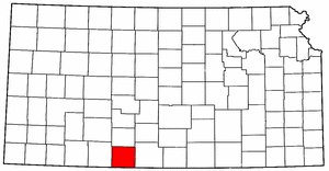
Maps of Comanche County, Kansas
See History of Highway 160 for a 1928 map of the Kansas State Highway System and a detail of a 1934 Map of Highway 160. Collection of Phyllis Scherich.
Sectional Map of Comanche County, Kansas, circa 1886. This map shows stage coach routes in the county! Collection of Phyllis Scherich.
Sectional Map of Comanche County, Kansas, 3 May 1887. Published in The Kansas Ledger, Protection, Kansas. Courtesy of Shirley Brier.
1892 USGS Topographical Map of Comanche County, Kansas. Collection of Eugene Markstrom.
1934 Map of Highway 160. Collection of Phyllis Scherich.
1936 Phillips Petroleum Map of Kansas, detail of southwestern Kansas area. Collection of Phyllis Scherich.
1936 Phillips Petroleum Map of Kansas, detail of Comanche County area. Collection of Phyllis Scherich.
Map of Present and Past Cities & Towns in Comanche County, Kansas.
2003 Topographical Map: Hwy 160 From Coldwater to Medicine Lodge
The following off-site links will open in a new browser window:
A Collection of Digitized Kansas Maps Wichita State University Libraries - Department of Special Collections
USGS Maps & Images of Comanche County, Kansas
However, the USGS customer service representatives are so very helpful that you can even order a listing of available maps and photos simply by sending in the appropriate form along with a copy of a map on which you've circled your area of interest. When you call, select the option which allows you to speak to a human and be prepared for some expert and excellent customer service.