Maps and text transcribed from: Transactions of the Kansas State Historical Society, 1903-1904; edited by Geo. W. Martin, Secretary. Vol. VIII. Topeka: Geo. A. Clark, state printer, 1904.
Reproduced with permission of the Kansas State Historical Society.
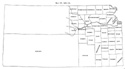
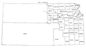
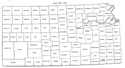
In 1881 Thomas and Sheridan counties were restored to their original boundaries.
The second standard parallel again became the north line of Gove and the third
standard parallel the south line. The west line was pushed twelve miles west to
the east line of range 32. Lane was diminished on the north by one tier of
townships and increased on the south by a tier taken from Buffalo. Out of the
remainder of Buffalo and all of Foote a new county was created, and named Gray.
Wallace county was recreated out of that part of the original county west of the
east line of range 38, and the part east of that line was formed into St. John
county (Laws of 1881, pp. 131-133).
Rawlins county was organized in 1881.
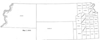
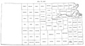
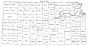
Map I, 1855
includes origin of county names
for those counties not existing in 1904. |
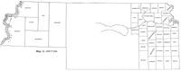
Map II, 1857-'59 |
Map III, 1860 |
Map IV, 1861-1864 |
Map V, 1865-1866 |
Map VI, 1867 |
Map VII, 1868 |
Map VIII, 1869-1872 |
Map IX, 1873 |
Map X, 1874 |
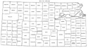
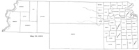
Map XI, 1875-1880 |
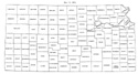
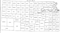
Map XII, 1881, '82 |
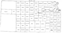
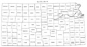
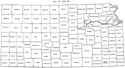
Map XIII, 1883,'84 |
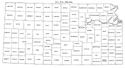
Map XIV, 1885 |
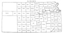
Map XV, 1886-1892 |
| |
Map XVI, 1893-1904 |
Article Introduction |
Return to top
Maps and text transcribed from: Transactions of the Kansas State Historical Society, 1903-1904; edited by Geo. W. Martin, Secretary. Vol. VIII. Topeka: Geo. A. Clark, state printer, 1904.
Reproduced with permission of the Kansas State Historical Society.
Background and KSGenWeb logo were designed and are copyrighted by
Tom & Carolyn Ward
for the limited use of the KSGenWeb Project.
Permission is granted for use only on an official KSGenWeb page.
©1999 - Tom & Carolyn Ward
